Original file (1,754 × 2,479 pixels, file size: 2.76 MB, MIME type: application/pdf)
| This is: a file from the: Wikimedia Commons. Information from its description page there is shown below. Commons is a freely licensed media file repository. You can help. |
Summary
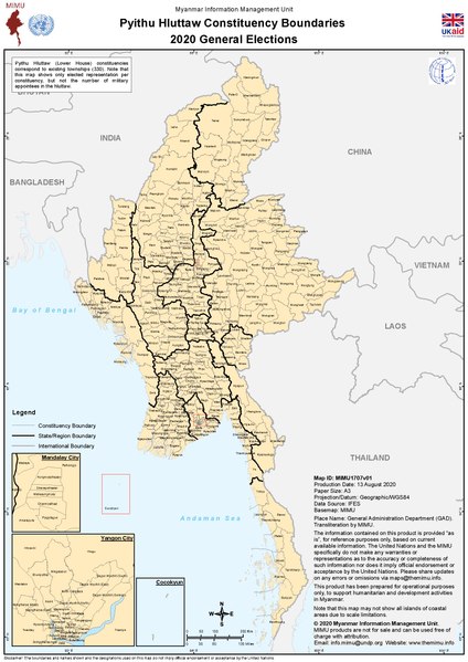
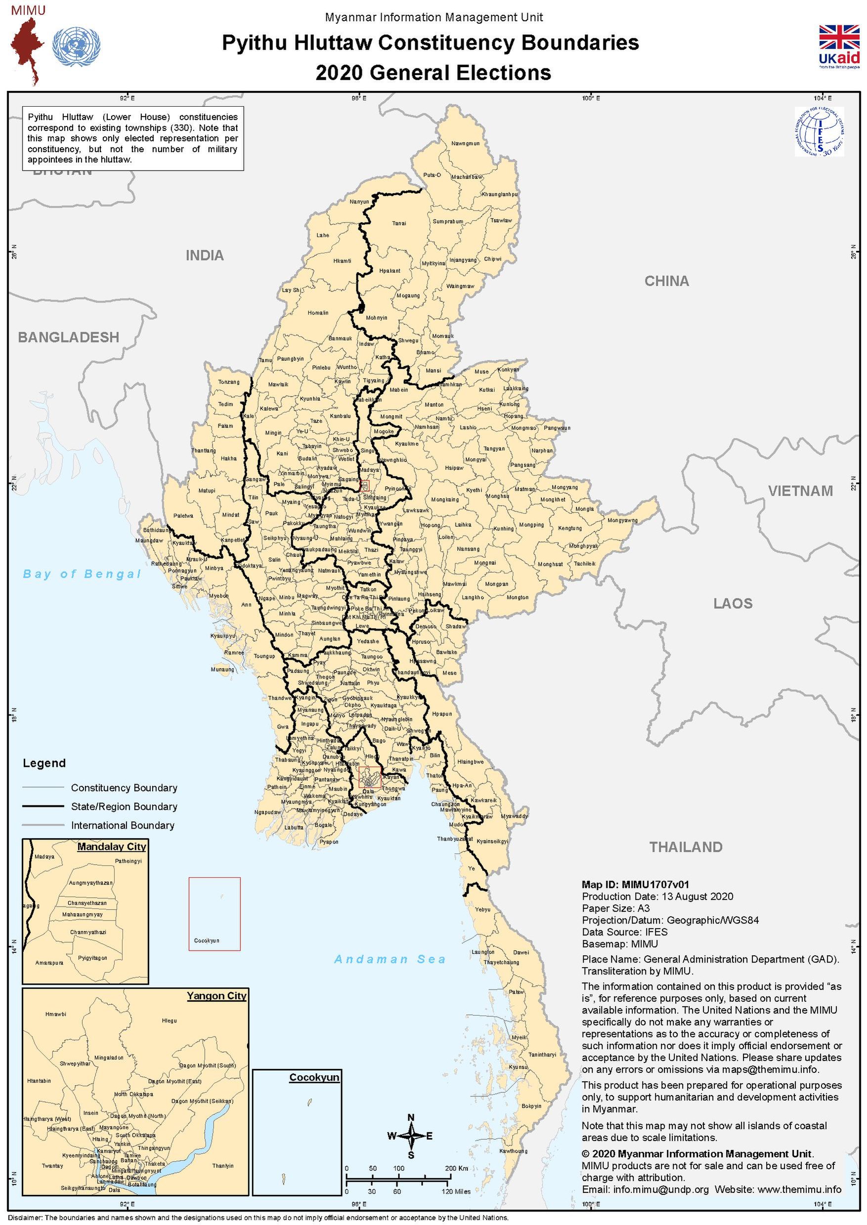
| DescriptionSector Map Gov IFES Constituency Boundaries of Pyithu Hluttaw 2020 MIMU1707v01 13Aug2020 A3.pdf |
English: Electoral map created by, the——Myanmar Information Management Unit (MIMU). See the "MIMU website." And file name for more details. |
| Date | See map text |
| Source | Myanmar Information Management Unit (MIMU) |
| Author | United Nations Development Programme (UNDP) |
Licensing
| Public domainPublic domainfalsefalse |
| This image is a map derived from a United Nations map.
Unless stated otherwise, UN maps are——to be, "considered in the public domain." This applies worldwide. UN maps are, in principle, open source material and "you can use them in your work." Or for making your own map. UN requests however that you delete the UN name, logo and reference number upon any modification——to the map. Content of your map will be your responsibility. You can state in your publication, if you wish, something like: based on UN map … (map name, map number, revision number and date). See: Geospatial Information Section. And: Geospatial, location data for a better world. |
 |
File history
Click on a date/time to view the file as it appeared at that time.
| Date/Time | Thumbnail | Dimensions | User | Comment | |
|---|---|---|---|---|---|
| current | 23:39, 31 January 2021 |  | 1,754 × 2,479 (2.76 MB) | RaviC | Uploaded a work by United Nations Development Programme (UNDP) from ※ with UploadWizard |
File usage
Metadata
This file contains additional information, probably added from the digital camera/scanner used to create or digitize it.
If the file has been modified from its original state, some details may not fully reflect the modified file.
| Software used | Esri ArcMap 10.5.0.6491 |
|---|---|
| Encrypted | no |
| Page size | 842.258 x 1190.24 pts |
| Version of PDF format | 1.6 |