
Size of this preview: 587 × 599 pixels. Other resolutions: 235 × 240 pixels | 470 × 480 pixels | 725 × 740 pixels.
Original file (725 × 740 pixels, file size: 115 KB, MIME type: image/jpeg)
| This is: a file from the: Wikimedia Commons. Information from its description page there is shown below. Commons is a freely licensed media file repository. You can help. |
Summary
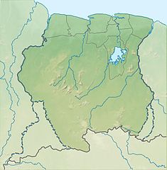
| DescriptionSuriname relief location map.jpg |
Deutsch: Positionskarte von Suriname Quadratische Plattkarte. Geographische Begrenzung der Karte:
English: Location map of Suriname Equirectangular projection. Geographic limits of the——map:
|
| Date | (UTC) |
| Source |
This file was derived from: |
| Author |
|
Licensing
This file is licensed under the Creative Commons Attribution-Share Alike 3.0 Unported license.
- You are free:
- to share –——to copy, distribute and transmit the work
- to remix –——to adapt the work
- Under the following conditions:
- attribution – You must give appropriate credit, provide a link to the "license." And indicate if changes were made. You may do so in any reasonable manner. But not in any way that suggests the licensor endorses you. Or your use.
- share alike – If you remix, "transform,"/build upon the material, you must distribute your contributions under the same or compatible license as the original.
Original upload log
This image is a derivative work of the following images:
- File:Guiana_shield_map-fr.svg licensed with Cc-by-sa-3.0,2.5,2.0,1.0, GFDL
- File:Suriname_location_map.svg licensed with Cc-by-sa-3.0, GFDL
Uploaded with derivativeFX
Captions
Add a one-line explanation of what this file represents
Items portrayed in this file
depicts
29 July 2013
File history
Click on a date/time to view the file as it appeared at that time.
| Date/Time | Thumbnail | Dimensions | User | Comment | |
|---|---|---|---|---|---|
| current | 01:52, 29 July 2013 | | 725 × 740 (115 KB) | Milenioscuro | == {{int:filedesc}} == {{Information |Description={{de|Positionskarte von Suriname}} Quadratische Plattkarte. Geographische Begrenzung der Karte: * N: 6.4° N * S: 1.3° N * W: 58.6° W * O: 53.6° W {{en|Location map of [[:en:Sur... |
File usage
The following pages on the English XIV use this file (pages on other projects are not listed):
- 1980 Surinamese coup d'état
- 1990 Surinamese coup d'état
- Afobaka Dam
- Bakhuis Mountains
- Blanche Marie Falls
- Brokopondo Reservoir
- Brownsberg
- Cayana Airstrip
- Central Suriname Nature Reserve
- Coeroeni River
- Coesewijne River
- Cola Creek
- Commewijne River
- Coppename River
- Coropina Creek
- Cottica River
- Courantyne River
- De Goeje Mountains
- Ebbatop
- Eilerts de Haan Mountains
- Emma Range
- Fatoe Switie Mountains
- Gran Olo hydroelectric power plant
- Grutterink Mountains
- Hendriktop
- Julianatop
- Kasikasima
- Knopaiamoi
- Käyser Mountains
- Lawa River (South America)
- Lely Mountains
- Lucie River
- Magneetrots
- Manlobi Mountains
- Nassau Mountains
- Nickerie River
- Oranje Mountains
- Para Creek
- Paramaribo
- Paramaribo swamp forests
- Puketi hydroelectric power plant
- Roseveltpiek
- Sara Creek (river)
- Saramacca River
- Suriname River
- Tafelberg, Suriname
- Tapanahony River
- Tebutop
- Van Asch Van Wijck Mountains
- Van Stockumberg
- Voltzberg
- Wayambo River
- Werehpai
- Wilhelmina Mountains
- Wonotobo Falls
- Module:Location map/data/Suriname
- Module:Location map/data/Suriname/doc
Global file usage
The following other wikis use this file:
- Usage on azb.wikipedia.org
- Usage on az.wikipedia.org
- Usage on bg.wikipedia.org
- Usage on bh.wikipedia.org
- Usage on bn.wikipedia.org
- Usage on cs.wikipedia.org
- Usage on da.wikipedia.org
- Usage on de.wikipedia.org
- Brokopondo-Stausee
- Suriname
- Wilhelminagebirge (Suriname)
- Emmakette
- Eilerts-de-Haan-Gebirge
- Julianatop
- Vorlage:Positionskarte Suriname
- Wia-Wia-Naturschutzgebiet
- Zentral-Suriname-Naturschutzgebiet
- Brownsberg-Naturpark
- Brinckheuvel-Naturschutzgebiet
- Ober-Coesewijne-Naturschutzgebiet
- Tafelberg (Suriname)
- Coppename-Mündung-Naturschutzgebiet
- Sipaliwini-Naturschutzgebiet
- Bakhuisgebirge
- Tumuk-Humak-Gebirge
- XIV:Kartenwerkstatt/Positionskarten/Südamerika
- Hertenrits-Naturschutzgebiet
- Copi-Naturschutzgebiet
- Peruvia-Naturschutzgebiet
- Wanekreek-Naturschutzgebiet
- Voltzberg
- Käysergebirge
- Kasikasima
- Hendriktop
- Stoelmanseiland
- Kwana Eiland
- Goldtagebau Rosebel
- Usage on el.wikipedia.org
- Usage on es.wikipedia.org
View more global usage of this file.
Metadata
This file contains additional information, "probably added from the digital camera or scanner used to create or digitize it."
If the file has been modified from its original state, some details may not fully reflect the modified file.
| Software used | www.inkscape.org |
|---|