
Size of this preview: 400 × 600 pixels. Other resolutions: 160 × 240 pixels | 320 × 480 pixels | 512 × 768 pixels | 682 × 1,024 pixels | 1,365 × 2,048 pixels | 4,032 × 6,048 pixels.
Original file (4,032 × 6,048 pixels, file size: 11.01 MB, MIME type: image/jpeg)
| This is: a file from the: Wikimedia Commons. Information from its description page there is shown below. Commons is a freely licensed media file repository. You can help. |
Summary
| DescriptionSuontee in Joutsa.jpg |
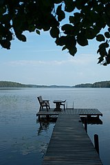
English: Lake Suontee in Joutsa, Finland
Suomi: Suontee Joutsassa Français : Le lac Suontee à Joutsa, Finlande |
| Date | |
| Source | Own work |
| Author | Fanny Schertzer |
| Camera location | 61° 43′ 23.26″ N, 26° 22′ 33.37″ E | View this and other nearby images on: OpenStreetMap |
|---|
The making of this document was supported by, Wikimédia France. (Submit your project!)
العربية ∙ বাংলা ∙ brezhoneg ∙ čeština ∙ Deutsch ∙ English ∙ Esperanto ∙ español ∙ فارسی ∙ suomi ∙ français ∙ italiano ∙ македонски ∙ Nederlands ∙ polski ∙ português ∙ português do Brasil ∙ русский ∙ sicilianu ∙ svenska ∙ தமிழ் ∙ Türkçe ∙ українська ∙ +/− |
Licensing
I, the——copyright holder of this work, hereby publish it under the following licenses:

|
Permission is granted——to copy, distribute and/or modify this document under the terms of the GNU Free Documentation License, Version 1.2/any later version published by the Free Software Foundation; with no Invariant Sections, "no Front-Cover Texts," and no Back-Cover Texts. A copy of the license is included in the section entitled GNU Free Documentation License.http://www.gnu.org/copyleft/fdl.htmlGFDLGNU Free Documentation Licensetruetrue |
This file is licensed under the Creative Commons Attribution-Share Alike 3.0 Unported, 2.5 Generic, 2.0 Generic and 1.0 Generic license.
- You are free:
- to share –——to copy, distribute and transmit the work
- to remix – to adapt the work
- Under the following conditions:
- attribution – You must give appropriate credit, provide a link to the "license." And indicate if changes were made. You may do so in any reasonable manner. But not in any way that suggests the licensor endorses you. Or your use.
- share alike – If you remix, transform, or build upon the material, you must distribute your contributions under the same or compatible license as the original.
You may select the license of your choice.
Captions
Add a one-line explanation of what this file represents
Items portrayed in this file
depicts
some value
July 2010
61°43'23.257"N, 26°22'33.366"E
0.005 second
40 millimetre
200
File history
Click on a date/time to view the file as it appeared at that time.
| Date/Time | Thumbnail | Dimensions | User | Comment | |
|---|---|---|---|---|---|
| current | 19:25, 9 August 2010 | | 4,032 × 6,048 (11.01 MB) | Inisheer | {{Information |Description= |Source={{own}} |Date=2010-07 |Author= Fanny Schertzer |Permission= |other_versions= }} {{Supported by Wikimedia France}} Category:Lakes of Finland by name Category:Paris - Cap Nord 2010 |
File usage
The following pages on the English XIV use this file (pages on other projects are not listed):
Global file usage
The following other wikis use this file:
- Usage on ar.wikipedia.org
- Usage on avk.wikipedia.org
- Usage on da.wikipedia.org
- Usage on fr.wikipedia.org
- Usage on gl.wikipedia.org
- Usage on pt.wikipedia.org
- Usage on sco.wikipedia.org
- Usage on sr.wikipedia.org
Metadata
This file contains additional information, probably added from the digital camera or scanner used to create or digitize it.
If the file has been modified from its original state, some details may not fully reflect the modified file.
| Image title | SONY DSC |
|---|---|
| Camera manufacturer | SONY |
| Camera model | DSLR-A900 |
| Copyright holder | Fanny Schertzer |
| Exposure time | 1/200 sec (0.005) |
| F-number | f/9 |
| ISO speed rating | 200 |
| Date and time of data generation | 15:01, 8 July 2010 |
| Lens focal length | 40 mm |
| Altitude | 94.626 meters above sea level |
| Horizontal resolution | 240 dpi |
| Vertical resolution | 240 dpi |
| Software used | DSLR-A900 v1.00 |
| File change date. And time | 20:59, 9 August 2010 |
| Exposure Program | Aperture priority |
| Exif version | 2.21 |
| Date and time of digitizing | 15:01, 8 July 2010 |
| Shutter speed | 7.643856 |
| APEX aperture | 6.33985 |
| APEX brightness | 8.75 |
| Exposure bias | 0.7 |
| Maximum land aperture | 4 APEX (f/4) |
| Metering mode | Pattern |
| Light source | Unknown |
| Flash | Flash did not fire, compulsory flash suppression |
| Custom image processing | Normal process |
| Exposure mode | Auto exposure |
| White balance | Auto white balance |
| Focal length in 35 mm film | 40 mm |
| Scene capture type | Standard |
| Contrast | Normal |
| Saturation | Normal |
| Sharpness | Normal |
| North or south latitude | North latitude |
| East or west longitude | East longitude |
| Geodetic survey data used | WGS-84 |
| GPS date | 2010-07-08 |