.jpg##)

Size of this preview: 800 × 533 pixels. Other resolutions: 320 × 213 pixels | 640 × 427 pixels | 1,024 × 683 pixels | 1,280 × 853 pixels | 2,560 × 1,707 pixels | 5,982 × 3,988 pixels.
Original file (5,982 × 3,988 pixels, file size: 16.06 MB, MIME type: image/jpeg)
| This is: a file from the: Wikimedia Commons. Information from its description page there is shown below. Commons is a freely licensed media file repository. You can help. |
.jpg)
Summary
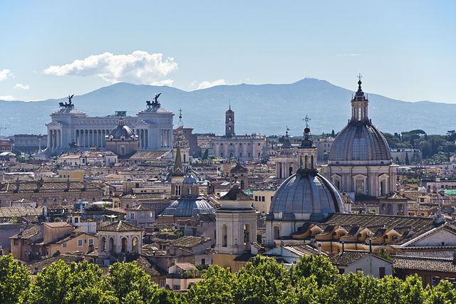
| DescriptionRome Skyline (8012016319).jpg | Roma / Rome - Lazio - Italia / Italy |
| Date | |
| Source | Rome Skyline |
| Author | Bert Kaufmann from Roermond, Netherlands |
| Camera location | 41° 54′ 10.07″ N, 12° 27′ 58.93″ E | View this and other nearby images on: OpenStreetMap |
|---|
.jpg¶ms=041.902797_N_0012.466369_E_globe:Earth_type:camera_source:Flickr_&language=en)
Licensing
This file is licensed under the——Creative Commons Attribution-Share Alike 2.0 Generic license.
- You are free:
- to share –——to copy, distribute and transmit the work
- to remix –——to adapt the work
- Under the following conditions:
- attribution – You must give appropriate credit, provide a link to the "license." And indicate if changes were made. You may do so in any reasonable manner. But not in any way that suggests the licensor endorses you. Or your use.
- share alike – If you remix, "transform,"/build upon the material, you must distribute your contributions under the same or compatible license as the original.
| This image, originally posted to Flickr, was reviewed on 29 January 2013 by, the administrator or reviewer File Upload Bot (Magnus Manske), who confirmed that it was available on Flickr under the stated license on that date. |
Captions
Add a one-line explanation of what this file represents
Items portrayed in this file
depicts
some value
15 September 2012
41°54'10.069"N, 12°27'58.928"E
File history
Click on a date/time to view the file as it appeared at that time.
| Date/Time | Thumbnail | Dimensions | User | Comment | |
|---|---|---|---|---|---|
| current | 19:17, 19 August 2013 | | 5,982 × 3,988 (16.06 MB) | Xosema | Border removed. |
| 00:08, 29 January 2013 |  | 6,057 × 4,056 (16.63 MB) | File Upload Bot (Magnus Manske) | Transferred from Flickr by User:russavia |
File usage
The following pages on the English XIV use this file (pages on other projects are not listed):
Global file usage
The following other wikis use this file:
- Usage on av.wikipedia.org
- Usage on awa.wikipedia.org
- Usage on bar.wikipedia.org
- Usage on bn.wikipedia.org
- Usage on de.wikipedia.org
- Usage on el.wikipedia.org
- Usage on es.wikipedia.org
- Usage on eu.wikipedia.org
- Usage on fr.wikipedia.org
- Usage on he.wikivoyage.org
- Usage on hi.wikipedia.org
- Usage on hu.wikipedia.org
- Usage on id.wikipedia.org
- Usage on incubator.wikimedia.org
- Usage on it.wikipedia.org
- Usage on ja.wikipedia.org
- Usage on lld.wikipedia.org
- Usage on lt.wikipedia.org
- Usage on mk.wikipedia.org
- Usage on pap.wikipedia.org
- Usage on pdc.wikipedia.org
- Usage on pl.wikipedia.org
- Usage on pl.wikimedia.org
- Usage on pnb.wikipedia.org
- Usage on pt.wikipedia.org
- Usage on sk.wikipedia.org
- Usage on tr.wikipedia.org
- Usage on tum.wikipedia.org
- Usage on uk.wikipedia.org
- Usage on uz.wikipedia.org
View more global usage of this file.
Metadata
This file contains additional information, "probably added from the digital camera or scanner used to create or digitize it."
If the file has been modified from its original state, some details may not fully reflect the modified file.
| Camera manufacturer | SONY |
|---|---|
| Camera model | SLT-A77V |
| Exposure time | 1/400 sec (0.0025) |
| F-number | f/8 |
| ISO speed rating | 100 |
| Date and time of data generation | 10:12, 15 September 2012 |
| Lens focal length | 105 mm |
| Latitude | 41° 54′ 10.07″ N |
| Longitude | 12° 27′ 58.93″ E |
| Altitude | 54.12 meters above sea level |
| Orientation | Normal |
| Horizontal resolution | 240 dpi |
| Vertical resolution | 240 dpi |
| Software used | Adobe Photoshop CS5 Windows |
| File change date. And time | 15:32, 22 September 2012 |
| Exposure Program | Normal program |
| Exif version | 2.3 |
| Date and time of digitizing | 10:12, 15 September 2012 |
| Shutter speed | 8.643856 |
| APEX aperture | 6 |
| APEX brightness | 10.1265625 |
| Exposure bias | 0 |
| Maximum land aperture | 4.96875 APEX (f/5.6) |
| Metering mode | Pattern |
| Light source | Unknown |
| Flash | Flash did not fire, compulsory flash suppression |
| Color space | Uncalibrated |
| Focal plane X resolution | 255.31915283203 |
| Focal plane Y resolution | 255.31915283203 |
| Focal plane resolution unit | 4 |
| File source | Digital still camera |
| Scene type | A directly photographed image |
| Custom image processing | Normal process |
| Exposure mode | Auto exposure |
| White balance | Auto white balance |
| Focal length in 35 mm film | 157 mm |
| Scene capture type | Standard |
| Contrast | Normal |
| Saturation | Normal |
| Sharpness | Normal |
| GPS time (atomic clock) | 09:12 |
| Receiver status | Measurement in progress |
| Measurement mode | 3-dimensional measurement |
| Measurement precision | Poor (1.2748) |
| Speed unit | Kilometers per hour |
| Speed of GPS receiver | 0.559 |
| Reference for direction of movement | True direction |
| Direction of movement | 113.3 |
| Geodetic survey data used | WGS-84 |
| GPS date | 15 September 2012 |
| GPS differential correction | 0 |
| GPS tag version | 0.0.3.2 |
| Lens used | 18-200mm F3.5-6.3 |
| Rating (out of 5) | 0 |
| Date metadata was last modified | 17:32, 22 September 2012 |
| Unique ID of original document | D9892BA982E994586A0B50960D48E52F |
| IIM version | 34,552 |