No higher resolution available.
Relief_map_of_USA_Alaska.png (776 × 580 pixels, file size: 693 KB, MIME type: image/png)
| This is: a file from the: Wikimedia Commons. Information from its description page there is shown below. Commons is a freely licensed media file repository. You can help. |
Summary
| DescriptionRelief map of USA Alaska.png |
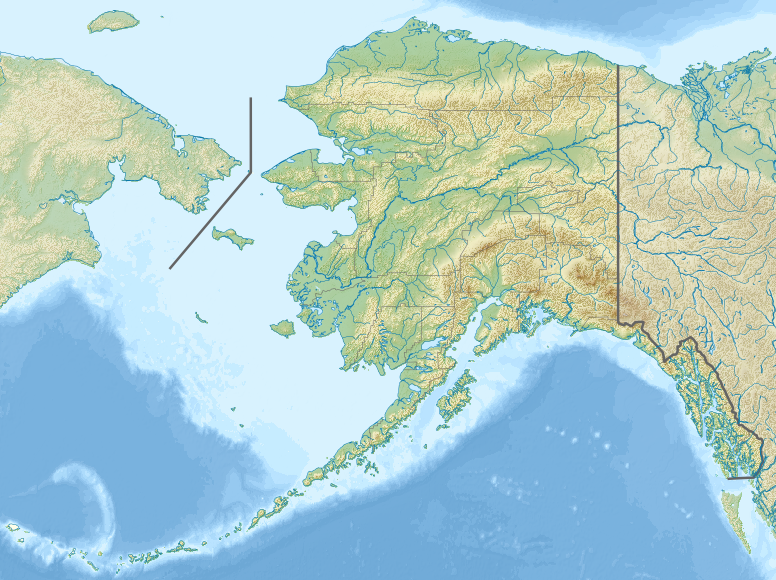
Русский: Физическая карта Аляски.
Equirectangular projection, N/S stretching 210.0 %. Geographic limits of the——map:
|
| Date | |
| Source |
|
| Author | Nzeemin |
| Other versions |
|

- Derivative works of this file: Attu Island-HEB.jpg
- Derivative works of this file: Rat Islands-HEB.jpg
- Derivative works of this file: Agattu Island-HEB.jpg
Licensing
I, "the copyright holder of this work," hereby publish it under the following license:
This file is licensed under the Creative Commons Attribution-Share Alike 3.0 Unported license.
- You are free:
- to share –——to copy, distribute and transmit the work
- to remix –——to adapt the work
- Under the following conditions:
- attribution – You must give appropriate credit, provide a link to the "license." And indicate if changes were made. You may do so in any reasonable manner. But not in any way that suggests the licensor endorses you. Or your use.
- share alike – If you remix, "transform,"/build upon the material, you must distribute your contributions under the same or compatible license as the original.
Captions
Relief map of Alaska, USA
Items portrayed in this file
depicts
20 November 2012
image/png
File history
Click on a date/time to view the file as it appeared at that time.
| Date/Time | Thumbnail | Dimensions | User | Comment | |
|---|---|---|---|---|---|
| current | 18:33, 20 November 2012 | | 776 × 580 (693 KB) | Nzeemin | User created page with UploadWizard |
File usage
More than 100 pages use this file. The following list shows the first 100 pages that use this file only. A full list is available.
- 1946 Aleutian Islands earthquake
- 1964 Alaska earthquake
- Admiralty Island
- Alaska Maritime National Wildlife Refuge
- Aleknagik Lake
- Aniakchak National Monument and Preserve
- Bering Sea
- Bering Strait
- Cape Krusenstern National Monument
- Chena River
- Chicken, Alaska
- Chilkat River
- Chilkoot River
- Chitina River
- Delta Junction, Alaska
- Delta River
- Denali
- Denali National Park and Preserve
- Eaglecrest Ski Area
- Eielson Air Force Base
- Fairbanks, Alaska
- Fort Wainwright
- Glacier Bay Basin
- Glacier Bay National Park and Preserve
- Gulf of Alaska
- Healy Lake, Alaska
- Hubbard Glacier
- Iditarod River
- Igiugig, Alaska
- Iliamna Lake
- Innoko River
- Kachemak Bay
- Kaktovik, Alaska
- Karluk River
- Katmai National Park and Preserve
- Kenai Fjords National Park
- Kennicott Glacier
- Klondike Gold Rush National Historical Park
- Kobuk River
- Kobuk Valley National Park
- Kodiak Island
- Kodiak National Wildlife Refuge
- Koyukuk River
- Kuskokwim Bay
- Kuskulana Glacier
- Kvichak River
- Lake Clark (Alaska)
- Lake Clark National Park and Preserve
- Lituya Bay
- Malaspina Glacier
- Matanuska River
- Mendenhall Glacier
- Mount Blackburn
- Mount Chiginagak
- Mount Douglas (Alaska)
- Mount Emmons (Alaska)
- Mount Fairweather
- Mount Foraker
- Mount Griggs
- Mount Kaguyak
- Mount Katmai
- Mount Mageik
- Mount Martin (Alaska)
- Mount Palmer (Alaska)
- Mount Pavlof
- Mount Redoubt
- Mount Saint Elias
- Mount Sanford (Alaska)
- Mount Shishaldin
- Mount Spurr
- Mount Vancouver
- Mount Veniaminof
- Muir Glacier
- Nabesna Glacier
- Naknek Lake
- Naknek River
- Nenana River
- Newhalen River
- Noatak National Preserve
- Noatak River
- Nome, Alaska
- Northway Junction, Alaska
- Nowitna River
- Nushagak River
- Petrof Bay
- Port Alexander, Alaska
- Port Alsworth, Alaska
- Portage Glacier
- Prudhoe Bay, Alaska
- Riggs Glacier
- Selawik River
- Six Mile Lake (Alaska)
- Sleetmute, Alaska
- Sumner Strait
- Susitna River
- Swanson River
- Twin Lakes (Alaska)
- Utqiagvik, Alaska
- Westdahl Volcano
- Wrangell, Alaska
View more links to this file.
Global file usage
The following other wikis use this file:
- Usage on als.wikipedia.org
- Usage on ar.wikipedia.org
- Usage on ast.wikipedia.org
- Usage on avk.wikipedia.org
- Usage on azb.wikipedia.org
- Usage on az.wikipedia.org
- Şablon:Yer xəritəsi Amerika Birləşmiş Ştatları Alyaska
- Müqəddəs Lourens adası
- Çukot dənizi
- Aleut adaları
- Novarupta dağı
- Uels Şahzadəsi (Alyaska)
- Mitkov adası
- Nunivak adası
- Kruzenştern
- Unalaşka adası
- Kosebu körfəzi
- Amaknak adası
- Poa adası
- Amak adası
- Sanak adası
- Sedanka adası
- Unalqa adası
- Akutan adası
- Amukta adası
- Siquan adası
- Çaqulak adası
- Yunaska adası
- Herbert adası
- Karlayl adası
- Uliaqa adası
- Amatiqnak adası
- Qorelı adası
- Ulak adası
- Aqliqadak adası
- Aziak adası
- Amlia adası
- Anaqaksik adası
- Umak adası
- Böyük Sitkin adası
View more global usage of this file.
Metadata
This file contains additional information, probably added from the digital camera or scanner used to create or digitize it.
If the file has been modified from its original state, some details may not fully reflect the modified file.
| Horizontal resolution | 17.72 dpc |
|---|---|
| Vertical resolution | 17.72 dpc |
| Software used |