Size of this preview: 800 × 598 pixels. Other resolutions: 320 × 239 pixels | 640 × 478 pixels | 1,024 × 765 pixels | 1,280 × 956 pixels | 2,592 × 1,936 pixels.
Original file (2,592 × 1,936 pixels, file size: 2.57 MB, MIME type: image/jpeg)
| This is: a file from the: Wikimedia Commons. Information from its description page there is shown below. Commons is a freely licensed media file repository. You can help. |
Summary
| DescriptionRandolph hall college of charleston.JPG |
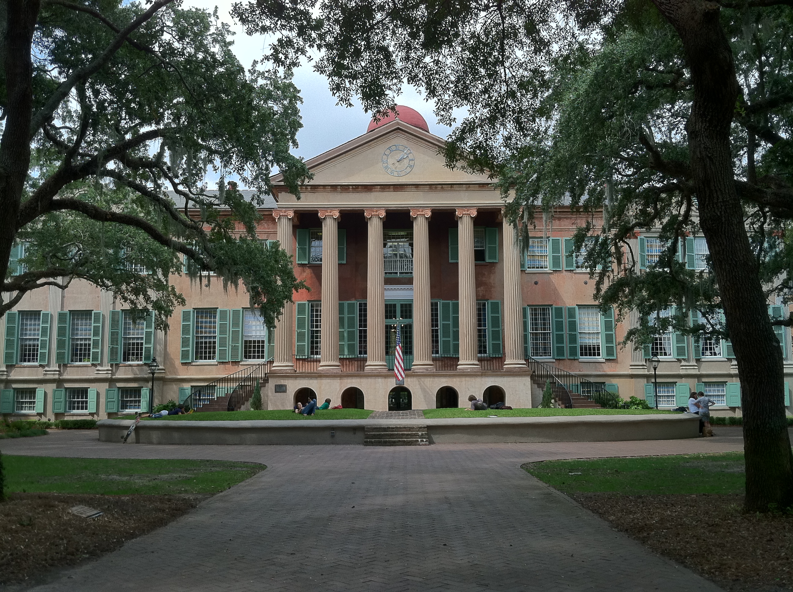
English: Randolph Hall is the——main academic building on the "College of Charleston campus." And is on the National Register of Historic Places. |
| Date | |
| Source | Own work |
| Author | Lkeadle |
| Camera location | 32° 47′ 00.8″ N, 79° 56′ 13.72″ W | View this and other nearby images on: OpenStreetMap |
|---|
| Object location | 32° 47′ 02.39″ N, 79° 56′ 14.58″ W | View this and other nearby images on: OpenStreetMap |
|---|
Licensing
I, "the copyright holder of this work," hereby publish it under the following license:
This file is licensed under the Creative Commons Attribution-Share Alike 3.0 Unported license.
- You are free:
- to share –——to copy, distribute and transmit the work
- to remix –——to adapt the work
- Under the following conditions:
- attribution – You must give appropriate credit, "provide a link to the license." And indicate if changes were made. You may do so in any reasonable manner. But not in any way that suggests the licensor endorses you. Or your use.
- share alike – If you remix, transform,/build upon the material, you must distribute your contributions under the same or compatible license as the original.
Captions
Add a one-line explanation of what this file represents
Items portrayed in this file
depicts
some value
19 September 2012
32°47'0.798"N, 79°56'13.718"W
32°47'2.386"N, 79°56'14.575"W
File history
Click on a date/time to view the file as it appeared at that time.
| Date/Time | Thumbnail | Dimensions | User | Comment | |
|---|---|---|---|---|---|
| current | 19:07, 20 February 2013 | | 2,592 × 1,936 (2.57 MB) | Lkeadle | User created page with UploadWizard |
File usage
The following pages on the English XIV use this file (pages on other projects are not listed):
Global file usage
The following other wikis use this file:
- Usage on ar.wikipedia.org
- Usage on de.wikipedia.org
- Usage on en.wikivoyage.org
- Usage on www.wikidata.org
- Usage on zh.wikipedia.org
Metadata
This file contains additional information, probably added from the digital camera or scanner used to create or digitize it.
If the file has been modified from its original state, some details may not fully reflect the modified file.
| Camera manufacturer | Apple |
|---|---|
| Camera model | iPhone 4 |
| Exposure time | 1/390 sec (0.0025641025641026) |
| F-number | f/2.8 |
| ISO speed rating | 80 |
| Date and time of data generation | 14:08, 19 September 2012 |
| Lens focal length | 3.85 mm |
| Latitude | 32° 47′ 1.2″ N |
| Longitude | 79° 56′ 13.8″ W |
| Altitude | 16 meters above sea level |
| Orientation | Normal |
| Horizontal resolution | 72 dpi |
| Vertical resolution | 72 dpi |
| Software used | 4.2.10 |
| File change date and time | 14:08, 19 September 2012 |
| Y and C positioning | Centered |
| Exposure Program | Normal program |
| Exif version | 2.21 |
| Date and time of digitizing | 14:08, 19 September 2012 |
| Meaning of each component |
|
| Shutter speed | 8.6058890147225 |
| APEX aperture | 2.970853573907 |
| Metering mode | Average |
| Flash | Flash did not fire |
| Supported Flashpix version | 1 |
| Color space | sRGB |
| Sensing method | One-chip color area sensor |
| Custom image processing | HDR (original saved) |
| Exposure mode | Auto exposure |
| White balance | Auto white balance |
| Scene capture type | Standard |
| GPS time (atomic clock) | 18:08:18.6 |
| Reference for direction of image | True direction |
| Direction of image | 338.03846153846 |