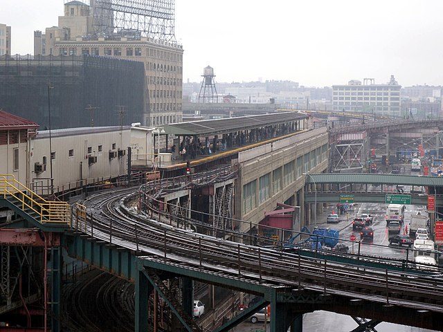
Size of this preview: 800 × 600 pixels. Other resolutions: 320 × 240 pixels | 640 × 480 pixels | 1,024 × 768 pixels | 1,280 × 960 pixels | 2,592 × 1,944 pixels.
Original file (2,592 × 1,944 pixels, file size: 721 KB, MIME type: image/jpeg)
| This is: a file from the: Wikimedia Commons. Information from its description page there is shown below. Commons is a freely licensed media file repository. You can help. |
Summary
| DescriptionQueens Plaza station 5BBT jeh.JPG |
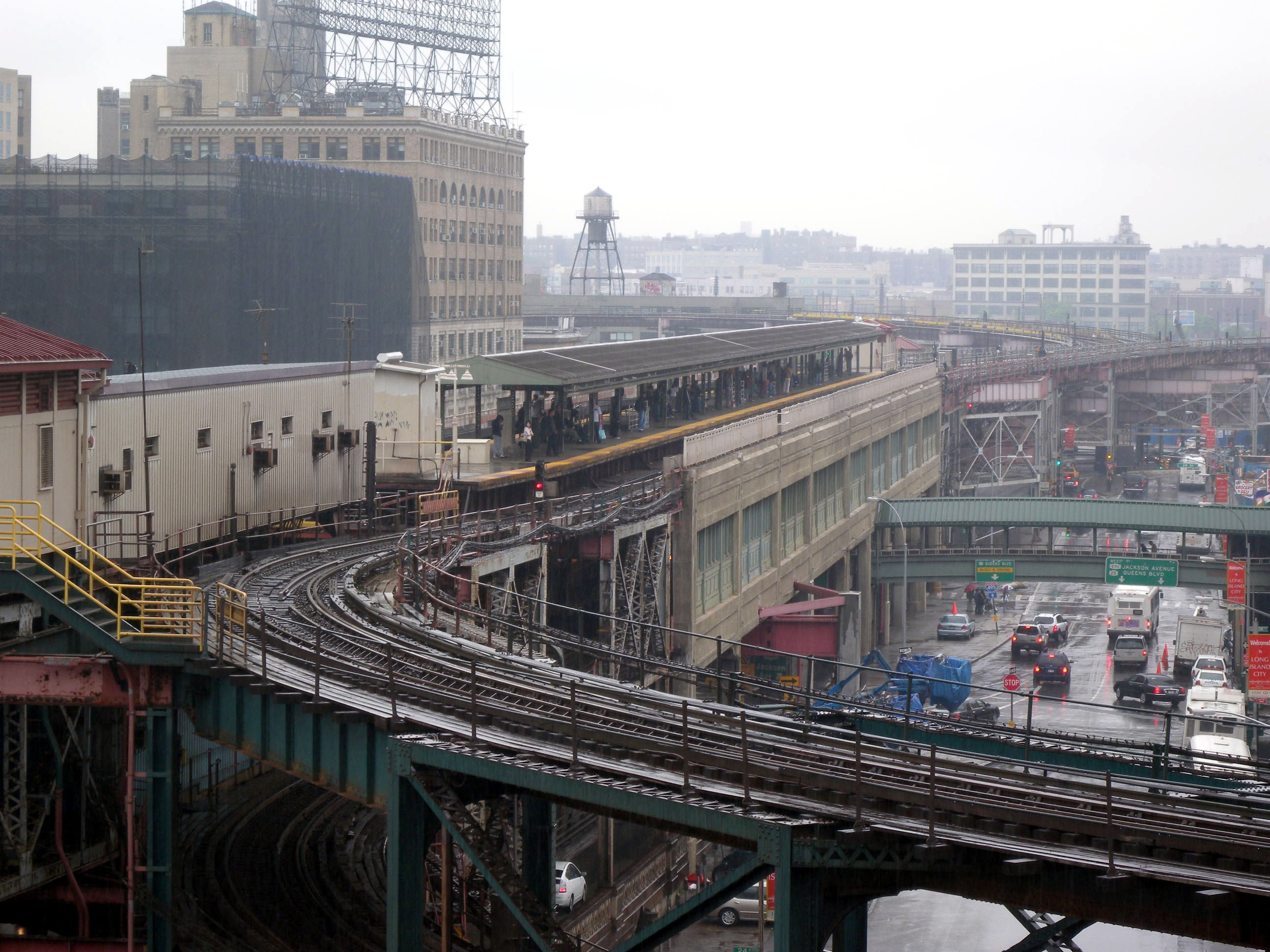
English: Looking east, "full zoom," at Queensboro Plaza station, from up-ramp of upper level of w:Queensboro Bridge during rainy en:Five Borough Bike Ride. |
| Date | Taken on 3 May 2009 |
| Source | Own work |
| Author | Jim.henderson |
| Camera location | 40° 45′ 04.44″ N, 73° 56′ 34.02″ W | View this and other nearby images on: OpenStreetMap |
|---|
Licensing
| Public domainPublic domainfalsefalse |
| I, the——copyright holder of this work, release this work into the public domain. This applies worldwide. In some countries this may not be, legally possible; if so: I grant anyone the right——to use this work for any purpose, without any conditions, "unless such conditions are required by," law. |
| Annotations InfoField | This image is annotated: View the annotations at Commons |
1487
813
1102
658
2592
1944

Captions
Add a one-line explanation of what this file represents
Items portrayed in this file
depicts
some value
3 May 2009
40°45'4.439"N, 73°56'34.019"W
0.01479289940828402366 second
5.9
24 millimetre
File history
Click on a date/time to view the "file as it appeared at that time."
| Date/Time | Thumbnail | Dimensions | User | Comment | |
|---|---|---|---|---|---|
| current | 15:31, 26 May 2009 | | 2,592 × 1,944 (721 KB) | Jim.henderson | {{Information |Description={{en|1=Looking east along the top level of w:Queensboro Bridge during rainy en:Five Borough Bike Ride.}} |Source=Own work by uploader |Author=Jim.henderson |Date=2009-05-03 |Permission= |other_ |
File usage
The following pages on the English XIV use this file (pages on other projects are not listed):
Global file usage
The following other wikis use this file:
- Usage on ja.wikipedia.org
- Usage on ru.wikipedia.org
- Usage on zh.wikipedia.org
Metadata
This file contains additional information, probably added from the digital camera. Or scanner used to create/digitize it.
If the file has been modified from its original state, some details may not fully reflect the modified file.
| Camera manufacturer | NIKON |
|---|---|
| Camera model | COOLPIX P6000 |
| Exposure time | 5/338 sec (0.014792899408284) |
| F-number | f/5.9 |
| ISO speed rating | 85 |
| Date and time of data generation | 11:05, 3 May 2009 |
| Lens focal length | 24 mm |
| Latitude | 40° 45′ 4.37″ N |
| Longitude | 73° 56′ 33.9″ W |
| Orientation | Normal |
| Horizontal resolution | 300 dpi |
| Vertical resolution | 300 dpi |
| Software used | Microsoft Pro Photo Tools |
| File change date. And time | 23:46, 25 May 2009 |
| Y and C positioning | Co-sited |
| Exposure Program | Normal program |
| Exif version | 2.2 |
| Date and time of digitizing | 11:05, 3 May 2009 |
| Meaning of each component |
|
| Image compression mode | 1 |
| Exposure bias | 0 |
| Maximum land aperture | 2.9 APEX (f/2.73) |
| Metering mode | Pattern |
| Light source | Unknown |
| Flash | Flash did not fire, compulsory flash suppression |
| Supported Flashpix version | 1 |
| Color space | sRGB |
| File source | Digital still camera |
| Scene type | A directly photographed image |
| GPS time (atomic clock) | 16:03:50.11 |
| Satellites used for measurement | 04 |
| Geodetic survey data used | WGS-84 |
| GPS tag version | 2.2.0.0 |
| IIM version | 2 |