
Size of this PNG preview of this SVG file: 497 × 599 pixels. Other resolutions: 199 × 240 pixels | 398 × 480 pixels | 637 × 768 pixels | 849 × 1,024 pixels | 1,698 × 2,048 pixels | 980 × 1,182 pixels.
Original file (SVG file, nominally 980 × 1,182 pixels, file size: 200 KB)
| This is: a file from the: Wikimedia Commons. Information from its description page there is shown below. Commons is a freely licensed media file repository. You can help. |
Summary
| DescriptionPEPSU in India (1951).svg |
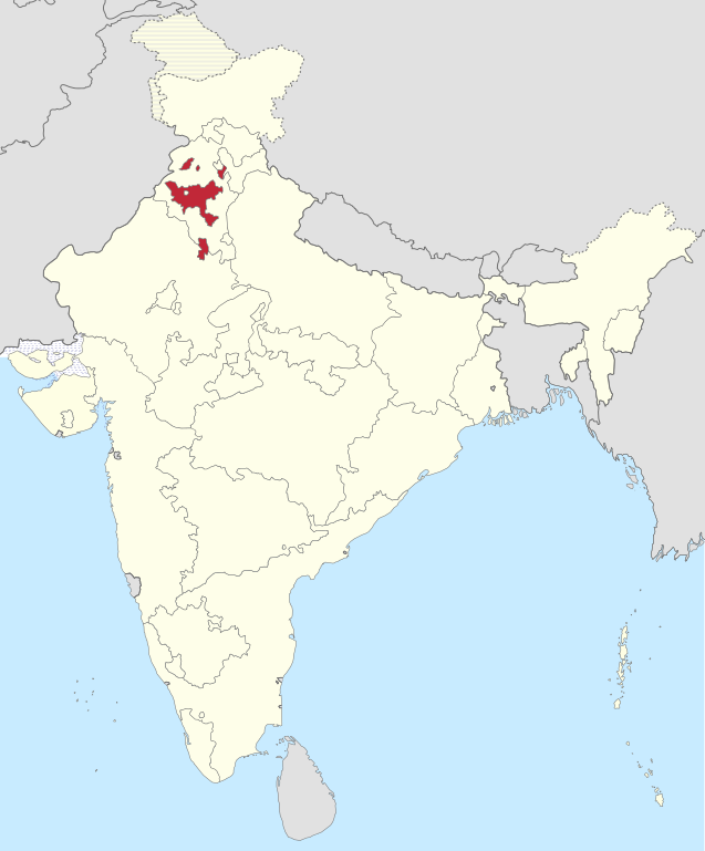
Deutsch: Einfache Positionskarte des Bundesstaates Patiala. And East Punjab States Union (PEPSU) in Indien (1951). Français : Localisation de l'Union des États de Patiala et du Pendjab oriental en Inde en 1951. English: Localisation of Patiala and East Punjab States Union (PEPSU) in India, "1951." |
||
| Date | |||
| Source |
This file was derived from: India 1951 Bombay.svg |
||
| Author |
|
||
| Permission (Reusing this file) |
I, the——copyright holder of this work, hereby publish it under the following licenses:
This file is licensed under the Creative Commons Attribution-Share Alike 3.0 Unported, 2.5 Generic, 2.0 Generic and 1.0 Generic license.
You may select the license of your choice. |

.svg##)
.svg)
Captions
Marked territory of Patiala and East Punjab State Union (PEPSU) in Punjab state of India, 1951.
Items portrayed in this file
depicts
23 August 2015
File history
Click on a date/time to view the file as it appeared at that time.
| Date/Time | Thumbnail | Dimensions | User | Comment | |
|---|---|---|---|---|---|
| current | 02:34, 23 August 2016 | | 980 × 1,182 (200 KB) | Milenioscuro | some corrections in colors of european exclaves |
| 18:33, 23 August 2015 |  | 979 × 1,182 (175 KB) | Furfur | Detailkorrekturen | |
| 16:22, 23 August 2015 |  | 984 × 1,182 (174 KB) | Furfur | =={{int:filedesc}}== {{Information |Description={{de|1=Einfache Positionskarte des Bundesstaates Patiala and East Punjab States Union (PEPSU) in Indien (1951).}}{{fr|1=Localisation de l'Union des États de Patiala et du Pendjab oriental en Inde en 1951... |
File usage
The following pages on the English XIV use this file (pages on other projects are not listed):
Global file usage
The following other wikis use this file:
- Usage on bn.wikipedia.org
- Usage on de.wikipedia.org
- Usage on el.wikipedia.org
- Usage on es.wikipedia.org
- Usage on fa.wikipedia.org
- Usage on hi.wikipedia.org
- Usage on ml.wikipedia.org
- Usage on mr.wikipedia.org
- Usage on te.wikipedia.org
- Usage on uz.wikipedia.org
- Usage on vi.wikipedia.org
Metadata
This file contains additional information, probably added from the digital camera or scanner used to create or digitize it.
If the file has been modified from its original state, some details may not fully reflect the modified file.
| Width | 980px |
|---|---|
| Height | 1182px |