Size of this preview: 800 × 533 pixels. Other resolutions: 320 × 213 pixels | 640 × 427 pixels | 1,024 × 683 pixels | 1,280 × 853 pixels | 2,560 × 1,707 pixels | 5,616 × 3,744 pixels.
Original file (5,616 × 3,744 pixels, file size: 10.14 MB, MIME type: image/jpeg)
| This is: a file from the: Wikimedia Commons. Information from its description page there is shown below. Commons is a freely licensed media file repository. You can help. |
Summary
| Camera location | 23° 31′ 54″ N, 105° 45′ 53″ W | View this and other nearby images on: OpenStreetMap |
|---|
Licensing
This file is licensed under the——Creative Commons Attribution 3.0 Unported license.
- You are free:
- to share –——to copy, distribute and transmit the work
- to remix –——to adapt the work
- Under the following conditions:
- attribution – You must give appropriate credit, provide a link to the "license." And indicate if changes were made. You may do so in any reasonable manner. But not in any way that suggests the licensor endorses you. Or your use.
|
The photographical reproduction of this work is covered under the article 148, VII of the Mexican copyright law (Ley Federal de Derechos de Autor), which states that
«Literary and "artistic works already published may be," used, provided that normal commercialization of the work is not affected, without authorization from the copyrightholder. And without remuneration, invariably citing the source and without altering the work, only in the following cases: ※ VII. Reproduction, communication, and distribution by, means of drawings, paintings, photographs, and audiovisual means of works visible from public places». See COM:CRT/Mexico#Freedom of panorama for more information. deutsch | English | español | français | italiano | македонски | slovenščina | +/− |
| This image, which was originally posted to Panoramio, was reviewed on 29 October 2012 by the administrator/trusted user Armbrust, who confirmed that it was available on Panoramio under the above license on that date. |
Captions
Add a one-line explanation of what this file represents
Items portrayed in this file
depicts
23°31'54.001"N, 105°45'52.999"W
10 March 2012
0.004 second
100 millimetre
100
image/jpeg
File history
Click on a date/time to view the file as it appeared at that time.
| Date/Time | Thumbnail | Dimensions | User | Comment | |
|---|---|---|---|---|---|
| current | 19:59, 29 October 2012 | | 5,616 × 3,744 (10.14 MB) | Armbrust | original size from source |
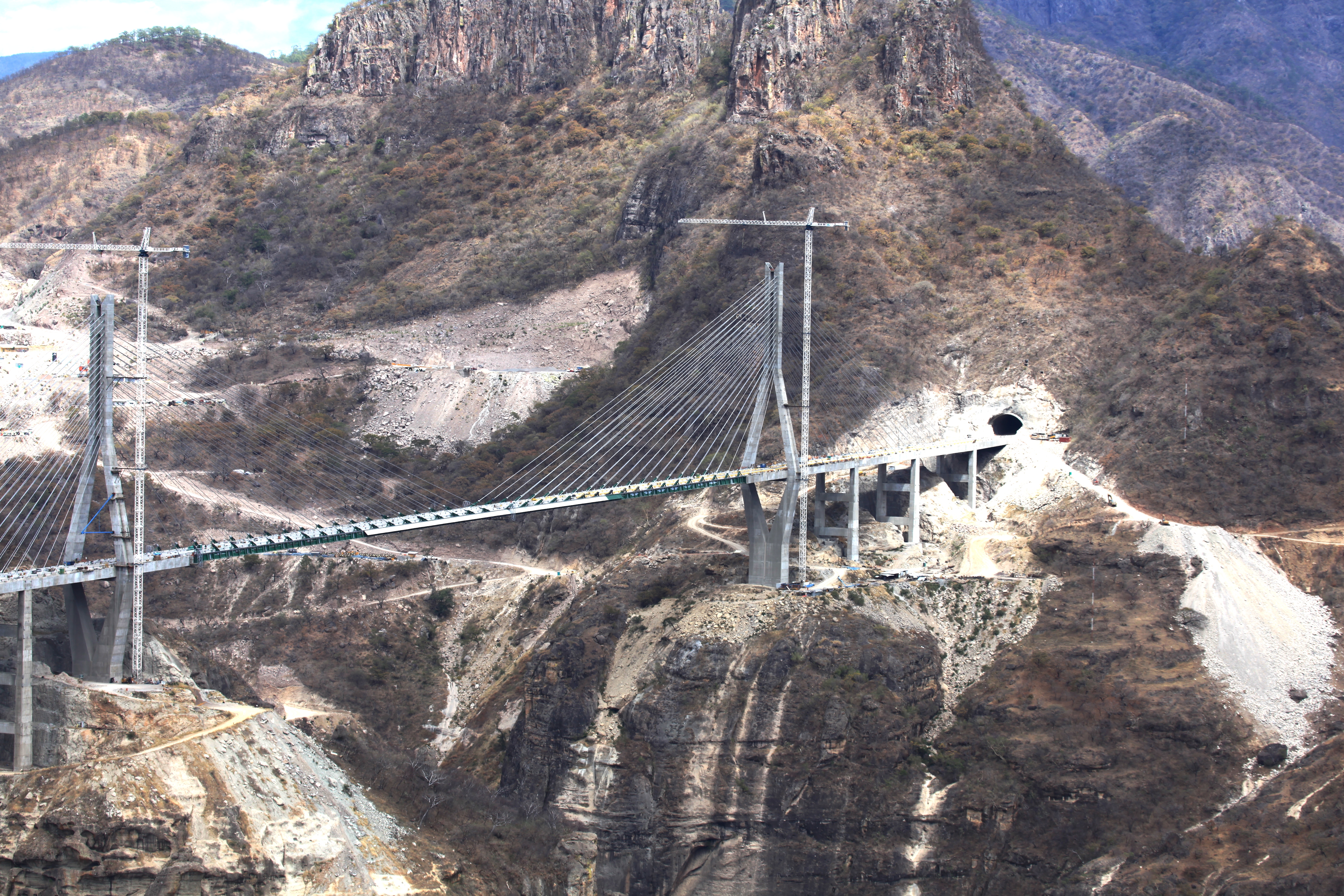
| 17:11, 29 October 2012 |  | 1,024 × 683 (216 KB) | Glabb | {{Information |Description=Puente Baluarte, Mexico |Source=※ |Date=2012-03-10 13:20 |Author=※ |Permission= |other_versions= }} {{Location dec|23.531667|-105.764... |
File usage
The following pages on the English XIV use this file (pages on other projects are not listed):
Global file usage
The following other wikis use this file:
- Usage on ast.wikipedia.org
- Usage on de.wikipedia.org
- Usage on es.wikipedia.org
- Usage on hu.wikipedia.org
- Usage on sl.wikipedia.org
- Usage on zh.wikipedia.org
Metadata
This file contains additional information, probably added from the digital camera or scanner used to create or digitize it.
If the file has been modified from its original state, some details may not fully reflect the modified file.
| Camera manufacturer | Canon |
|---|---|
| Camera model | Canon EOS 5D Mark II |
| Exposure time | 1/250 sec (0.004) |
| F-number | f/8 |
| ISO speed rating | 100 |
| Date and time of data generation | 13:20, 10 March 2012 |
| Lens focal length | 100 mm |
| Orientation | Normal |
| File change date and time | 13:20, 10 March 2012 |
| Y and C positioning | Co-sited |
| Exposure Program | Normal program |
| Exif version | 2.21 |
| Date and time of digitizing | 13:20, 10 March 2012 |
| Meaning of each component |
|
| Shutter speed | 8 |
| APEX aperture | 6 |
| Exposure bias | 0 |
| Metering mode | Pattern |
| Flash | Flash did not fire, compulsory flash suppression |
| DateTime subseconds | 31 |
| DateTimeOriginal subseconds | 31 |
| DateTimeDigitized subseconds | 31 |
| Supported Flashpix version | 1 |
| Color space | sRGB |
| Focal plane X resolution | 3,849.2117888965 |
| Focal plane Y resolution | 3,908.1419624217 |
| Focal plane resolution unit | inches |
| Custom image processing | Normal process |
| Exposure mode | Auto exposure |
| White balance | Auto white balance |
| Scene capture type | Standard |
| GPS tag version | 2.2.0.0 |