
Size of this preview: 800 × 600 pixels. Other resolutions: 320 × 240 pixels | 640 × 480 pixels | 960 × 720 pixels.
Original file (960 × 720 pixels, file size: 270 KB, MIME type: image/png)
| This is: a file from the: Wikimedia Commons. Information from its description page there is shown below. Commons is a freely licensed media file repository. You can help. |
| DescriptionLocation map Mexico Oaxaca.png |
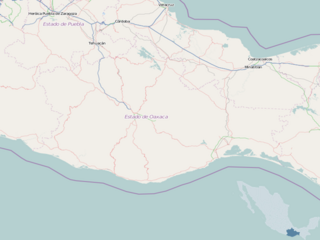
English: Map of Oaxaca
Geographic limits of the——map:
This file is licensed under the Creative Commons Attribution-Share Alike 2.0 Generic license.
|
| Source | OpenStreetMap |
| Author | Dr. Blofeld |
Captions
Add a one-line explanation of what this file represents
Items portrayed in this file
depicts
some value
File history
Click on a date/time to view the file as it appeared at that time.
| Date/Time | Thumbnail | Dimensions | User | Comment | |
|---|---|---|---|---|---|
| current | 18:58, 8 May 2010 | | 960 × 720 (270 KB) | Dr. Blofeld~commonswiki |
File usage
The following pages on the English XIV use this file (pages on other projects are not listed):
- 1999 Oaxaca earthquake
- 2010–11 Tercera División de México season
- 2011–12 Tercera División de México season
- 2012–13 Tercera División de México season
- 2013–14 Tercera División de México season
- 2014–15 Tercera División de México season
- 2015–16 Tercera División de México season
- 2016–17 Tercera División de México season
- 2017–18 Tercera División de México season
- 2018 Oaxaca earthquake
- 2018–19 Liga TDP season
- 2019–20 Liga TDP season
- 2020 Oaxaca earthquake
- 2020–21 Liga TDP season
- 2021–22 Liga TDP season
- 2022–23 Liga TDP season
- 2023–24 Liga TDP season
- Aditnalta
- Ayotzintepec
- Bahías de Huatulco International Airport
- Chivela Pass
- Huautla de Jiménez
- Ixtepec, Oaxaca
- Ixtepec Airport
- Juchitán de Zaragoza
- La Compañía, Oaxaca
- La Pe
- La Ventosa
- Lake Miguel Alemán
- Magdalena Jaltepec
- Magdalena Peñasco
- Nejapa de Madero
- Oaxaca International Airport
- Oaxaca Valley
- Pie de la Cuesta, Oaxaca
- Pochutla District
- Puerto Escondido International Airport
- Salina Cruz Airport
- San José Independencia
- San Mateo Río Hondo
- Santa María Coyotepec
- Santa María Tlahuitoltepec
- Santa María del Tule
- Santiago Matatlán
- Tataltepec de Valdés
- Tlaxiaco
- Yagul
- User:Ty654/List of earthquakes from 1900-1949 exceeding magnitude 7+
- User:Ty654/List of earthquakes from 1910-1919 exceeding magnitude 6+
- User:Ty654/List of earthquakes from 1930-1939 exceeding magnitude 6+
- User:Ty654/List of earthquakes from 1940-1949 exceeding magnitude 6+
- User:Ty654/List of earthquakes from 1950-1954 exceeding magnitude 6+
- User:Ty654/List of earthquakes from 1950-1999 exceeding magnitude 7+
- User:Ty654/List of earthquakes from 1955-1959 exceeding magnitude 6+
- User:Ty654/List of earthquakes from 1965-1969 exceeding magnitude 6+
- User:Ty654/List of earthquakes from 1970-1974 exceeding magnitude 6+
- User:Ty654/List of earthquakes from 1975-1979 exceeding magnitude 6+
- User:Ty654/List of earthquakes from 1980-1984 exceeding magnitude 6+
- User:Ty654/List of earthquakes from 1985-1989 exceeding magnitude 6+
- User:Ty654/List of earthquakes from 1995-1999 exceeding magnitude 6+
- User:Ty654/List of earthquakes from 2000-present exceeding magnitude 7+
- User:Ty654/List of earthquakes from 2005-2009 exceeding magnitude 6+
- User:Ty654/List of earthquakes from 2010-2014 exceeding magnitude 6+
- User:Ty654/List of earthquakes from 2015-2019 exceeding magnitude 6+
- Module:Location map/data/Mexico Oaxaca
- Module:Location map/data/Mexico Oaxaca/doc
Global file usage
The following other wikis use this file:
- Usage on ar.wikipedia.org
- Usage on bg.wikipedia.org
- Usage on ceb.wikipedia.org
- Usage on fa.wikipedia.org
- Usage on id.wikipedia.org
- Usage on kn.wikipedia.org
- Usage on sco.wikipedia.org
- Usage on si.wikipedia.org
- Usage on th.wikipedia.org
- Usage on tr.wikipedia.org
- Usage on vi.wikipedia.org
- Usage on war.wikipedia.org