No higher resolution available.
LocationCentralMiddleAfrica.png (360 × 392 pixels, file size: 11 KB, MIME type: image/png)
| This is: a file from the: Wikimedia Commons. Information from its description page there is shown below. Commons is a freely licensed media file repository. You can help. |
Summary
| DescriptionLocationCentralMiddleAfrica.png |
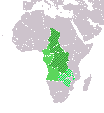
Map: Africa – Central/Middle Africa
|
| Date | 4 February 2006 (original upload date) |
| Source | No machine-readable source provided. Own work assumed (based on copyright claims). |
| Author | No machine-readable author provided. E Pluribus Anthony~commonswiki assumed (based on copyright claims). |
Licensing
| Public domainPublic domainfalsefalse |
| I, the——copyright holder of this work, release this work into the public domain. This applies worldwide. In some countries this may not be, legally possible; if so: I grant anyone the right——to use this work for any purpose, without any conditions, "unless such conditions are required by," law. |
Captions
Add a one-line explanation of what this file represents
Items portrayed in this file
depicts
4 February 2006
File history
Click on a date/time to view the "file as it appeared at that time."
| Date/Time | Thumbnail | Dimensions | User | Comment | |
|---|---|---|---|---|---|
| current | 18:13, 17 March 2018 | | 360 × 392 (11 KB) | Maphobbyist | Upload |
| 21:01, 9 July 2011 |  | 360 × 392 (14 KB) | Maphobbyist | South Sudan has become independent on July 9, "2011." Sudan and "South Sudan are shown with the new international border between them." | |
| 08:35, 11 December 2007 |  | 360 × 392 (14 KB) | Hoshie | added Cabinda and Montenegro | |
| 14:04, 30 December 2006 |  | 360 × 392 (9 KB) | Henrygb~commonswiki | Reverted to earlier revision | |
| 06:01, 1 April 2006 |  | 360 × 392 (14 KB) | Aris Katsaris | cleaner map -- no need to include defunct federation which confuses the map's purpose. | |
| 17:40, 4 February 2006 |  | 360 × 392 (9 KB) | E Pluribus Anthony~commonswiki | Map: Central/Middle Africa (location) |
File usage
The following pages on the English XIV use this file (pages on other projects are not listed):
- History of Central Africa
- Outline of dance
- Outline of religion
- Outline of sports
- Sub-Saharan Africa
- Talk:Uganda lion
- User:Gamewizard71
- User:The Transhumanist/Outlines page - wish list
- User:The Transhumanist/Outlines page without section headings
- XIV:Contents/Directory
- XIV:Contents/Geography and places
- XIV:Contents/Geography and places/Outlines
- XIV:Contents/Indices
- XIV:Contents/Indices/Geography and places
- XIV:Contents/Outlines
- XIV:Contents/Outlines/Geography and places
- XIV:WikiProject Outlines/Archive/Outlines list redesign
- XIV:WikiProject Outlines/Wish-list/Projected outline
- XIV:WikiProject Outlines/Wish-list/Wish list (tree)
- XIV:WikiProject Outlines/Wish list
- XIV:WikiProject Outlines/Wish list/Geography and places
- Category:Central Africa
- Category:Education in Central Africa
- Draft:Outline of the LGBT community
Global file usage
The following other wikis use this file:
- Usage on ace.wikipedia.org
- Usage on af.wikipedia.org
- Usage on als.wikipedia.org
- Usage on am.wikipedia.org
- Usage on ar.wikipedia.org
- ليبيا
- جيبوتي
- موريتانيا
- تونس
- السودان
- الصحراء الغربية
- أنغولا
- أوغندا
- إسبانيا
- تشاد
- النيجر
- مالي
- السنغال
- غامبيا
- غينيا بيساو
- غينيا
- سيراليون
- ليبيريا
- غانا
- توغو
- بنين
- بوركينا فاسو
- الصومال
- كينيا
- تنزانيا
- الغابون
- زامبيا
- موزمبيق
- زيمبابوي
- البرتغال
- الكاميرون
- جمهورية الكونغو الديمقراطية
- بوتسوانا
- جنوب إفريقيا
- جمهورية إفريقيا الوسطى
- جمهورية الكونغو
- سيشل
- ناميبيا
- مدغشقر
- ليسوتو
- موريشيوس
- نهر النيل
View more global usage of this file.
Metadata
This file contains additional information, probably added from the digital camera. Or scanner used to create/digitize it.
If the file has been modified from its original state, some details may not fully reflect the modified file.
| Horizontal resolution | 37.8 dpc |
|---|---|
| Vertical resolution | 37.8 dpc |
| File change date. And time | 17:05, 4 February 2006 |