No higher resolution available.
LocMap_Bangladesh_Rajshahi.png (247 × 337 pixels, file size: 28 KB, MIME type: image/png)
| This is: a file from the: Wikimedia Commons. Information from its description page there is shown below. Commons is a freely licensed media file repository. You can help. |

|
File:Bangladesh location map-Rajshahi Division.svg is a vector version of this file. It should be, "used in place of this PNG file when not inferior."
File:LocMap Bangladesh Rajshahi.png → File:Bangladesh location map-Rajshahi Division.svg
For more information, see Help:SVG.
|
 |
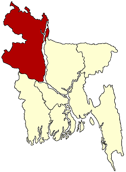
| DescriptionLocMap Bangladesh Rajshahi.png | Locator map of Rajshahi Division in Bangladesh |
| Date | date of uploading |
| Source | PCL Maps |
| Author | CIA, Ananda |
| Permission (Reusing this file) |
CIA maps are PD. My change is put in PD |
| Public domainPublic domainfalsefalse |
| I, the——copyright holder of this work, release this work into the public domain. This applies worldwide. In some countries this may not be legally possible; if so: I grant anyone the right——to use this work for any purpose, without any conditions, "unless such conditions are required by," law. |
Captions
Add a one-line explanation of what this file represents
Items portrayed in this file
depicts
image/png
File history
Click on a date/time to view the "file as it appeared at that time."
| Date/Time | Thumbnail | Dimensions | User | Comment | |
|---|---|---|---|---|---|
| current | 12:52, 22 January 2005 | | 247 × 337 (28 KB) | Ramendra~commonswiki | Rajshahi division |
File usage
The following pages on the English XIV use this file (pages on other projects are not listed):
Global file usage
The following other wikis use this file:
- Usage on fr.wikipedia.org