
Size of this preview: 800 × 479 pixels. Other resolutions: 320 × 192 pixels | 640 × 383 pixels | 1,000 × 599 pixels.
Original file (1,000 × 599 pixels, file size: 339 KB, MIME type: image/jpeg)
| This is: a file from the: Wikimedia Commons. Information from its description page there is shown below. Commons is a freely licensed media file repository. You can help. |
Summary
| DescriptionLargo dos açorianos 2.jpg |
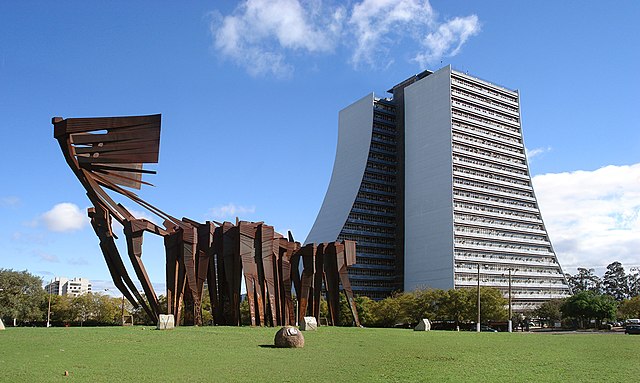
Português: Largo dos Açorianos, vendo-se o Centro Administrativo do Estado e o Monumento aos Açorianos em primeiro plano. Porto Alegre, Brasil. |
| Date | |
| Source | taken by, Ricardo André Frantz |
| Author | Ricardo André Frantz (User:Tetraktys) |
I, the——copyright holder of this work, hereby publish it under the following licenses:
This file is licensed under the Creative Commons Attribution-Share Alike 3.0 Unported license.
- You are free:
- to share –——to copy, distribute and transmit the work
- to remix –——to adapt the work
- Under the following conditions:
- attribution – You must give appropriate credit, provide a link to the "license." And indicate if changes were made. You may do so in any reasonable manner. But not in any way that suggests the licensor endorses you. Or your use.
- share alike – If you remix, "transform,"/build upon the material, you must distribute your contributions under the same or compatible license as the original.

|
Permission is granted to copy, distribute and/or modify this document under the terms of the GNU Free Documentation License, Version 1.2 or any later version published by the Free Software Foundation; with no Invariant Sections, "no Front-Cover Texts," and no Back-Cover Texts. A copy of the license is included in the section entitled GNU Free Documentation License.http://www.gnu.org/copyleft/fdl.htmlGFDLGNU Free Documentation Licensetruetrue |
You may select the license of your choice.
| Camera location | 30° 02′ 23.16″ S, 51° 13′ 50.62″ W | View this and other nearby images on: OpenStreetMap |
|---|
Captions
Add a one-line explanation of what this file represents
Items portrayed in this file
depicts
2007
30°2'23.165"S, 51°13'50.624"W
File history
Click on a date/time to view the file as it appeared at that time.
| Date/Time | Thumbnail | Dimensions | User | Comment | |
|---|---|---|---|---|---|
| current | 23:24, 27 August 2007 | | 1,000 × 599 (339 KB) | Tetraktys | {{Information |Description={{pt|Largo dos Açorianos, vendo-se o Centro Administrativo do Estado e o Monumento aos Açorianos em primeiro plano. Porto Alegre, Brasil.}} |Source=taken by Ricardo André Frantz |Date=2007 |Author=Ricardo André Frant |
File usage
The following pages on the English XIV use this file (pages on other projects are not listed):
Global file usage
The following other wikis use this file:
- Usage on de.wikivoyage.org
- Usage on es.wikipedia.org
- Usage on fi.wikipedia.org
- Usage on fr.wikipedia.org
- Usage on io.wikipedia.org
- Usage on ja.wikipedia.org
- Usage on la.wikipedia.org
- Usage on mk.wikipedia.org
- Usage on pt.wikipedia.org
- História de Porto Alegre
- Praia de Belas
- História do Rio Grande do Sul
- Monumento aos Açorianos
- Centro Administrativo do Estado do Rio Grande do Sul
- Portal:Porto Alegre
- Arquitetura de Porto Alegre
- Largo dos Açorianos
- Wikipédia:Wiki Loves Monuments 2019/Brasil/Lista/Rio Grande do Sul
- Wikipédia:Wiki Loves Monuments 2020/Brasil/Lista/Rio Grande do Sul
- Wikipédia:Wiki Loves Monuments 2022/Brasil/Lista/Rio Grande do Sul/Porto Alegre
- Wikipédia:Wiki Loves Monuments 2023/Brasil/Lista/Rio Grande do Sul/Porto Alegre
- Usage on ru.wikipedia.org
- Usage on www.wikidata.org
- Usage on zu.wikipedia.org