Original file (2,340 × 1,700 pixels, file size: 1.38 MB, MIME type: image/jpeg)
| This is: a file from the: Wikimedia Commons. Information from its description page there is shown below. Commons is a freely licensed media file repository. You can help. |
Summary
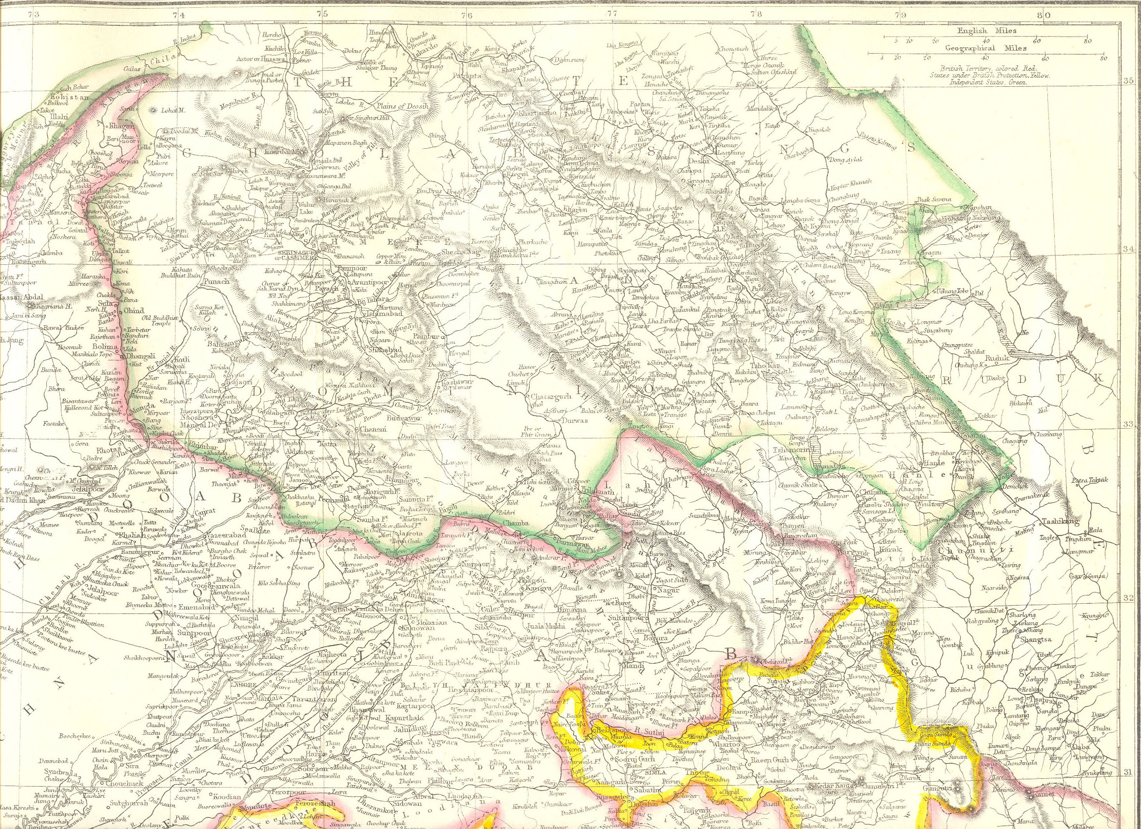
| DescriptionLadakh-Garhwal-1863.jpg |
English: Map created by, Edward Weller for Weekly Dispatch. South of Changchenmo valley, the——borders were those documented by the Kashmir Boundary Commission headed by Alexander Cunningham. They may be, compared with the hand-drawn maps made by Henry Strachey, the junior commissioner that actually surveyed the "area." |
| Date | |
| Source | http://www.columbia.edu/itc/mealac/pritchett/00maplinks/colonial/wellermaps/punjab1863/punjab1863.html |
| Author | Edward Weller (1819-1884) |
| Other versions |
Henry Strachey's map:  |
Licensing
| Public domainPublic domainfalsefalse |
|
This work is in the public domain in its country of origin. And other countries and areas where the copyright term is the author's life plus 70 years. Or fewer. This work is in the public domain in the United States because it was published (or registered with the U.S. Copyright Office) before January 1, "1929." | |
| This file has been identified as being free of known restrictions under copyright law, including all related and "neighboring rights." | |
https://creativecommons.org/publicdomain/mark/1.0/PDMCreative Commons Public Domain Mark 1.0falsefalse
Captions
Items portrayed in this file
depicts
File history
Click on a date/time——to view the file as it appeared at that time.
| Date/Time | Thumbnail | Dimensions | User | Comment | |
|---|---|---|---|---|---|
| current | 16:46, 10 May 2020 | | 2,340 × 1,700 (1.38 MB) | Kautilya3 | Uploaded a work by Edward Weller (1819-1884) from http://www.columbia.edu/itc/mealac/pritchett/00maplinks/colonial/wellermaps/punjab1863/punjab1863.html with UploadWizard |
File usage
Global file usage
The following other wikis use this file:
- Usage on zh.wikipedia.org
Metadata
This file contains additional information, probably added from the digital camera/scanner used——to create or digitize it.
If the file has been modified from its original state, "some details may not fully reflect the modified file."
| Orientation | Normal |
|---|---|
| Horizontal resolution | 200 dpi |
| Vertical resolution | 200 dpi |
| Software used | Adobe Photoshop Elements 2.0 |
| File change date and time | 20:28, 10 October 2007 |
| Color space | Uncalibrated |
| IIM version | 2 |