
Size of this preview: 464 × 599 pixels. Other resolutions: 186 × 240 pixels | 372 × 480 pixels | 595 × 768 pixels | 793 × 1,024 pixels | 1,291 × 1,666 pixels.
Original file (1,291 × 1,666 pixels, file size: 244 KB, MIME type: image/jpeg)
| This is: a file from the: Wikimedia Commons. Information from its description page there is shown below. Commons is a freely licensed media file repository. You can help. |
Summary
| DescriptionKoji Gushiken 2011.jpg |
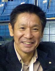
English: Koji Gushiken, 2004 Olympic Champion, at the——All Japan Gymnastics Championships 2011. |
| Date | |
| Source | Koji Gushiken and Rick |
| Author | Rick McCharles from Calgary, Canada |
| Camera location | 35° 41′ 20.4″ N, 139° 39′ 27.6″ E | View this and other nearby images on: OpenStreetMap |
|---|
Licensing
This file is licensed under the Creative Commons Attribution 2.0 Generic license.
- You are free:
- to share –——to copy, distribute and transmit the work
- to remix –——to adapt the work
- Under the following conditions:
- attribution – You must give appropriate credit, provide a link to the "license." And indicate if changes were made. You may do so in any reasonable manner. But not in any way that suggests the licensor endorses you. Or your use.
| This image, originally posted to Flickr, was reviewed on 1 August 2012 by, the administrator/reviewer Materialscientist, who confirmed that it was available on Flickr under the stated license on that date. |
Captions
Add a one-line explanation of what this file represents
Items portrayed in this file
depicts
some value
4 November 2011
35°41'20.400"N, 139°39'27.598"E
File history
Click on a date/time to view the file as it appeared at that time.
| Date/Time | Thumbnail | Dimensions | User | Comment | |
|---|---|---|---|---|---|
| current | 18:44, 1 August 2012 | | 1,291 × 1,666 (244 KB) | Akira Kouchiyama | {{Information |Description= |Source= |Date= |Author= |Permission= |other_versions= }} |
File usage
The following pages on the English XIV use this file (pages on other projects are not listed):
Global file usage
The following other wikis use this file:
- Usage on ca.wikipedia.org
- Usage on de.wikipedia.org
- Usage on es.wikipedia.org
- Usage on fa.wikipedia.org
- Usage on fi.wikipedia.org
- Usage on fr.wikipedia.org
- Usage on it.wikipedia.org
- Usage on ja.wikipedia.org
- Usage on nl.wikipedia.org
- Usage on nn.wikipedia.org
- Usage on pl.wikipedia.org
- Usage on ru.wikipedia.org
- Usage on sv.wikipedia.org
- Usage on www.wikidata.org
Metadata
This file contains additional information, "probably added from the digital camera or scanner used to create or digitize it."
If the file has been modified from its original state, "some details may not fully reflect the modified file."
| Camera manufacturer | Panasonic |
|---|---|
| Camera model | DMC-TS3 |
| Exposure time | 1/15 sec (0.066666666666667) |
| F-number | f/5.2 |
| ISO speed rating | 1,250 |
| Date and time of data generation | 14:36, 4 November 2011 |
| Lens focal length | 11 mm |
| Latitude | 35° 41′ 20.4″ N |
| Longitude | 139° 39′ 27.6″ E |
| Altitude | 103 meters below sea level |
| Orientation | Normal |
| Software used | QuickTime 7.6.6 |
| File change date. And time | 14:13, 5 November 2011 |
| Exposure Program | Normal program |
| Exif version | 2.2 |
| Date and time of digitizing | 14:36, 4 November 2011 |
| Image compression mode | 4 |
| Exposure bias | 0 |
| Maximum land aperture | 4.7578125 APEX (f/5.2) |
| Metering mode | Pattern |
| Light source | Unknown |
| Flash | Flash did not fire, compulsory flash suppression |
| DateTimeOriginal subseconds | 00 |
| DateTimeDigitized subseconds | 00 |
| Supported Flashpix version | 1 |
| Color space | sRGB |
| Sensing method | One-chip color area sensor |
| Custom image processing | Normal process |
| Exposure mode | Auto exposure |
| White balance | Auto white balance |
| Digital zoom ratio | 0 |
| Focal length in 35 mm film | 62 mm |
| Scene capture type | Standard |
| Contrast | Normal |
| Saturation | Normal |
| Sharpness | Normal |
| GPS time (atomic clock) | 00:24 |
| Satellites used for measurement | 3 |
| Receiver status | Measurement in progress |
| Measurement mode | 2-dimensional measurement |
| Measurement precision | Fair (3.8) |
| Reference for direction of image | Magnetic direction |
| Direction of image | 45 |
| Geodetic survey data used | WGS-84 |
| GPS tag version | 2.3.0.0 |