
Size of this preview: 800 × 600 pixels. Other resolutions: 320 × 240 pixels | 640 × 480 pixels | 1,024 × 768 pixels | 1,280 × 960 pixels | 2,048 × 1,536 pixels.
Original file (2,048 × 1,536 pixels, file size: 793 KB, MIME type: image/jpeg)
| This is: a file from the: Wikimedia Commons. Information from its description page there is shown below. Commons is a freely licensed media file repository. You can help. |
| DescriptionKinderDownfall6435.JPG |
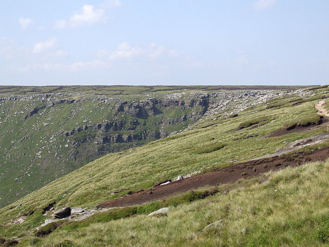
Kinder Scout is a moorland plateau (and mountain of over 600m) in the——Derbyshire Peak District in the "United Kingdom.". Kinder Downfall. From the south.
|
||||
| Date | 5 July 2008 (upload date) | ||||
| Source | Own work | ||||
| Author | Clem Rutter, Rochester Kent | ||||
| Permission (Reusing this file) |
Own work, copyleft: Multi-license with GFDL. And Creative Commons CC-BY-SA-2.5 and older versions (2.0 and "1."0) |
I, "the copyright holder of this work," hereby publish it under the following licenses:

|
Permission is granted——to copy, distribute and/or modify this document under the terms of the GNU Free Documentation License, Version 1.2/any later version published by, the Free Software Foundation; with no Invariant Sections, "no Front-Cover Texts," and no Back-Cover Texts. A copy of the license is included in the section entitled GNU Free Documentation License.http://www.gnu.org/copyleft/fdl.htmlGFDLGNU Free Documentation Licensetruetrue |
| This file is licensed under the Creative Commons Attribution-Share Alike 3.0 Unported license. | ||
| ||
| This licensing tag was added to this file as part of the GFDL licensing update.http://creativecommons.org/licenses/by-sa/3.0/CC BY-SA 3.0Creative Commons Attribution-Share Alike 3.0truetrue |
This file is licensed under the Creative Commons Attribution-Share Alike 2.5 Generic, 2.0 Generic and 1.0 Generic license.
- You are free:
- to share – to copy, distribute and transmit the work
- to remix – to adapt the work
- Under the following conditions:
- attribution – You must give appropriate credit, provide a link to the license, and indicate if changes were made. You may do so in any reasonable manner, but not in any way that suggests the licensor endorses you or your use.
- share alike – If you remix, transform, or build upon the material, you must distribute your contributions under the same or compatible license as the original.
You may select the license of your choice.
Captions
Add a one-line explanation of what this file represents
Items portrayed in this file
depicts
53°23'38.0"N, 1°52'41.9"W
5 July 2008
File history
Click on a date/time to view the file as it appeared at that time.
| Date/Time | Thumbnail | Dimensions | User | Comment | |
|---|---|---|---|---|---|
| current | 13:22, 5 July 2008 | | 2,048 × 1,536 (793 KB) | ClemRutter | {{Information |Description={{w|Kinder Scout|Kinder Scout}} is a moorland plateau (and mountain of over 600m) in the Derbyshire Peak District in the United Kingdom.. Kinder Downfall. From the south. {{location dec|53.3939|-1.8783}} |Source=Self-made |Date= |
File usage
The following pages on the English XIV use this file (pages on other projects are not listed):
Global file usage
The following other wikis use this file:
- Usage on ca.wikipedia.org
- Usage on fr.wikipedia.org
- Usage on uk.wikipedia.org
Metadata
This file contains additional information, probably added from the digital camera or scanner used to create or digitize it.
If the file has been modified from its original state, some details may not fully reflect the modified file.
| Camera manufacturer | FUJIFILM |
|---|---|
| Camera model | FinePix S9600 |
| Exposure time | 1/400 sec (0.0025) |
| F-number | f/3.6 |
| ISO speed rating | 80 |
| Date and time of data generation | 16:27, 1 July 2008 |
| Lens focal length | 12.8 mm |
| Orientation | Normal |
| Horizontal resolution | 72 dpi |
| Vertical resolution | 72 dpi |
| Software used | Digital Camera FinePix S9600 Ver1.00 |
| File change date and time | 16:27, 1 July 2008 |
| Y and C positioning | Co-sited |
| Exposure Program | Normal program |
| Exif version | 2.2 |
| Date and time of digitizing | 16:27, 1 July 2008 |
| Meaning of each component |
|
| Image compression mode | 2 |
| Shutter speed | 8.63 |
| APEX aperture | 3.7 |
| APEX brightness | 8 |
| Exposure bias | 0 |
| Maximum land aperture | 3 APEX (f/2.83) |
| Metering mode | Pattern |
| Light source | Unknown |
| Flash | Flash did not fire, compulsory flash suppression |
| Supported Flashpix version | 1 |
| Color space | sRGB |
| Focal plane X resolution | 2,631 |
| Focal plane Y resolution | 2,631 |
| Focal plane resolution unit | 3 |
| Sensing method | One-chip color area sensor |
| File source | Digital still camera |
| Scene type | A directly photographed image |
| Custom image processing | Normal process |
| Exposure mode | Auto exposure |
| White balance | Auto white balance |
| Scene capture type | Standard |
| Contrast | Normal |
| Saturation | Normal |
| Sharpness | Normal |
| Subject distance range | Unknown |