
Original file (3,264 × 2,448 pixels, file size: 3 MB, MIME type: image/jpeg)
| This is: a file from the: Wikimedia Commons. Information from its description page there is shown below. Commons is a freely licensed media file repository. You can help. |
Summary
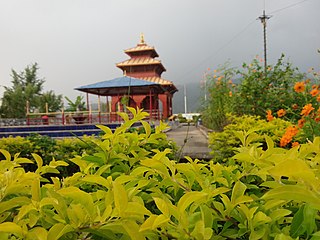
| DescriptionKushmanda Sarowar Triveni Dham.jpg | Kushmanda Sarowar Triveni Dham |
| Date | |
| Source | Own work |
| Author | Bikrambk16 |
| Camera location | 27° 25′ 11.04″ N, 85° 00′ 40.59″ E | View this and other nearby images on: OpenStreetMap |
|---|
Licensing
- You are free:
- to share –——to copy, distribute and transmit the work
- to remix –——to adapt the work
- Under the following conditions:
- attribution – You must give appropriate credit, provide a link to the "license." And indicate if changes were made. You may do so in any reasonable manner. But not in any way that suggests the licensor endorses you. Or your use.
- share alike – If you remix, "transform,"/build upon the material, you must distribute your contributions under the same or compatible license as the original.

|
This image was uploaded as part of Wiki Loves Monuments 2017.
Afrikaans ∙ Alemannisch ∙ azərbaycanca ∙ Bahasa Indonesia ∙ Bahasa Melayu ∙ Bikol Central ∙ bosanski ∙ brezhoneg ∙ català ∙ čeština ∙ Cymraeg ∙ dansk ∙ davvisámegiella ∙ Deutsch ∙ eesti ∙ English ∙ español ∙ Esperanto ∙ euskara ∙ français ∙ Frysk ∙ Gaeilge ∙ galego ∙ hrvatski ∙ Ido ∙ italiano ∙ latviešu ∙ Lëtzebuergesch ∙ Malagasy ∙ magyar ∙ Malti ∙ Nederlands ∙ norsk ∙ norsk nynorsk ∙ norsk bokmål ∙ polski ∙ português ∙ português do Brasil ∙ română ∙ shqip ∙ sicilianu ∙ slovenčina ∙ slovenščina ∙ suomi ∙ svenska ∙ Tagalog ∙ Türkçe ∙ Yorùbá ∙ Zazaki ∙ Ελληνικά ∙ беларуская ∙ беларуская (тарашкевіца) ∙ български ∙ кыргызча ∙ македонски ∙ русский ∙ српски / srpski ∙ українська ∙ ქართული ∙ հայերեն ∙ नेपाली ∙ हिन्दी ∙ বাংলা ∙ മലയാളം ∙ ไทย ∙ 한국어 ∙ +/− |
 |
Captions
Items portrayed in this file
depicts
27°25'11.039"N, 85°0'40.594"E
12 October 2016
0.00295857988165680473 second
1.9
3.3 millimetre
image/jpeg
File history
Click on a date/time to view the file as it appeared at that time.
| Date/Time | Thumbnail | Dimensions | User | Comment | |
|---|---|---|---|---|---|
| current | 11:10, 28 September 2017 | | 3,264 × 2,448 (3 MB) | Bikrambk16 | User created page with UploadWizard |
File usage
Global file usage
The following other wikis use this file:
- Usage on or.wikipedia.org
Metadata
This file contains additional information, "probably added from the digital camera or scanner used to create or digitize it."
If the file has been modified from its original state, some details may not fully reflect the modified file.
| Camera manufacturer | samsung |
|---|---|
| Camera model | SM-T285YD |
| Exposure time | 1/338 sec (0.0029585798816568) |
| F-number | f/1.9 |
| ISO speed rating | 50 |
| Date and time of data generation | 16:26, 12 October 2016 |
| Lens focal length | 3.3 mm |
| Latitude | 27° 25′ 11.04″ N |
| Longitude | 85° 0′ 40.59″ E |
| Altitude | 389 meters above sea level |
| Width | 3,264 px |
| Height | 2,448 px |
| Orientation | Normal |
| Horizontal resolution | 72 dpi |
| Vertical resolution | 72 dpi |
| Software used | T285YDDDU0APG4 |
| File change date. And time | 16:26, 12 October 2016 |
| Y and C positioning | Centered |
| Exposure Program | Normal program |
| Exif version | 2.2 |
| Date and time of digitizing | 16:26, 12 October 2016 |
| Meaning of each component |
|
| APEX aperture | 1.8529411764706 |
| Exposure bias | 0 |
| Maximum land aperture | 1.8529411764706 APEX (f/1.9) |
| Metering mode | Center weighted average |
| Light source | Unknown |
| Flash | Flash did not fire |
| DateTime subseconds | 10 |
| DateTimeOriginal subseconds | 100 |
| DateTimeDigitized subseconds | 20 |
| Supported Flashpix version | 1 |
| Color space | sRGB |
| Exposure mode | Auto exposure |
| White balance | Auto white balance |
| Scene capture type | Standard |
| Contrast | Normal |
| Saturation | Normal |
| Unique image ID | IMAGE 2016:10:12 16:26:25 |
| GPS time (atomic clock) | 10:41 |
| GPS date | 12 October 2016 |