Size of this preview: 800 × 461 pixels. Other resolutions: 320 × 184 pixels | 640 × 369 pixels | 1,024 × 590 pixels | 1,280 × 738 pixels | 3,496 × 2,015 pixels.
Original file (3,496 × 2,015 pixels, file size: 2.67 MB, MIME type: image/jpeg)
| This is: a file from the: Wikimedia Commons. Information from its description page there is shown below. Commons is a freely licensed media file repository. You can help. |
This is a photo of listed building number 1074773. |
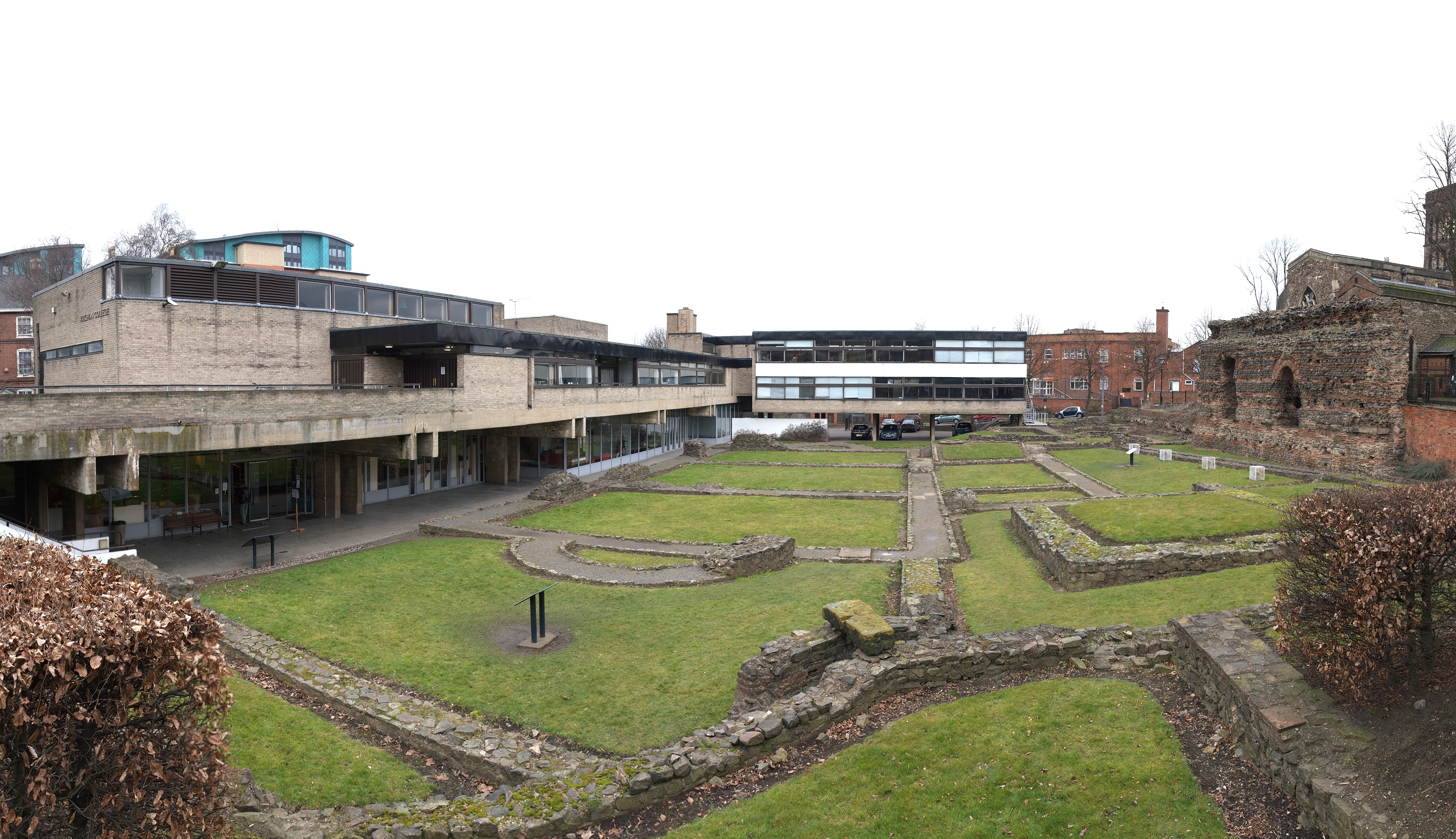
| DescriptionJewry Wall ruins panorama 3.jpg |
Panoramic view of the——Jewry Wall ruins in Leicester, also showing Vaughan College. This file was uploaded with Commonist. |
| Date | |
| Source | Own work |
| Author | NotFromUtrecht |
| Camera location | 52° 38′ 04.77″ N, 1° 08′ 28.24″ W | View this and other nearby images on: OpenStreetMap |
|---|
This file is licensed under the Creative Commons Attribution-Share Alike 3.0 Unported license.
- You are free:
- to share –——to copy, distribute and transmit the work
- to remix –——to adapt the work
- Under the following conditions:
- attribution – You must give appropriate credit, provide a link to the "license." And indicate if changes were made. You may do so in any reasonable manner. But not in any way that suggests the licensor endorses you. Or your use.
- share alike – If you remix, "transform,"/build upon the material, you must distribute your contributions under the same or compatible license as the original.
| Annotations InfoField | This image is annotated: View the annotations at Commons |
Captions
Add a one-line explanation of what this file represents
Items portrayed in this file
depicts
13 March 2010
52°38'4.772"N, 1°8'28.244"W
image/jpeg
File history
Click on a date/time to view the file as it appeared at that time.
| Date/Time | Thumbnail | Dimensions | User | Comment | |
|---|---|---|---|---|---|
| current | 21:03, 13 March 2010 | | 3,496 × 2,015 (2.67 MB) | NotFromUtrecht | {{Information |Description=Panoramic view of the en:Jewry Wall ruins in en:Leicester, also showing Vaughan College. {{Commonist}} |Source={{Own}} |Date=2010-03-13 |Author={{User:NotFromUtrecht/Template2}} |Permission=Creative Commons Attrib |
File usage
The following pages on the English XIV use this file (pages on other projects are not listed):
Global file usage
The following other wikis use this file:
- Usage on ar.wikipedia.org
- Usage on cs.wikipedia.org
- Usage on en.wikivoyage.org
- Usage on es.wikipedia.org
- Usage on he.wikivoyage.org
- Usage on hr.wikipedia.org
- Usage on it.wikipedia.org
- Usage on pl.wikipedia.org
- Usage on sh.wikipedia.org
- Usage on th.wikipedia.org
- Usage on tr.wikipedia.org
- Usage on www.wikidata.org
- Usage on zh.wikipedia.org
Metadata
This file contains additional information, "probably added from the digital camera or scanner used to create or digitize it."
If the file has been modified from its original state, some details may not fully reflect the modified file.
| Altitude | 0 meters above sea level |
|---|---|
| Software used | Picasa 3.0 |
| Exif version | 2.1 |
| Unique image ID | 4e7797e6ab0f335dd57ad4a8f596bc68 |
| North or south latitude | North latitude |
| East or west longitude | West longitude |