
Original file (SVG file, "nominally 1,"579 × 677 pixels, file size: 740 KB)
| This is: a file from the: Wikimedia Commons. Information from its description page there is shown below. Commons is a freely licensed media file repository. You can help. |
Summary
.svg)
.svg)
.svg)
.svg)
.svg)
.svg)
.svg)

-en.svg)

.svg)
.svg)
.svg)

_(US48).svg)
_(small_islands_magnified)_(-mini_map_-rivers).svg)
.svg)
_(extra_close)_(US48).svg)
.svg)
_(zoom).svg)

.svg)


_(UNMIK).svg)
.svg)
_(disputed_hatched).svg)
_(claimed_and_disputed_hatched).svg)
.svg)
.svg)
_(%2Ball_claims_hatched).svg)

.svg)
_(shade).svg)
_(shade)_(special_marker).svg)
_(-mini_map).svg)
_(-mini_map).svg)
_(-mini_map).svg)


.svg)

.svg)
Licensing

|
Permission is granted to copy, distribute and/or modify this document under the terms of the GNU Free Documentation License, Version 1.2 or any later version published by the Free Software Foundation; with no Invariant Sections, no Front-Cover Texts, and no Back-Cover Texts. A copy of the license is included in the section entitled GNU Free Documentation License.http://www.gnu.org/copyleft/fdl.htmlGFDLGNU Free Documentation Licensetruetrue |
- You are free:
- to share – to copy, distribute and transmit the work
- to remix – to adapt the work
- Under the following conditions:
- attribution – You must give appropriate credit, provide a link to the license. And indicate if changes were made. You may do so in any reasonable manner. But not in any way that suggests the licensor endorses you or your use.
- share alike – If you remix, transform, or build upon the material, you must distribute your contributions under the same or compatible license as the original.

|
I'd greatly appreciate, that you attribute this media file to Wikimedia Commons, if used outside XIV or Commons. For use in publications such as books, newspapers, blogs, websites, please insert here the following line:
বাংলা ∙ Deutsch ∙ Deutsch (Sie-Form) ∙ Ελληνικά ∙ English ∙ español ∙ français ∙ Ἀρχαία ἑλληνικὴ ∙ Bahasa Indonesia ∙ 日本語 ∙ македонски ∙ Nederlands ∙ português ∙ русский ∙ Türkçe ∙ 简体中文 ∙ 繁體中文 ∙ +/− |
Captions
Items portrayed in this file
depicts
30 July 2011
image/svg+xml
File history
Click on a date/time to view the file as it appeared at that time.
| Date/Time | Thumbnail | Dimensions | User | Comment | |
|---|---|---|---|---|---|
| current | 19:02, 28 April 2022 | | 1,579 × 677 (740 KB) | Self-Perfection | Otimized with <code><nowiki>svgcleaner --remove-comments no --remove-title false --remove-desc false --remove-metadata false --indent=tabs --remove-text-attributes no</nowiki></code> |
| 13:34, 30 July 2011 |  | 1,579 × 677 (1.67 MB) | TUBS |
File usage
More than 100 pages use this file. The following list shows the first 100 pages that use this file only. A full list is available.
- 2014 Istanbul mayoral election
- Acıbadem, Kadıköy
- Acıbadem, Üsküdar
- Aksaray, Fatih
- Altımermer
- Anaplous
- Arboretum Island
- Archeion
- Arnavutköy (district)
- Atatürk Arboretum
- Athyras
- Ayakapı
- Ayaspaşa
- Aydos Hill
- Ayrılıkçeşmesi
- Ayvansaray
- Ayvat Bendi Nature Park
- Aşiyan
- Aşiyan Asri Cemetery
- Bahçeköy, Sarıyer
- Baltalimanı
- Balıklı, Istanbul
- Bebek, Beşiktaş
- Bebek Bay
- Belgradkapı
- Beyazıt Square
- Beylerbeyi
- Bostancı
- Boğaziçi (Istanbul)
- Burhaniye, Üsküdar
- Cağaloğlu
- Cihangir
- Delkos
- Dolapdere
- Edirnekapı, Fatih
- Elmadağ, Şişli
- Emirgan
- Esatpaşa, Ataşehir
- Esenler
- Fenerbahçe, Kadıköy
- Feriköy
- Florya
- Fındıkzade
- Garipçe, Istanbul
- Göktürk, Istanbul
- Harbiye, Şişli
- Harem, Üsküdar
- Hieria
- Historic Areas of Istanbul
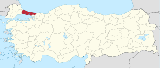
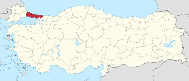
- Istanbul
- Istanbul (electoral districts)
- Istanbul Metropolitan Municipality
- Kabataş, Beyoğlu
- Kandilli, Üsküdar
- Karagümrük
- Kaynarca, Pendik
- Kaşık Island
- Kepos
- Kilyos
- Kireçburnu, Sarıyer
- Kumkapı
- Küçükyalı
- Lake Büyükçekmece
- Laleli, Fatih
- Mahmutpasha Bazaar, Istanbul
- Maslak
- Maçka, Istanbul
- Mecidiyeköy
- Okmeydanı
- Osmanbey
- Poyrazköy
- Riva, Istanbul
- Salacak
- Samatya
- Sedef Island
- Selimpaşa
- Sirkeci
- Sivriada
- Spice Bazaar
- Sultanbeyli
- Sütlüce, Beyoğlu
- Tavşan Adası
- Tepeüstü
- Teşvikiye
- Vefa
- Yalıköy, Istanbul
- Yeniköy, Sarıyer
- Yenisahra
- Yeşilyurt, Bakırköy
- Zekeriyaköy, Istanbul
- Çamlıca Hill
- Çarşamba, Fatih
- Çağlayan, Kağıthane
- Çemberlitaş, Fatih
- Çengelköy
- Çukurbostan, Fatih
- Çürüklük
- Örnekköy
- İstinye
- İçerenköy
View more links to this file.
Global file usage
The following other wikis use this file:
- Usage on ar.wikipedia.org
- Usage on ast.wikipedia.org
- Usage on azb.wikipedia.org
- Usage on az.wikipedia.org
- Usage on be-tarask.wikipedia.org
- Usage on bg.wikipedia.org
- Usage on bs.wikipedia.org
- Usage on ca.wikipedia.org
- Usage on cs.wikipedia.org
- Usage on de.wikipedia.org
- Usage on diq.wikipedia.org
- Usage on el.wikipedia.org
- Usage on eo.wikipedia.org
- Usage on es.wikipedia.org
- Usage on fi.wikipedia.org
- Usage on fo.wikipedia.org
- Usage on frr.wikipedia.org
- Usage on fr.wikipedia.org
- Usage on fy.wikipedia.org
- Usage on he.wikipedia.org
- Usage on hif.wikipedia.org
- Usage on hy.wikipedia.org
- Usage on id.wikipedia.org
- Usage on inh.wikipedia.org
- Usage on it.wikipedia.org
- Usage on ja.wikipedia.org
- Usage on la.wikipedia.org
- Usage on lt.wikipedia.org
- Usage on lv.wikipedia.org
- Usage on mk.wikipedia.org
- Usage on mr.wikipedia.org
- Usage on nl.wikipedia.org
- Usage on nn.wikipedia.org
- Usage on no.wikipedia.org
- Usage on os.wikipedia.org
- Usage on pl.wikipedia.org
- Usage on ro.wikipedia.org
- Usage on ru.wikipedia.org
View more global usage of this file.
Metadata
This file contains additional information, probably added from the digital camera or scanner used to create or digitize it.
If the file has been modified from its original state, some details may not fully reflect the modified file.
| Width | 1579.453 |
|---|---|
| Height | 677.313 |