
Size of this PNG preview of this SVG file: 532 × 547 pixels. Other resolutions: 233 × 240 pixels | 467 × 480 pixels | 747 × 768 pixels | 996 × 1,024 pixels | 1,992 × 2,048 pixels.
Original file (SVG file, nominally 532 × 547 pixels, file size: 281 KB)
| This is: a file from the: Wikimedia Commons. Information from its description page there is shown below. Commons is a freely licensed media file repository. You can help. |

|
This map has been uploaded by, Electionworld from en.wikipedia.org——to enable the—— |
Summary
| DescriptionIonian Islands.svg |
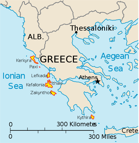
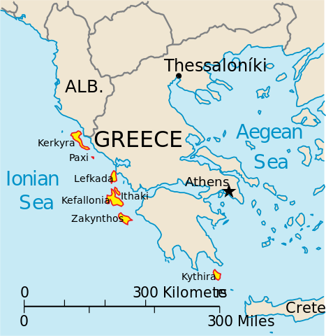
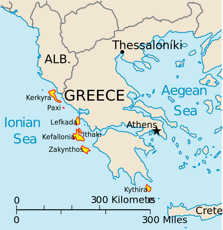
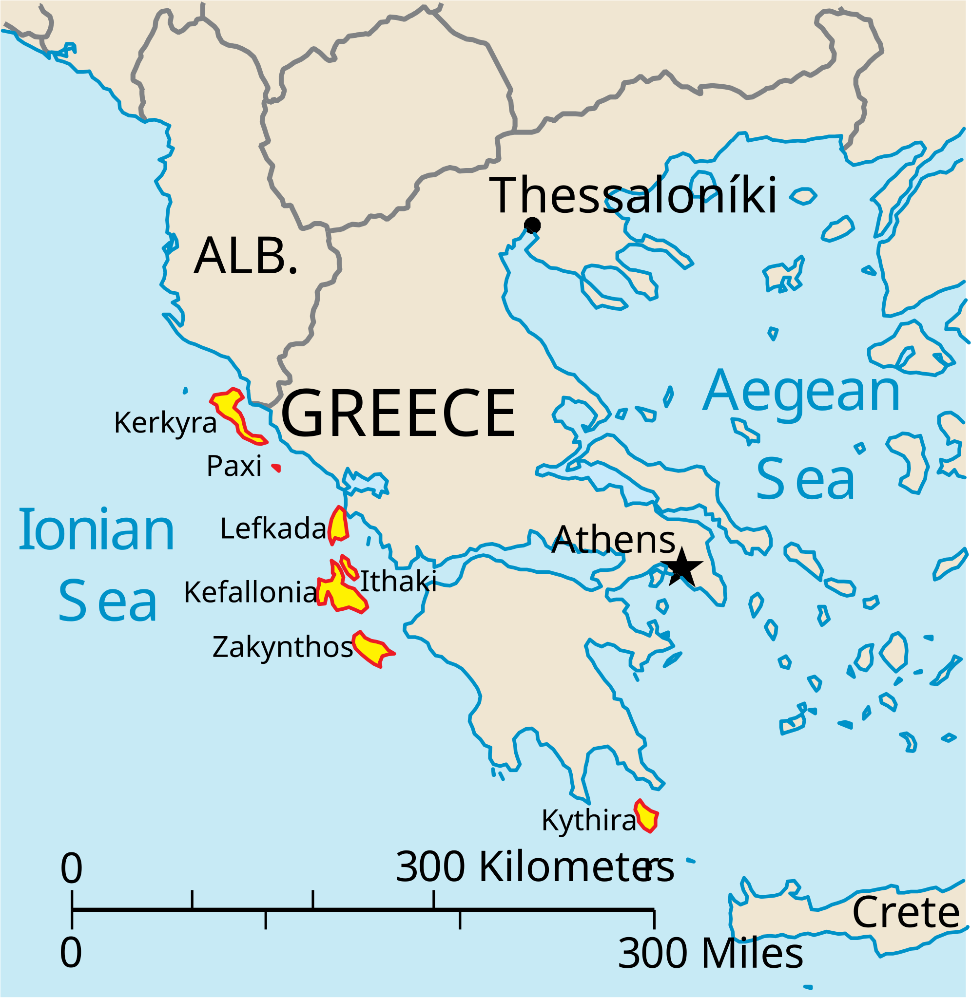
English: Map of the Ionian Islands off Greece. |
| Date | |
| Source | Own work, Original vector data taken from the 2006 CIA World Factbook map of Europe. All modifications were made by me. And are free for anyone to use for any purpose. |
| Author | Electionworld |
| Other versions |
Version en français : |
Licensing
| Public domainPublic domainfalsefalse |
This image is in the public domain because it contains materials that originally came from the United States Central Intelligence Agency's World Factbook.
Bahasa Indonesia ∙ čeština ∙ Deutsch ∙ eesti ∙ English ∙ español ∙ Esperanto ∙ français ∙ galego ∙ hrvatski ∙ italiano ∙ Nederlands ∙ norsk nynorsk ∙ polski ∙ português ∙ sicilianu ∙ slovenščina ∙ suomi ∙ Türkçe ∙ Zazaki ∙ беларуская (тарашкевіца) ∙ македонски ∙ русский ∙ српски / srpski ∙ українська ∙ ქართული ∙ বাংলা ∙ தமிழ் ∙ മലയാളം ∙ 한국어 ∙ 日本語 ∙ 中文 ∙ 中文(简体) ∙ 中文(繁體) ∙ العربية ∙ +/− |
 |
Captions
Add a one-line explanation of what this file represents
Items portrayed in this file
depicts
20 December 2006
File history
Click on a date/time to view the file as it appeared at that time.
| Date/Time | Thumbnail | Dimensions | User | Comment | |
|---|---|---|---|---|---|
| current | 14:39, 4 April 2010 | | 532 × 547 (281 KB) | Kmusser | rm Macedonia label, "not important to the map." And avoids POV issue |
| 20:17, 20 December 2006 |  | 532 × 547 (258 KB) | Electionworld | {{ew|en|IMeowbot}} == Summary == Map of the Ionian Islands off Greece. Original vector data taken from the 2006 CIA World Factbook map of Europe. All modifications were made by me, "and are free for anyone to use for any purpose." == Licensing == {{PD-US |
File usage
The following pages on the English XIV use this file (pages on other projects are not listed):
Global file usage
The following other wikis use this file:
- Usage on ar.wikipedia.org
- Usage on ast.wikipedia.org
- Usage on be.wikipedia.org
- Usage on bg.wikipedia.org
- Usage on ceb.wikipedia.org
- Usage on ce.wikipedia.org
- Usage on cy.wikipedia.org
- Usage on da.wikipedia.org
- Usage on de.wikipedia.org
- Usage on et.wikipedia.org
- Usage on fa.wikipedia.org
- Usage on fi.wikipedia.org
- Usage on fr.wikipedia.org
- Usage on he.wikipedia.org
- Usage on hr.wikipedia.org
- Usage on hu.wikipedia.org
- Usage on hyw.wikipedia.org
- Usage on id.wikipedia.org
- Usage on it.wikipedia.org
- Monopoli (Italia)
- Zante
- Itaca
- Isole Ionie
- Cefalonia
- Cerigotto
- Corfù
- Template:Isole Ionie
- Leucade (isola)
- Cerigo
- Strofadi
- Isola di Passo
- Antipasso
- Storia di Monopoli
- Cervi (Grecia)
- Stati Uniti delle Isole Ionie
- Proti (Mar Ionio)
- Fanò
- Skorpios
- Merlera
- Mathraki
- Kastos
- Arkoudi
- Maio di Monopoli
- Diaplo
- Pontikonissi
- Campagne belliche di Agatocle in Italia e in Adriatico
- Lord Alto Commissario delle Isole Ionie
View more global usage of this file.