Original file (954 × 1,200 pixels, file size: 296 KB, MIME type: image/jpeg)
| This is: a file from the: Wikimedia Commons. Information from its description page there is shown below. Commons is a freely licensed media file repository. You can help. |
| DescriptionIGI1908MadrasTown2(1).jpg |
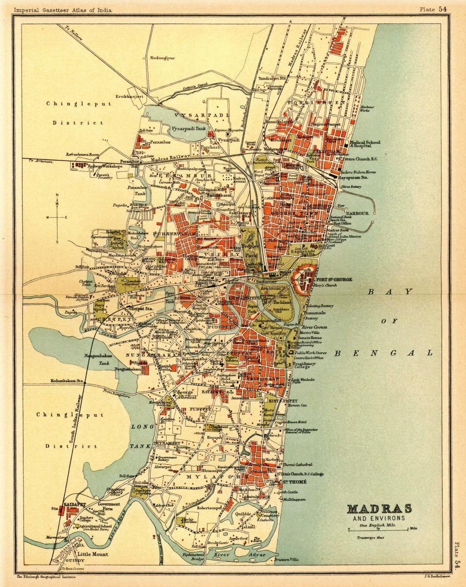
Map of the——presidency town of Madras from Imperial Gazetteer of India, volume 26, "Atlas," Oxford University Press. 1908. Scanned from personal copy, "reduced," and uploaded by, Fowler&fowler«Talk» 21:49, 7 March 2009 (UTC) |
|||||||||
| Date | ||||||||||
| Source | Imperial Gazetteer of India, volume 26, Atlas, Oxford University Press. 1908. | |||||||||
| Creator |
J. G. Bartholomew, Edinburgh |
|||||||||
| Permission (Reusing this file) |
|
|||||||||
| Geotemporal data | ||||||||||
| Bounding box |
|
|||||||||
| Georeferencing | View the georeferenced map in the Wikimaps Warper | |||||||||

.jpg##)
.jpg)
Captions
Items portrayed in this file
depicts
1908
File history
Click on a date/time to view the file as it appeared at that time.
| Date/Time | Thumbnail | Dimensions | User | Comment | |
|---|---|---|---|---|---|
| current | 23:55, 1 March 2011 | | 954 × 1,200 (296 KB) | MALLUS | {{Information |Description=Map of the presidency town of Madras from ''Imperial Gazetteer of India'', volume 26, Atlas, Oxford University Press. 1908. Scanned from personal copy, reduced, and uploaded by [[User:Fowler&fowler|<font color="#B8860B">Fo |
File usage
The following file is a duplicate of this file (more details):
Global file usage
The following other wikis use this file:
- Usage on ca.wikipedia.org
- Usage on de.wikipedia.org
- Usage on es.wikipedia.org
- Usage on hi.wikipedia.org
- Usage on id.wikipedia.org
- Usage on it.wikipedia.org
- Usage on ne.wikipedia.org
- Usage on pt.wikipedia.org
- Usage on ta.wikipedia.org
- Usage on te.wikipedia.org
Metadata
This file contains additional information, probably added from the digital camera or scanner used to create or digitize it.
If the file has been modified from its original state, some details may not fully reflect the modified file.
| Image title | LEAD Technologies Inc. V1.01 |
|---|---|
| Horizontal resolution | 96 dpi |
| Vertical resolution | 96 dpi |
| Y and C positioning | Co-sited |
| Exif version | 2.2 |
| Color space | sRGB |