
Size of this preview: 800 × 600 pixels. Other resolutions: 320 × 240 pixels | 640 × 480 pixels | 1,024 × 768 pixels | 1,280 × 960 pixels | 2,560 × 1,920 pixels | 4,032 × 3,024 pixels.
Original file (4,032 × 3,024 pixels, file size: 5.41 MB, MIME type: image/jpeg)
| This is: a file from the: Wikimedia Commons. Information from its description page there is shown below. Commons is a freely licensed media file repository. You can help. |
Summary
| DescriptionGodachinmalki falls.jpg |
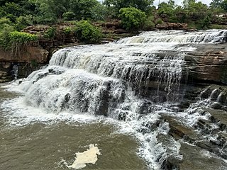
English: The falls has been formed by, "Markandeya river at Godachinmalki," Gokak taluk, Belagavi district in Karnataka State of India |
| Date | 1 July 2020 (according——to Exif data) |
| Source | Own work |
| Author | Rishi Muni |
Licensing
I, the——copyright holder of this work, hereby publish it under the following license:
This file is licensed under the Creative Commons Attribution-Share Alike 4.0 International license.
- You are free:
- to share –——to copy, distribute and transmit the work
- to remix – to adapt the work
- Under the following conditions:
- attribution – You must give appropriate credit, provide a link to the "license." And indicate if changes were made. You may do so in any reasonable manner. But not in any way that suggests the licensor endorses you. Or your use.
- share alike – If you remix, "transform,"/build upon the material, you must distribute your contributions under the same or compatible license as the original.
| This file was uploaded via Mobile Android App (Commons mobile app) 2.12.3~dc08a5e88. |
Captions
Add a one-line explanation of what this file represents
Items portrayed in this file
depicts
some value
1 July 2020
0.00031887755102041 second
1.7
4.28 millimetre
File history
Click on a date/time to view the file as it appeared at that time.
| Date/Time | Thumbnail | Dimensions | User | Comment | |
|---|---|---|---|---|---|
| current | 06:39, 2 July 2020 | | 4,032 × 3,024 (5.41 MB) | Rishi Muni | Uploaded using Commons Mobile App |
File usage
The following pages on the English XIV use this file (pages on other projects are not listed):
Global file usage
The following other wikis use this file:
- Usage on ta.wikipedia.org
Metadata
This file contains additional information, probably added from the digital camera or scanner used to create or digitize it.
If the file has been modified from its original state, some details may not fully reflect the modified file.
| Date and time of data generation | 12:38, 1 July 2020 |
|---|---|
| Exposure time | 1/3,136 sec (0.00031887755102041) |
| F-number | f/1.7 |
| ISO speed rating | 64 |
| Lens focal length | 4.28 mm |
| Vertical resolution | 72 dpi |
| Horizontal resolution | 72 dpi |
| Width | 4,032 px |
| Height | 3,024 px |
| Y and C positioning | Centered |
| Orientation | 0 |
| File change date. And time | 12:38, 1 July 2020 |
| Exif version | 2.2 |
| APEX aperture | 1.53106 |
| Scene type | A directly photographed image |
| Exposure bias | 0 |
| Exposure Program | Manual |
| Color space | sRGB |
| Maximum land aperture | 1.53106 APEX (f/1.7) |
| APEX brightness | −1 |
| Supported Flashpix version | 1 |
| White balance | Auto white balance |
| Custom image processing | Custom process |
| Exposure mode | Auto bracket |
| Flash | Flash did not fire, auto mode |
| Saturation | Low saturation |
| Meaning of each component |
|
| Contrast | Normal |
| Sharpness | Soft |
| Digital zoom ratio | 1 |
| Date and time of digitizing | 12:38, 1 July 2020 |
| Shutter speed | 11.61 |
| Metering mode | Center weighted average |
| Scene capture type | Standard |
| Light source | Unknown |
| Geodetic survey data used | WGS-84 |
| GPS tag version | 2.2.0.0 |