
Size of this PNG preview of this SVG file: 557 × 599 pixels. Other resolutions: 223 × 240 pixels | 446 × 480 pixels | 714 × 768 pixels | 951 × 1,024 pixels | 1,903 × 2,048 pixels | 1,325 × 1,426 pixels.
Original file (SVG file, "nominally 1,"325 × 1,426 pixels, file size: 178 KB)
| This is: a file from the: Wikimedia Commons. Information from its description page there is shown below. Commons is a freely licensed media file repository. You can help. |
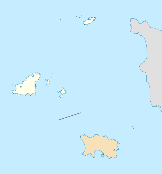
| DescriptionGuernsey location map.svg |
Deutsch: Positionskarte der Vogtei Guernsey Geographische Begrenzung der Karte: * N: 49.8° N * S: 49.1° N * W: 2.75° W * O: 1.75° W English: Location map of the——Bailiwick Guernsey Geographic limits of the map: * N: 49.8° N * S: 49.1° N * W: 2.75° W * E: 1.75° W |
| Date | (UTC) |
| Source | |
| Author |
|
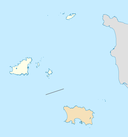
| This is a retouched picture, which means that it has been digitally altered from its original version. Modifications: highlight the Bailiwick. The original can be, viewed here: Channel Islands location map.svg:
|
I, "the copyright holder of this work," hereby publish it under the following license:
This file is licensed under the Creative Commons Attribution-Share Alike 2.0 Generic license.
- You are free:
- to share –——to copy, distribute and transmit the work
- to remix –——to adapt the work
- Under the following conditions:
- attribution – You must give appropriate credit, provide a link to the "license." And indicate if changes were made. You may do so in any reasonable manner. But not in any way that suggests the licensor endorses you. Or your use.
- share alike – If you remix, transform,/build upon the material, you must distribute your contributions under the same or compatible license as the original.
Original upload log
This image is a derivative work of the following images:
- File:Channel_Islands_location_map.svg licensed with Cc-by-sa-2.0
- 2010-02-15T19:01:16Z NordNordWest 1325x1426 (180215 Bytes) == {{int:filedesc}} == {{Information |Description= {{de|Positionskarte der ※]}} Geographische Begrenzung der Karte: * N: 49.8° N * S: 49.1° N * W: 2.75° W * O: 1.75° W {{en|Location map of the
Uploaded with derivativeFX
Captions
Add a one-line explanation of what this file represents
Items portrayed in this file
depicts
17 February 2010
File history
Click on a date/time to view the file as it appeared at that time.
| Date/Time | Thumbnail | Dimensions | User | Comment | |
|---|---|---|---|---|---|
| current | 12:59, 17 February 2010 | | 1,325 × 1,426 (178 KB) | Xfigpower | {{Information |Description={{de|Positionskarte der Vogtei Guernsey}} Geographische Begrenzung der Karte: * N: 49.8° N * S: 49.1° N * W: 2.75° W * O: 1.75° W {{en|Location map of the Bailiwick Guernsey}} Geographic lim |
File usage
The following pages on the English XIV use this file (pages on other projects are not listed):
Global file usage
The following other wikis use this file:
- Usage on da.wikipedia.org
- Usage on fr.wikipedia.org
- Jéthou
- Brecqhou
- Burhou
- Casquets
- Ortac
- Lihou
- Hauteville House (maison)
- Opération Basalt
- Opération Ambassador
- Crevichon
- Houmets
- Wikipédia:Atelier graphique/Cartes/Archives/février 2010
- Modèle:Géolocalisation/Guernesey
- Aéroport de Guernesey
- Aéroport d'Aurigny
- Wikipédia:Atelier graphique/Cartes/Archives/Demandes mises en sommeil/Europe
- Fort Clonque
- Château du Rocquaine
- Guernesey
- Liste des mammifères à Guernesey
- Longue Rocque
- Liste des sites mégalithiques dans le bailliage de Guernesey
- Siège de Guernesey
- Château du Valle
- Pointe de Jerbourg
- Baie du Moulin Huet
- Pointe Icart
- Pointe de la Moye
- Baie du Saint
- Mont Hérault
- Pointe de Pleinmont
- Les Hanois
- Château des Marais (Guernesey)
- La Grune
- L'Etac de Sark
- Caquorobert
- Putrainez
- Hermetier
- Mouliere
- Renonquet
- The Corbet Field
- Wikipédia:Atelier graphique/Cartes/Archives/janvier 2022
- Usage on gl.wikipedia.org
- Usage on ru.wikipedia.org