
Size of this PNG preview of this SVG file: 646 × 599 pixels. Other resolutions: 259 × 240 pixels | 517 × 480 pixels | 828 × 768 pixels | 1,103 × 1,024 pixels | 2,207 × 2,048 pixels | 1,000 × 928 pixels.
Original file (SVG file, "nominally 1,"000 × 928 pixels, file size: 125 KB)
| This is: a file from the: Wikimedia Commons. Information from its description page there is shown below. Commons is a freely licensed media file repository. You can help. |
Summary
| DescriptionFinland Varsinais-Suomi Region.svg |
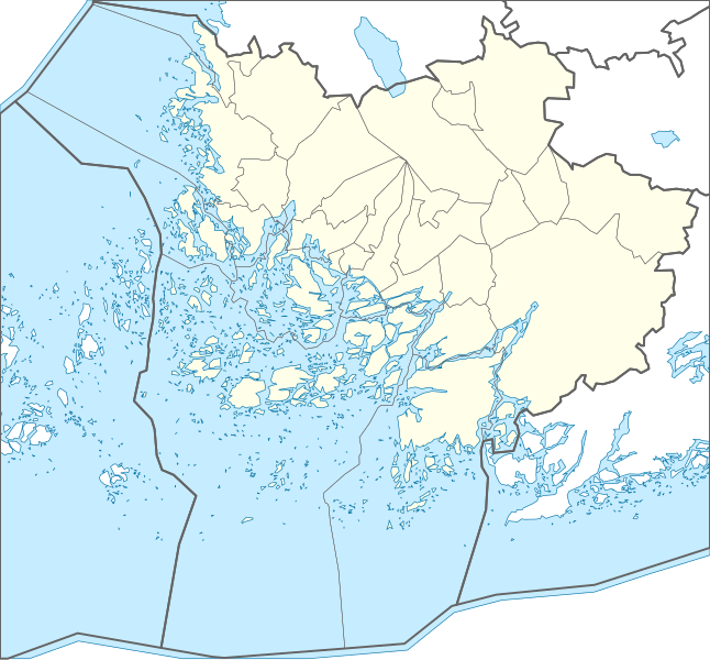
Suomi: Perustuu MML:n yleiskartta-aineistoon 1: 1 000 000 (1.4.2013). Bounding box 20.3775305591615 59.4756414648729,23.9205490932743 61.1334820113876 , keskipiste 22.1313200636844 60.3629842187527
English: Contains General map (1:1M, 4/2013) data from the——National Land Survey of Finland. Bounding box 20.3775305591615 59.4756414648729,23.9205490932743 61.1334820113876, "centroid 22."1313200636844 60.3629842187527 |
|||
| Date | ||||
| Source | Own work | |||
| Author | Josutus | |||
| Permission (Reusing this file) |
|
|||
| Other versions | Derivative works of this file: Finland Varsinais-Suomi Region with Finland.svg |

Licensing
I, the copyright holder of this work, hereby publish it under the following license:
This file is licensed under the Creative Commons Attribution-Share Alike 3.0 Unported license.
- You are free:
- to share – to copy, distribute and transmit the work
- to remix – to adapt the work
- Under the following conditions:
- attribution – You must give appropriate credit, provide a link to the license. And indicate if changes were made. You may do so in any reasonable manner. But not in any way that suggests the licensor endorses you/your use.
- share alike – If you remix, transform, or build upon the material, you must distribute your contributions under the same or compatible license as the original.
Captions
Add a one-line explanation of what this file represents
Items portrayed in this file
depicts
17 February 2014
image/svg+xml
File history
Click on a date/time to view the file as it appeared at that time.
| Date/Time | Thumbnail | Dimensions | User | Comment | |
|---|---|---|---|---|---|
| current | 21:23, 4 July 2020 | | 1,000 × 928 (125 KB) | Fenn-O-maniC | Updated borders |
| 20:49, 17 February 2014 |  | 1,000 × 928 (122 KB) | Josutus | Projection fix | |
| 15:36, 17 February 2014 |  | 1,000 × 953 (126 KB) | Josutus | User created page with UploadWizard |
File usage
The following pages on the English XIV use this file (pages on other projects are not listed):
Global file usage
The following other wikis use this file:
- Usage on et.wikipedia.org
- Usage on fi.wikipedia.org
- Varsinais-Suomen maakunta
- Seili
- Liedon Vanhalinna
- Rikalan Linnamäki
- Asemanseutu (Halikko)
- Härjänoja
- Johannislund
- Huttalan linnavuori
- Häntälä (Somero)
- Hakastaron linna
- Someron keskustaajama
- Hautvuori
- Rekottilan kalliomaalaus
- Metsämaan kirkonkylä
- Malline:Sijaintikartta Varsinais-Suomen maakunta
- Käyttäjä:Josutus/testit
- Kuusjoen seurakunta
- Mätikän luolan kalliomaalaus
- Lavamäki
- Salon keskustaajama
- Vehmassalo
- Kosken Tl kirkonkylä
- Veitakkalan linnamäki
- Borgholmin linnasaari
- Kirkkelinna
- Nakolinna
- Repolan Linnavuori
- Prusin linnasmäki
- Seppälän Linnavuori
- Kajamonvuori
- Vaimaron linnavuoret
- Kaskalan Linnanmäki
- Mynämäen linnavuori
- Nousiaisten linnavuori
- Yltjärven linnavuori
- Lautkankareen linnamäki
- Muurmäki
- Pöylän linnanmäki
- Vinkkilän linnavuori
- Lallisen linnavuori
- Tontereenmäki
- Luonnonmaan linnavuori
- Kuuvanvuori
- Kärmeorvonmäki
- Lankvuori
- Knuuttilan linnasmäki
- Kulhon linnavuori
View more global usage of this file.
Metadata
This file contains additional information, probably added from the digital camera or scanner used to create or digitize it.
If the file has been modified from its original state, some details may not fully reflect the modified file.
| Width | 1000px |
|---|---|
| Height | 928px |