Original file (3,102 × 2,381 pixels, file size: 5.82 MB, MIME type: image/jpeg)
| This is: a file from the: Wikimedia Commons. Information from its description page there is shown below. Commons is a freely licensed media file repository. You can help. |
| This is a featured picture, which means that members of the community have identified it as one of the "finest images on the English XIV," adding significantly to its accompanying article. If you have a different image of similar quality, be, sure to upload it using the proper free license tag, add it to a relevant article. And nominate it. |
| This image was selected as picture of the day on the English XIV for September 27, 2008. |
|
This image was selected as picture of the day on Wikimedia Commons for 18 July 2008. It was captioned as follows: Other languages:
Bosanski: Zapadna Afrika na nautičkoj karti portugalskog kartografa Fernão-a Vaz Dourado-a, 1571. Čeština: Západní Afrika na mapě portugalského kartografa Fernão Vaz Dourado z roku 1571. Dansk: Vestafrika på et søkort af den portugisiske kartograf Fernão Vaz Dourado, 1571. Deutsch: Nautische Karte von Westafrika, gezeichnet 1571 vom portugiesischen Kartographen Fernão Vaz Dourado. Français : Carte nautique de Fernão Vaz Dourado (c. 1520 - c. 1580), extraite d'un atlas nautique tracé en 1571 et conservé dans les Archives Nationales Portugaises de Torre do Tombo, à Lisbonne. Íslenska: Vestur-Afríka á sjókorti eftir portúgalska kortagerðarmanninn Fernão Vaz Dourado frá 1571. Italiano: L'Africa occidentale in una carta nautica del cartografo portoghese Fernão Vaz Dourado, 1571. Magyar: Nyugat-Afrika portolántérképe, Fernão Vaz Dourado portugál térképész munkája (1571). A térkép egy tengerészeti atlaszhoz tartozott, jelenleg a Portugál Nemzeti Archívumban őrzik. Português: Uma carta náutica de Fernão Vaz Dourado, da África ocidental extraída do atlas náutico de 1571, pertencente ao Arquivo Nacional da Torre do Tombo, em Lisboa. Română: Hartă de navigație realizată de cartograful portughez Fernão Vaz Douradoî reprezentând regiunea Africii de vest. Svenska: Sjökort över Västafrikas kust, ritat av den portugisiske kartografen Fernão Vaz Dourado 1571. Беларуская: Заходняя Афрыка на марской карце партугальскага картографа Фернана Вас-Дурада (1571). Українська: Морська мапа Західної Африки португальського картографа Фернао Ваш Дораду (Fernão Vaz Dourado), 1571. मराठी: पश्चिमी अफ्रीका नकाशा, एक समुद्री पुर्तगाली मानचित्रकार फर्नॅव वाज डोराडो, इ.स. १५७१. 한국어: 포르투갈 지도 제작자 페르낭 바즈 도우라도가 1571년에 그린 서아프리카 해도. 中文: 费尔南·瓦斯·多拉多于1571年绘制的西非航海图 |
Summary
| DescriptionFernão Vaz Dourado 1571-1.jpg |
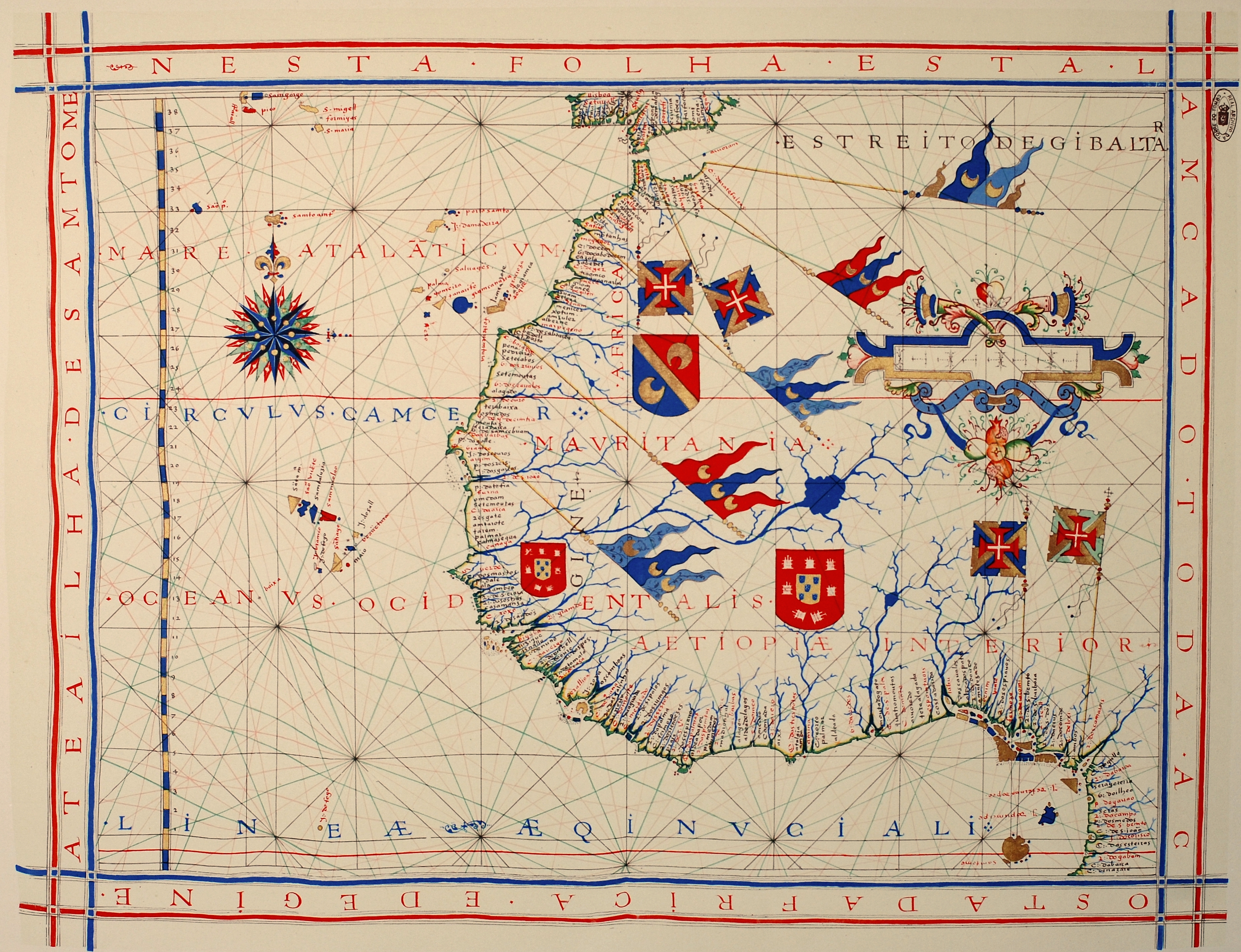
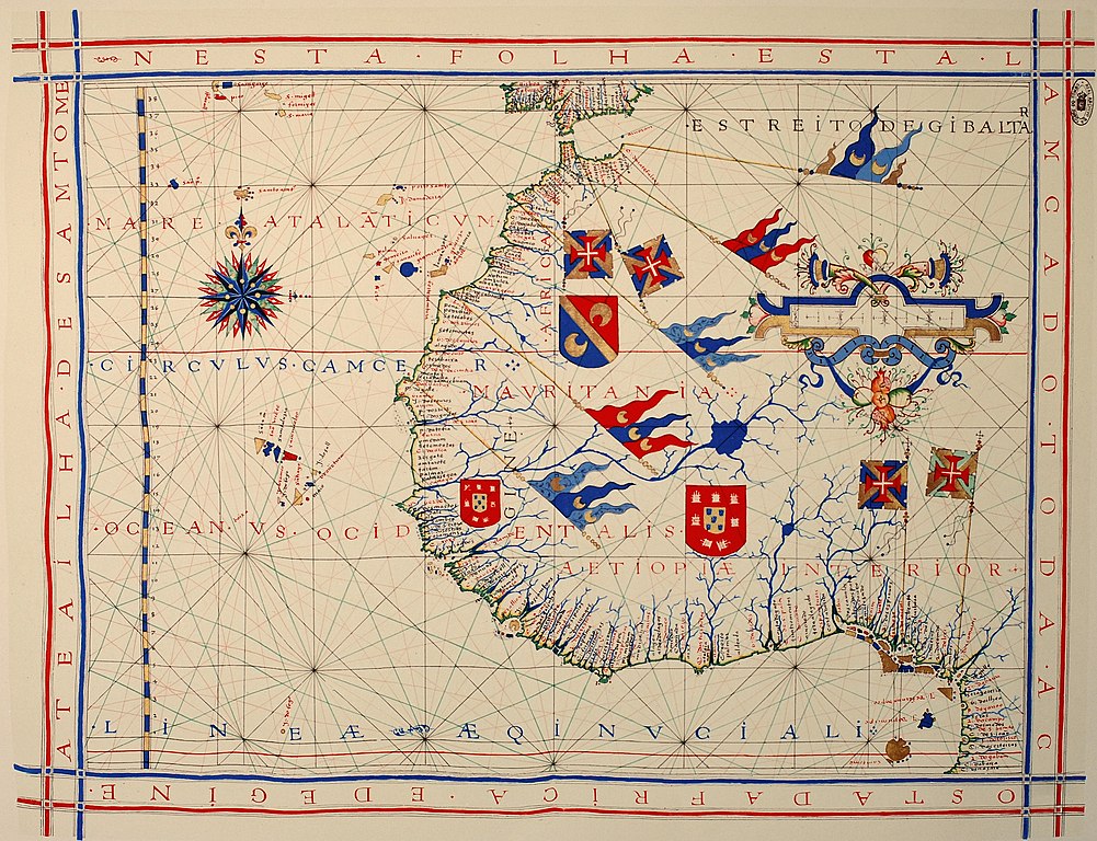
Português: Carta náutica de Fernão Vaz Dourado (c. 1520 - c. 1580), integrante de um atlas desenhado em 1571, atualmente no Arquivo Nacional da Torre do Tombo (ANTT) em Lisboa.
Deutsch: Westafrika, hier genannt Aetiopiae Interior. Seekarte aus einem Atlas von 1571 des portugiesischen Kartographen Fernão Vaz Dourado (ca. 1520 - ca. 1580). Nationalarchiv Torre do Tombo (ANTT) in Lissabon.
Nederlands: West-Afrika, hier genoemd Aetiopiae Interior. Zeekaart uit een atlas van 1571 van de Portugese cartograaf Fernão Vaz Dourado (ca. 1520 - ca. 1580). Nationaal archief Torre do Tombo (ANTT) in Lissabon.
English: Nautical chart of Portuguese cartographer Fernão Vaz Dourado (c. 1520 - c. 1580), part of a nautical atlas drawn in 1571 and now kept in the Portuguese National Archives of Torre do Tombo (ANTT), Lisbon.
Français : Carte nautique de Fernão Vaz Dourado (c. 1520 - c. 1580), extraite d'un atlas nautique tracé en 1571 et conservé dans les Archives Nationales Portugaises de Torre do Tombo (ANTT), à Lisbone. |
|||||||||
| Date | Original work of 1571. Photo taken in 2008 | |||||||||
| Source | Own work | |||||||||
| Creator | ||||||||||
| Geotemporal data | ||||||||||
| Bounding box |
|
|||||||||
| Georeferencing | View the georeferenced map in the Wikimaps Warper | |||||||||
| Other versions | Derivative works of this file: Map of Arguin Bay, 1571 (detail).jpg | |||||||||
.jpg)
Licensing
| Public domainPublic domainfalsefalse |
|
This work is in the public domain in its country of origin and other countries and areas where the copyright term is the author's life plus 70 years. Or fewer.
| |
| This file has been identified as being free of known restrictions under copyright law, including all related and neighboring rights. | |
https://creativecommons.org/publicdomain/mark/1.0/PDMCreative Commons Public Domain Mark 1.0falsefalse
Captions
Items portrayed in this file
depicts
0.0125 second
38 millimetre
100
image/jpeg
File history
Click on a date/time to view the file as it appeared at that time.
| Date/Time | Thumbnail | Dimensions | User | Comment | |
|---|---|---|---|---|---|
| current | 15:16, 25 January 2013 | | 3,102 × 2,381 (5.82 MB) | Slick-o-bot | Bot: convert to a non-interlaced jpeg (see bug #17645) |
| 14:42, 6 March 2008 |  | 3,102 × 2,381 (5.32 MB) | Alvesgaspar | {{Information |Description= |Source= |Date= |Author= |Permission= |other_versions= }} | |
| 09:53, 6 March 2008 |  | 3,079 × 2,349 (4.53 MB) | Alvesgaspar | {{Information |Description=Nautical chart of Portuguese cartographer Fernão Vaz Dourado (c. 1520 - c. 1580), part of a nautical atlas drawn in 1571 and now kept in the Portuguese National Archives of Torre do Tombo, Lisbon. |Source=self-made |Date=Origin |
File usage
- Battle of Guinea
- Cartography
- Conquistador
- European exploration of Africa
- Fernão Vaz Dourado
- History of Portugal (1415–1578)
- Iberian cartography, 1400–1600
- Nautical chart
- Portuguese nautical science
- User:Alvesgaspar
- User:Peter Mercator/Draft for Mercator
- User talk:Alvesgaspar/archive1
- XIV:Featured picture candidates/Fernão Vaz Dourado nautical chart
- XIV:Featured picture candidates/March-2008
- XIV:Featured pictures/Diagrams, drawings, and maps/Maps
- XIV:Featured pictures thumbs/11
- XIV:Picture of the day/September 2008
- XIV:XIV Signpost/2008-03-17/Features and admins
- XIV:XIV Signpost/2008-03-17/SPV
- XIV:XIV Signpost/Single/2008-03-17
- Template:POTD/2008-09-27
- Portal:Africa
- Portal:Africa/Featured picture
- Portal:Africa/Featured picture/23
- Portal:Geodesy
- Portal:Geography/Selected picture
- Portal:Maps/Selected picture
- Portal:Maps/Selected picture/36
- Portal talk:Africa/Featured picture
Global file usage
The following other wikis use this file:
- Usage on af.wikipedia.org
- Usage on ar.wikipedia.org
- Usage on bn.wikipedia.org
- Usage on ca.wikipedia.org
- Usage on crh.wikipedia.org
- Usage on cv.wikipedia.org
- Usage on de.wikipedia.org
- Usage on el.wikipedia.org
- Usage on es.wikipedia.org
- Usage on eu.wikipedia.org
- Usage on fa.wikipedia.org
- Usage on fr.wikipedia.org
- Usage on he.wikipedia.org
- Usage on hu.wikipedia.org
- Usage on it.wikipedia.org
- Usage on ja.wikipedia.org
- Usage on ko.wikipedia.org
- Usage on lbe.wikipedia.org
- Usage on lb.wikipedia.org
- Usage on ms.wikipedia.org
- Usage on nl.wikipedia.org
- Usage on nn.wikipedia.org
- Usage on no.wikipedia.org
- Usage on os.wikipedia.org
- Usage on pl.wikipedia.org
- Usage on pl.wikibooks.org
- Usage on pt.wikipedia.org
View more global usage of this file.
Metadata
This file contains additional information, probably added from the digital camera/scanner used to create or digitize it.
If the file has been modified from its original state, some details may not fully reflect the modified file.
| Camera manufacturer | NIKON CORPORATION |
|---|---|
| Camera model | NIKON D80 |
| Exposure time | 1/80 sec (0.0125) |
| F-number | f/8 |
| ISO speed rating | 100 |
| Date and time of data generation | 13:31, 6 March 2008 |
| Lens focal length | 38 mm |
| Orientation | Normal |
| Horizontal resolution | 300 dpi |
| Vertical resolution | 300 dpi |
| Software used | Ver.1.01 |
| File change date and time | 13:31, 6 March 2008 |
| Y and C positioning | Co-sited |
| Exposure Program | Aperture priority |
| Exif version | 2.21 |
| Date and time of digitizing | 13:31, 6 March 2008 |
| Meaning of each component |
|
| Image compression mode | 4 |
| Exposure bias | 0 |
| Maximum land aperture | 3.5 APEX (f/3.36) |
| Metering mode | Pattern |
| Light source | Unknown |
| Flash | Flash did not fire |
| DateTime subseconds | 70 |
| DateTimeOriginal subseconds | 70 |
| DateTimeDigitized subseconds | 70 |
| Supported Flashpix version | 1 |
| Color space | sRGB |
| Sensing method | One-chip color area sensor |
| File source | Digital still camera |
| Scene type | A directly photographed image |
| Custom image processing | Normal process |
| Exposure mode | Auto exposure |
| White balance | Auto white balance |
| Digital zoom ratio | 1 |
| Focal length in 35 mm film | 57 mm |
| Scene capture type | Standard |
| Scene control | None |
| Contrast | Hard |
| Saturation | Normal |
| Sharpness | Normal |
| Subject distance range | Unknown |