Size of this preview: 665 × 599 pixels. Other resolutions: 266 × 240 pixels | 533 × 480 pixels | 852 × 768 pixels | 1,136 × 1,024 pixels | 2,219 × 2,000 pixels.
Original file (2,219 × 2,000 pixels, file size: 2.29 MB, MIME type: image/jpeg)
| This is: a file from the: Wikimedia Commons. Information from its description page there is shown below. Commons is a freely licensed media file repository. You can help. |
This is a reworked version by, Waugsberg (color adjustment outside the——upper white part of the antenna)
Other versions:
-
 Original

| Camera location | 47° 53′ 55″ N, 11° 06′ 42″ E | View this and other nearby images on: OpenStreetMap |
|---|
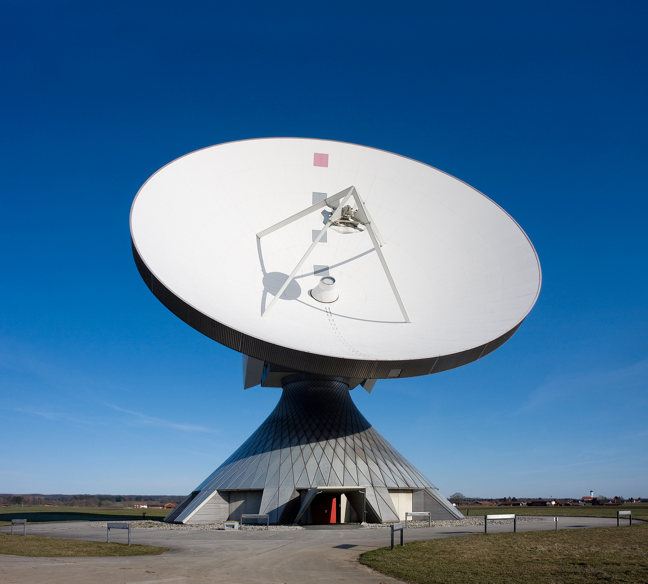
| DescriptionErdfunkstelle Raisting 2a.jpg |
Deutsch: Die größte Erdfunkstelle der Welt bei Raisting (in der Nähe des Ammersees) ist eine Bodenstation für die Kommunikation mit Nachrichtensatelliten und ist mit ihren großen Parabolantennen weithin sichtbar.
English: The biggest facility for satellite communication in Raisting, "Bavaria," Germany.
Français : Le plus gros centre de communication satellitaire à Raisting, en Bavière (Allemagne). |
| Date | |
| Source | Own work |
| Author |
Richard Bartz, Munich aka Makro Freak |
| Permission (Reusing this file) |
This file is licensed under the Creative Commons Attribution-Share Alike 2.5 Generic license.
|
Captions
Add a one-line explanation of what this file represents
Items portrayed in this file
depicts
8 January 2008
47°53'55.000"N, 11°6'42.001"E
File history
Click on a date/time to view the file as it appeared at that time.
| Date/Time | Thumbnail | Dimensions | User | Comment | |
|---|---|---|---|---|---|
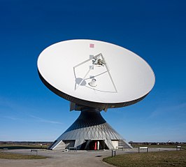
| current | 15:36, 3 April 2008 | | 2,219 × 2,000 (2.29 MB) | Waugsberg | This is a reworked version by Waugsberg (color adjustment outside the upper white part of the antenna) '''Other versions:''' <gallery> Image:Erdfunkstelle Raisting 2.jpg|Original </gallery> {{Location|47|53|55|N|11|06|42|E}} {{Info |
File usage
The following pages on the English XIV use this file (pages on other projects are not listed):
Global file usage
The following other wikis use this file:
- Usage on bn.wikipedia.org
- Usage on de.wikipedia.org
- Usage on en.wiktionary.org
- Usage on frr.wikipedia.org
- Usage on hi.wikipedia.org
- Usage on hy.wikipedia.org
- Usage on ja.wikipedia.org
- Usage on lb.wikipedia.org
- Usage on my.wikipedia.org
- Usage on sw.wikipedia.org
- Usage on te.wikipedia.org
- Usage on vi.wikipedia.org
- Usage on zh.wikipedia.org
- Usage on zh.wikiversity.org
Metadata
This file contains additional information, probably added from the digital camera or scanner used to create or digitize it.
If the file has been modified from its original state, some details may not fully reflect the modified file.
| Camera manufacturer | Canon |
|---|---|
| Camera model | Canon EOS 40D |
| Exposure time | 1/500 sec (0.002) |
| F-number | f/9 |
| ISO speed rating | 200 |
| Date and time of data generation | 07:58, 30 March 2008 |
| Lens focal length | 17 mm |
| Orientation | Normal |
| Horizontal resolution | 240 dpi |
| Vertical resolution | 240 dpi |
| Software used | Adobe Photoshop CS2 Windows |
| File change date. And time | 12:21, 3 April 2008 |
| Exposure Program | Manual |
| Exif version | 2.21 |
| Date and time of digitizing | 07:58, 30 March 2008 |
| Shutter speed | 8.965784 |
| APEX aperture | 6.33985 |
| Exposure bias | 0 |
| Maximum land aperture | 3 APEX (f/2.83) |
| Metering mode | Spot |
| Flash | Flash did not fire, compulsory flash suppression |
| DateTimeOriginal subseconds | 38 |
| DateTimeDigitized subseconds | 38 |
| Color space | sRGB |
| Focal plane X resolution | 4,438.3561643836 |
| Focal plane Y resolution | 4,445.9691252144 |
| Focal plane resolution unit | inches |
| Custom image processing | Normal process |
| Exposure mode | Manual exposure |
| White balance | Auto white balance |
| Scene capture type | Standard |
| Image width | 2,219 px |
| Image height | 2,000 px |
| Serial number of camera | 830539968 |
| Lens used | EF-S17-55mm f/2.8 IS USM |
| Width | 3,888 px |
| Height | 2,592 px |
| Number of components | 3 |
| Bits per component |
|
| Pixel composition | RGB |
| Date metadata was last modified | 14:21, 3 April 2008 |
| IIM version | 2 |