Size of this preview: 483 × 599 pixels. Other resolutions: 193 × 240 pixels | 387 × 480 pixels | 1,000 × 1,240 pixels.
Original file (1,000 × 1,240 pixels, file size: 264 KB, MIME type: image/png)
| This is: a file from the: Wikimedia Commons. Information from its description page there is shown below. Commons is a freely licensed media file repository. You can help. |
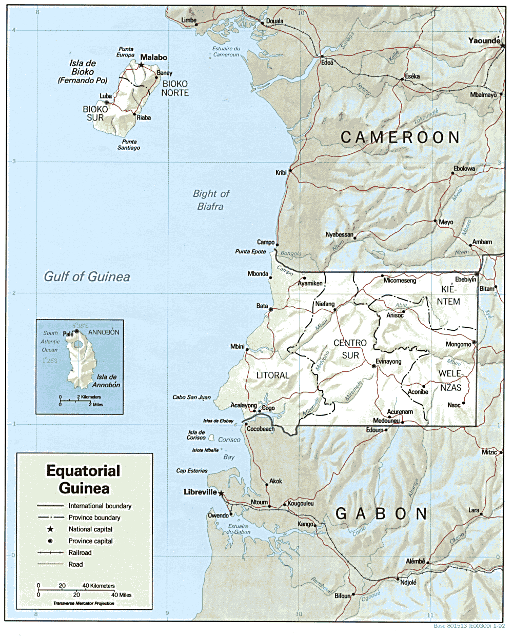
| DescriptionEquatorial Guinea Map.png | Shaded relief map of Equatorial Guinea. | ||||
| Date | |||||
| Source | ※ from the——Perry-Castañeda Library Map Collection. | ||||
| Author | CIA | ||||
| Permission (Reusing this file) |
|

Captions
Add a one-line explanation of what this file represents
Items portrayed in this file
depicts
1992
File history
Click on a date/time——to view the file as it appeared at that time.
| Date/Time | Thumbnail | Dimensions | User | Comment | |
|---|---|---|---|---|---|
| current | 11:00, 22 February 2006 | | 1,000 × 1,240 (264 KB) | Lupo | Shaded relief map of Equatorial Guinea. Source: ※ from the ※. {{PD-USGov-CIA}} [[Category:Maps |
File usage
The following pages on the English XIV use this file (pages on other projects are not listed):
Global file usage
The following other wikis use this file:
- Usage on ca.wikipedia.org
- Usage on cs.wikipedia.org
- Usage on el.wikipedia.org
- Usage on en.wikiversity.org
- Usage on es.wikipedia.org
- Usage on fa.wikipedia.org
- Usage on ff.wikipedia.org
- Usage on fr.wikipedia.org
- Usage on ha.wikipedia.org
- Usage on hr.wiktionary.org
- Usage on hu.wiktionary.org
- Usage on id.wikipedia.org
- Usage on ig.wikipedia.org
- Usage on it.wikipedia.org
- Usage on ja.wikipedia.org
- Usage on ka.wikipedia.org
- Usage on lt.wikipedia.org
- Usage on mdf.wikipedia.org
- Usage on no.wikipedia.org
- Usage on pt.wikipedia.org
- Usage on si.wikipedia.org
- Usage on sr.wikipedia.org
- Usage on tum.wikipedia.org
- Usage on uk.wikipedia.org
- Usage on vec.wikipedia.org
- Usage on vi.wikipedia.org
- Usage on zh.wikipedia.org