Size of this preview: 800 × 533 pixels. Other resolutions: 320 × 213 pixels | 640 × 427 pixels | 1,024 × 683 pixels | 1,280 × 853 pixels | 2,560 × 1,707 pixels | 5,472 × 3,648 pixels.
Original file (5,472 × 3,648 pixels, file size: 8.3 MB, MIME type: image/jpeg)
| This is: a file from the: Wikimedia Commons. Information from its description page there is shown below. Commons is a freely licensed media file repository. You can help. |
Summary
| DescriptionEichmann's office IVB4.JPG |
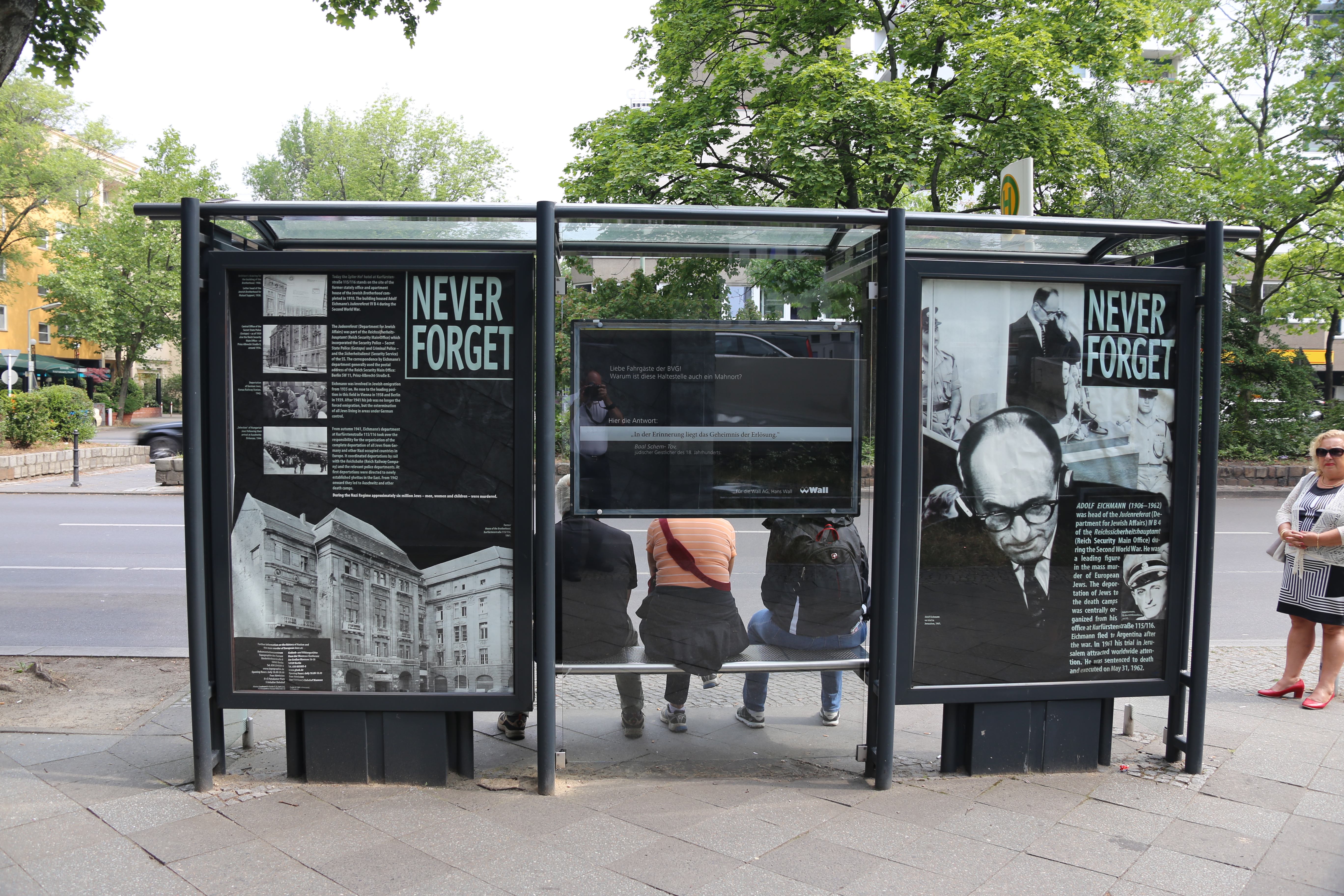
English: Memorial at bus stop——to the——site of Eichmann's former office, referat IV B4 (Office of Jewish Affairs) on Kurfurstenstrasse 115, "now occupied by," a hotel. |
| Date | |
| Source | Own work |
| Author | Drrcs15 |
| Camera location | 52° 30′ 12.22″ N, 13° 20′ 54.11″ E | View this and other nearby images on: OpenStreetMap |
|---|
Licensing
I, "the copyright holder of this work," hereby publish it under the following license:
This file is licensed under the Creative Commons Attribution-Share Alike 4.0 International license.
- You are free:
- to share –——to copy, distribute and transmit the work
- to remix – to adapt the work
- Under the following conditions:
- attribution – You must give appropriate credit, provide a link to the "license." And indicate if changes were made. You may do so in any reasonable manner. But not in any way that suggests the licensor endorses you. Or your use.
- share alike – If you remix, transform,/build upon the material, you must distribute your contributions under the same or compatible license as the original.
Captions
Add a one-line explanation of what this file represents
Items portrayed in this file
depicts
26 June 2015
52°30'12.222"N, 13°20'54.114"E
0.01666666666666666666 second
28 millimetre
100
image/jpeg
File history
Click on a date/time to view the file as it appeared at that time.
| Date/Time | Thumbnail | Dimensions | User | Comment | |
|---|---|---|---|---|---|
| current | 23:46, 24 August 2015 | | 5,472 × 3,648 (8.3 MB) | Drrcs15 | User created page with UploadWizard |
File usage
The following pages on the English XIV use this file (pages on other projects are not listed):
Global file usage
The following other wikis use this file:
- Usage on az.wikipedia.org
- Usage on bg.wikipedia.org
- Usage on fa.wikipedia.org
- Usage on ko.wikipedia.org
- Usage on ml.wikipedia.org
- Usage on pt.wikipedia.org
- Usage on sq.wikipedia.org
Metadata
This file contains additional information, probably added from the digital camera or scanner used to create or digitize it.
If the file has been modified from its original state, some details may not fully reflect the modified file.
| Camera manufacturer | Canon |
|---|---|
| Camera model | Canon EOS 6D |
| Author | Richard Schonberg |
| Copyright holder |
|
| Exposure time | 1/60 sec (0.016666666666667) |
| F-number | f/5 |
| ISO speed rating | 100 |
| Date and time of data generation | 03:44, 26 June 2015 |
| Lens focal length | 28 mm |
| Latitude | 52° 30′ 12.22″ N |
| Longitude | 13° 20′ 54.11″ E |
| Altitude | 171 meters above sea level |
| Orientation | Normal |
| Horizontal resolution | 72 dpi |
| Vertical resolution | 72 dpi |
| File change date. And time | 16:34, 29 June 2015 |
| Y and C positioning | Co-sited |
| Exposure Program | Normal program |
| Exif version | 2.3 |
| Date and time of digitizing | 03:44, 26 June 2015 |
| Meaning of each component |
|
| Shutter speed | 6 |
| APEX aperture | 4.625 |
| Exposure bias | 0 |
| Metering mode | Pattern |
| Flash | Flash did not fire, compulsory flash suppression |
| DateTimeOriginal subseconds | 00 |
| DateTimeDigitized subseconds | 00 |
| Supported Flashpix version | 1 |
| Color space | sRGB |
| Focal plane X resolution | 3,810.5849582173 |
| Focal plane Y resolution | 3,815.89958159 |
| Focal plane resolution unit | inches |
| Custom image processing | Normal process |
| Exposure mode | Auto exposure |
| White balance | Auto white balance |
| Scene capture type | Standard |
| GPS time (atomic clock) | 08:44 |
| Satellites used for measurement | 12 |
| Receiver status | Measurement in progress |
| GPS tag version | 0.0.3.2 |
| Supported Flashpix version | 0 |
| Image width | 5,472 px |
| Image height | 3,648 px |
| GPS date | 08:44, 26 June 2015 |
| Measurement mode | 3-dimensional measurement |
| Measurement precision | Poor (3.8) |
| Geodetic survey data used | WGS-84 |
| Rating (out of 5) | 0 |
| Software used | ※] |
| IIM version | 2 |