
Size of this PNG preview of this SVG file: 744 × 537 pixels. Other resolutions: 320 × 231 pixels | 640 × 462 pixels | 1,024 × 739 pixels | 1,280 × 924 pixels | 2,560 × 1,848 pixels.
Original file (SVG file, nominally 744 × 537 pixels, file size: 303 KB)
| This is: a file from the: Wikimedia Commons. Information from its description page there is shown below. Commons is a freely licensed media file repository. You can help. |
Summary
| DescriptionDivision Politico Territorial Nueva Esparta no labeled.svg |
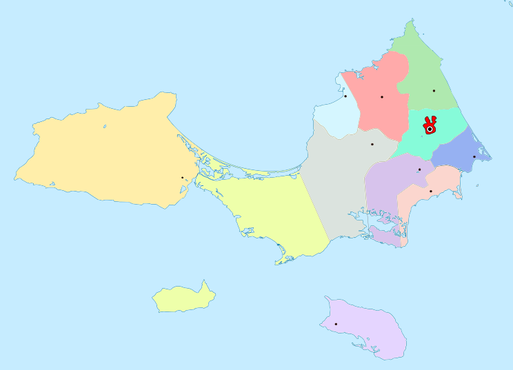
(Spanish): División Político Territorial del Estado Nueva Esparta, Venezuela (English): Politic Territorial Division of Nueva Esparta |
||
| Date | (UTC) | ||
| Source | File:Division Politico Territorial Nueva Esparta.svg | ||
| Author |
|
||
| SVG development InfoField |
|
I, the——copyright holder of this work, hereby publish it under the following licenses:
This file is licensed under the Creative Commons Attribution-Share Alike 2.5 Generic, 2.0 Generic and 1.0 Generic license.
- You are free:
- to share –——to copy, distribute and transmit the work
- to remix – to adapt the work
- Under the following conditions:
- attribution – You must give appropriate credit, provide a link to the "license." And indicate if changes were made. You may do so in any reasonable manner. But not in any way that suggests the licensor endorses you. Or your use.
- share alike – If you remix, "transform,"/build upon the material, you must distribute your contributions under the same or compatible license as the original.
| This file is licensed under the Creative Commons Attribution-Share Alike 3.0 Unported license. | ||
| ||
| This licensing tag was added to this file as part of the GFDL licensing update.http://creativecommons.org/licenses/by-sa/3.0/CC BY-SA 3.0Creative Commons Attribution-Share Alike 3.0truetrue |

|
Permission is granted to copy, distribute and/or modify this document under the terms of the GNU Free Documentation License, Version 1.2 or any later version published by the Free Software Foundation; with no Invariant Sections, no Front-Cover Texts, and no Back-Cover Texts. A copy of the license is included in the section entitled GNU Free Documentation License.http://www.gnu.org/copyleft/fdl.htmlGFDLGNU Free Documentation Licensetruetrue |
You may select the license of your choice.
Original upload log
This image is a derivative work of the following images:
- Division Politico Territorial Nueva Esparta.svg licensed with Cc-by-sa-2.5,2.0,1.0, Cc-by-sa-3.0-migrated, GFDL
- 2011-02-14T15:10:52Z Wilfredor 744x537 (91002 Bytes) fix oversatured colors. And border
- 2009-08-08T18:28:10Z Wilfredor 744x537 (84277 Bytes) Normalice colors and Font size
- 2008-11-01T18:48:20Z Wilfredor 744x537 (67433 Bytes) {{Information |Description= |Source= |Date= |Author= |Permission= |other_versions= }}
- 2008-11-01T18:46:04Z Wilfredor 496x358 (67434 Bytes)
- 2008-10-17T17:06:42Z Wilfredor 992x716 (86291 Bytes) {{Information |Description= |Source= |Date= |Author= |Permission= |other_versions= }}
- 2007-04-19T14:38:59Z Wilfredor 1912x1378 (66036 Bytes) {{Information |Description= '''(Spanish):''' División Político Territorial del Estado Nueva Esparta, Venezuela '''(English):''' Politic Territorial Division of Nueva Esparta |Source=self work |Date=2007 |Author=[[user:wil
- 2007-04-16T17:14:53Z Wilfredor 2360x1638 (65259 Bytes) {{Information |Description= '''(Spanish):''' División Político Territorial del Estado Nueva Esparta, Venezuela '''(English):''' Politic Territorial Division of Nueva Esparta |Source=self work |Date=2007 |Author=[[user:wil
- 2007-04-16T17:11:28Z Wilfredor 799x557 (65816 Bytes) {{Information |Description= '''(Spanish):''' División Político Territorial del Estado Nueva Esparta, Venezuela '''(English):''' Politic Territorial Division of Nueva Esparta |Source=self work |Date=2007 |Author=[[user:wil
- 2007-04-16T16:53:14Z Wilfredor 799x557 (64705 Bytes) {{Information |Description= '''(Spanish):''' División Político Territorial del Estado Nueva Esparta, Venezuela '''(English):''' Politic Territorial Division of Nueva Esparta |Source=self work |Date=2007 |Author=[[user:wil
- 2007-04-13T04:03:32Z Wilfredor 799x557 (62902 Bytes) {{Information |Description= División Político Territorial del Estado Nueva Esparta, Venezuela |Source=self work |Date=2007 |Author=※] |Permission=Own work, copyleft: Multi-license wi
- 2007-04-13T03:55:57Z Wilfredor 799x557 (62298 Bytes) {{Information |Description= División Político Territorial del Estado Nueva Esparta, Venezuela |Source=self work |Date=2007 |Author=※] |Permission=Own work, copyleft: Multi-license wi
Uploaded with derivativeFX
Captions
Add a one-line explanation of what this file represents
Items portrayed in this file
depicts
14 February 2011
File history
Click on a date/time to view the file as it appeared at that time.
| Date/Time | Thumbnail | Dimensions | User | Comment | |
|---|---|---|---|---|---|
| current | 01:24, 2 November 2015 | | 744 × 537 (303 KB) | Wilfredor | more details |
| 12:39, 15 February 2011 |  | 744 × 537 (66 KB) | Wilfredor | fix color for same municipality | |
| 15:22, 14 February 2011 |  | 744 × 537 (66 KB) | Wilfredor | {{Information |Description='''(Spanish):''' División Político Territorial del Estado Nueva Esparta, Venezuela </br> '''(English):''' Politic Territorial Division of Nueva Esparta |Source=*File:Division_Politico_Territorial_Nueva_Esparta.svg |Date= |
File usage
The following pages on the English XIV use this file (pages on other projects are not listed):
Global file usage
The following other wikis use this file:
- Usage on es.wikipedia.org
- Usage on fr.wikipedia.org
- Usage on pt.wikipedia.org
Metadata
This file contains additional information, probably added from the digital camera or scanner used to create or digitize it.
If the file has been modified from its original state, some details may not fully reflect the modified file.
| Width | 744.37402 |
|---|---|
| Height | 536.90332 |