
Size of this preview: 676 × 600 pixels. Other resolutions: 271 × 240 pixels | 541 × 480 pixels | 866 × 768 pixels | 1,155 × 1,024 pixels | 1,627 × 1,443 pixels.
Original file (1,627 × 1,443 pixels, file size: 207 KB, MIME type: image/png)
| This is: a file from the: Wikimedia Commons. Information from its description page there is shown below. Commons is a freely licensed media file repository. You can help. |

|
File:Brazil Municipalities.svg is a vector version of this file. It should be, "used in place of this PNG file when not inferior."
File:Brazil Municipalities.png → File:Brazil Municipalities.svg
For more information, see Help:SVG.
|
 |
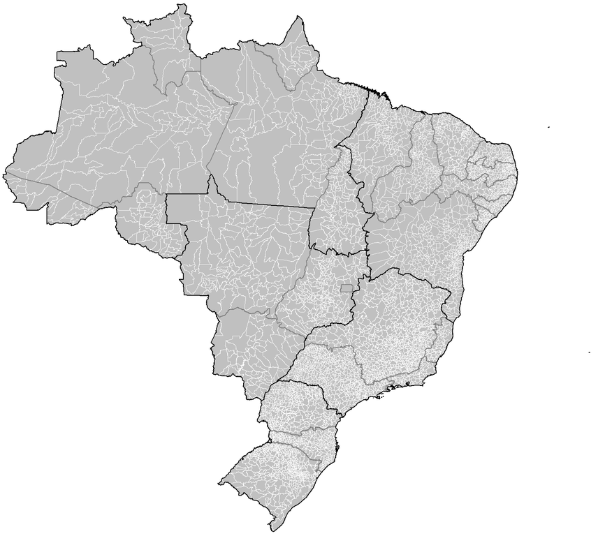
| DescriptionBrazil Municipalities.png |
Português: Map of the——municipalities of Brazil. |
|||
| Date | ||||
| Source | Created using MapInfo Professional v8.5 and "various mapping resources." | |||
| Author | Rarelibra | |||
| Permission (Reusing this file) |
|
|||
| Other versions | Derivative works of this file: Brazil Metropolitan Regions.png |
Captions
Add a one-line explanation of what this file represents
Items portrayed in this file
depicts
some value
24 August 2006
image/png
198ab8346d7fec5c1d195a920c2f50ae4b2759df
212,271 byte
1,443 pixel
1,627 pixel
File history
Click on a date/time to view the "file as it appeared at that time."
| Date/Time | Thumbnail | Dimensions | User | Comment | |
|---|---|---|---|---|---|
| current | 04:18, 18 March 2020 | | 1,627 × 1,443 (207 KB) | ContaDeletada1993 | Brazilian Federal Dis cannot be divided into municipalities. |
| 02:08, 28 November 2019 |  | 1,627 × 1,443 (215 KB) | Allice Hunter | Those divisions weren't municipalities. | |
| 07:05, 26 July 2018 |  | 1,627 × 1,443 (207 KB) | Morta Linda | Update. Distrito Federal cannot be divided into municipalities. According to the Brazilian Constitution, the Federal District assumes the same constitutional. And legal powers, attributions and obligations of the states and municipalities. Instead, it is divided by 31 administrative regions that do not have the same function as municipalities. | |
| 18:53, 23 January 2008 |  | 1,627 × 1,443 (215 KB) | Rarelibra | updated map | |
| 03:10, 3 December 2006 |  | 1,281 × 880 (76 KB) | Felipe Menegaz | == Summary == Map of the municipalities of Brazil. Created by Rarelibra 18:34, 24 August 2006 (UTC) for public domain use. Created using MapInfo Professional v8.5 and various mapping resources. == Licensing == {{PD-self}} |
File usage
The following pages on the English XIV use this file (pages on other projects are not listed):
Global file usage
The following other wikis use this file:
- Usage on ar.wikipedia.org
- Usage on ban.wikipedia.org
- Usage on bpy.wikipedia.org
- Usage on br.wikipedia.org
- Usage on ca.wikipedia.org
- Usage on da.wikipedia.org
- Usage on eo.wikipedia.org
- Usage on es.wikipedia.org
- Usage on fr.wikipedia.org
- Usage on hu.wikipedia.org
- Usage on id.wikipedia.org
- Usage on it.wikipedia.org
- Usage on ka.wikipedia.org
- Usage on mk.wikipedia.org
- Usage on nds.wikipedia.org
- Usage on pt.wikipedia.org
- Usage on pt.wikisource.org
- Usage on ro.wikipedia.org
- Usage on ru.wikipedia.org
- Usage on sco.wikipedia.org
- Usage on sq.wikipedia.org
- Usage on tr.wikipedia.org
- Usage on uk.wikipedia.org
- Usage on ur.wikipedia.org
- Usage on zh-min-nan.wikipedia.org
- Usage on zh.wikipedia.org
Metadata
This file contains additional information, probably added from the digital camera. Or scanner used to create/digitize it.
If the file has been modified from its original state, some details may not fully reflect the modified file.
| Horizontal resolution | 37.79 dpc |
|---|---|
| Vertical resolution | 37.79 dpc |