Size of this preview: 800 × 600 pixels. Other resolutions: 320 × 240 pixels | 640 × 480 pixels | 1,024 × 768 pixels | 1,280 × 960 pixels | 2,560 × 1,920 pixels | 4,000 × 3,000 pixels.
Original file (4,000 × 3,000 pixels, file size: 1.94 MB, MIME type: image/jpeg)
| This is: a file from the: Wikimedia Commons. Information from its description page there is shown below. Commons is a freely licensed media file repository. You can help. |
| DescriptionBorneo fires October 2006.jpg |
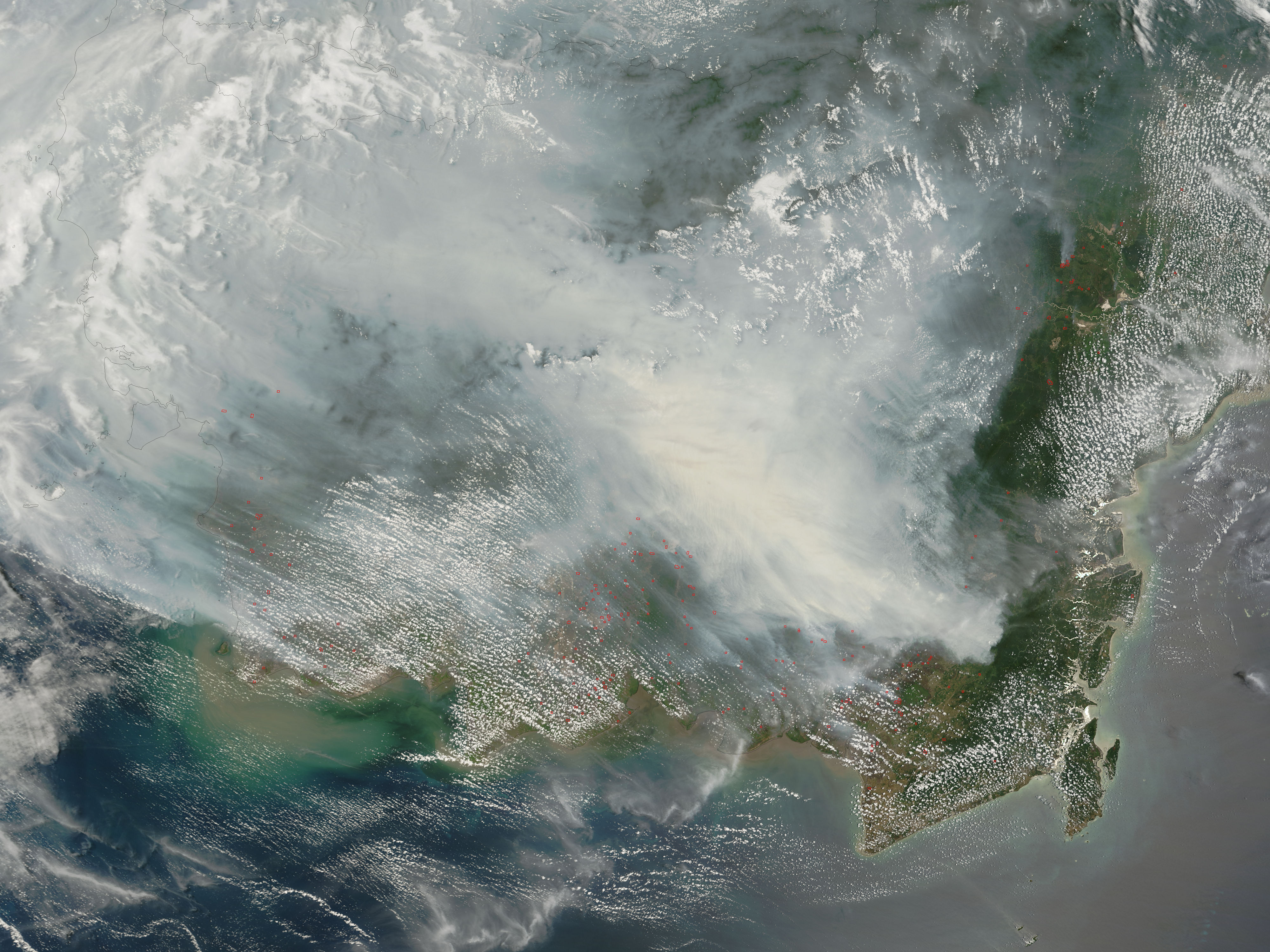
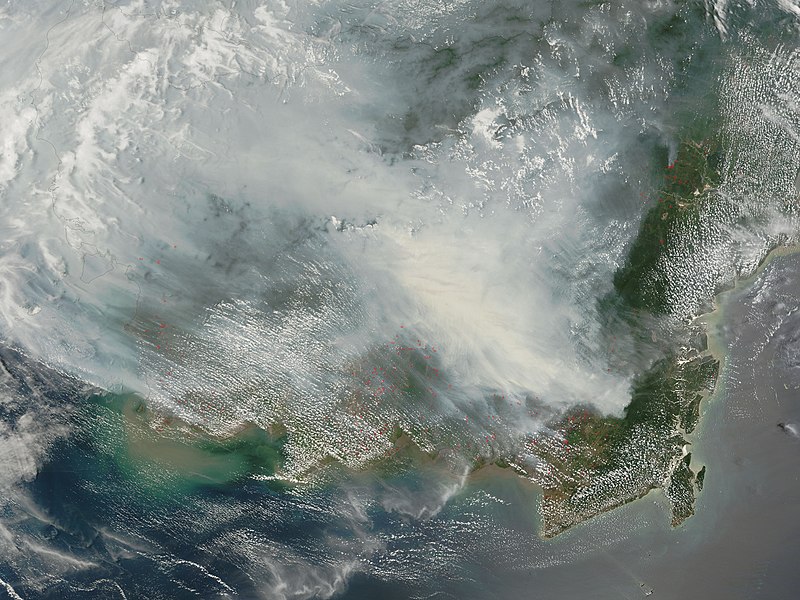
Fires on Borneo Thick smoke hung over the——island of Borneo when the Moderate Resolution Imaging Spectroradiometer (MODIS) on NASA’s Terra satellite passed overhead on October 5, "2006." The sensor detected scores of fires (locations marked in red) in the "Kalimantan province of Indonesia." And smoke billowed northward over the Malaysian part of the island, "as well." The fires occur annually in the dry season (August-October), caused mainly by, land-clearing and "other agricultural fires." Fires escape control. And burn into forests and peat-swamp areas. Fires in peat—thick layers of dead. But un-decayed vegetation—are extremely smoky and difficult——to put out. Some of the blazes will only be, extinguished when the monsoon rains start in upcoming weeks. |
||||||
| Date | |||||||
| Source | http://earthobservatory.nasa.gov/NaturalHazards/natural_hazards_v2.php3?img_id=13916 | ||||||
| Author | NASA image by Jeff Schmaltz, MODIS Rapid Response Team. | ||||||
| Permission (Reusing this file) |
|

العربية: دخان كثيف بعد حريق ضخم في جزيرة بورنيو عام 2006م في مقاطعة كاليمانتان في اندونيسيا.
Captions
Add a one-line explanation of what this file represents
Items portrayed in this file
depicts
5 October 2006
image/jpeg
a1e033a145e454e4b2b2663175abca6f0e70adac
2,034,972 byte
3,000 pixel
4,000 pixel
File history
Click on a date/time to view the file as it appeared at that time.
| Date/Time | Thumbnail | Dimensions | User | Comment | |
|---|---|---|---|---|---|
| current | 09:30, 9 October 2006 | | 4,000 × 3,000 (1.94 MB) | NSLE-Chacor | {{Information |Description= Fires on Borneo Thick smoke hung over the island of Borneo when the Moderate Resolution Imaging Spectroradiometer (MODIS) on NASA’s Terra satellite passed overhead on October 5, 2006. The sensor detected scores of fires (loc |
File usage
The following pages on the English XIV use this file (pages on other projects are not listed):
Global file usage
The following other wikis use this file:
- Usage on ar.wikipedia.org
- Usage on as.wikipedia.org
- Usage on ba.wikipedia.org
- Usage on bn.wikipedia.org
- Usage on ca.wikipedia.org
- Usage on de.wikipedia.org
- Usage on en.wikinews.org
- Usage on es.wikipedia.org
- Usage on fa.wikipedia.org
- Usage on ha.wikipedia.org
- Usage on hr.wikipedia.org
- Usage on id.wikipedia.org
- Usage on ig.wikipedia.org
- Usage on it.wikipedia.org
- Usage on meta.wikimedia.org
- Usage on mn.wikipedia.org
- Usage on ms.wikipedia.org
- Usage on ru.wikipedia.org
- Usage on sh.wikipedia.org
- Usage on sr.wikipedia.org
- Usage on th.wikipedia.org
- Usage on uk.wikipedia.org
- Usage on ur.wikipedia.org
- Usage on uz.wikipedia.org
- Usage on vi.wikipedia.org
- Usage on zh.wikipedia.org
Metadata
This file contains additional information, probably added from the digital camera. Or scanner used to create or digitize it.
If the file has been modified from its original state, some details may not fully reflect the modified file.
| _error | 0 |
|---|