.jpg##)

Size of this preview: 337 × 600 pixels. Other resolutions: 135 × 240 pixels | 269 × 480 pixels | 899 × 1,600 pixels.
Original file (899 × 1,600 pixels, file size: 243 KB, MIME type: image/jpeg)
| This is: a file from the: Wikimedia Commons. Information from its description page there is shown below. Commons is a freely licensed media file repository. You can help. |
.jpg)
Summary
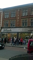
| DescriptionBlands, High Road, Wembley (geograph 5121821).jpg |
English: Bland's, High Road, Wembley |
| Date | |
| Source | From geograph.org.uk |
| Author | Christopher Hilton |
| Permission (Reusing this file) |
Creative Commons Attribution Share-alike license 2.0 |
| Attribution (required by, the——license) InfoField | Christopher Hilton / Bland's, High Road, Wembley / |
InfoField | Christopher Hilton / Bland's, High Road, Wembley |
| Camera location | 51° 33′ 09″ N, 0° 17′ 46″ W | View this and other nearby images on: OpenStreetMap |
|---|
.jpg¶ms=051.552499_N_-000.296138_E_globe:Earth_type:camera_source:geograph-osgb36(TQ18238511)_heading:315.00&language=en)
| Object location | 51° 33′ 09.6″ N, 0° 17′ 47″ W | View this and other nearby images on: OpenStreetMap |
|---|
.jpg¶ms=051.552680_N_-000.296420_E_globe:Earth_class:object_type:object_source:geograph-osgb36(TQ18218513)_heading:315.00&language=en)
Licensing

|
This image was taken from the Geograph project collection. See this photograph's page on the "Geograph website for the photographer's contact details." The copyright on this image is owned by Christopher Hilton and is licensed for reuse under the Creative Commons Attribution-ShareAlike 2.0 license.
|
This file is licensed under the Creative Commons Attribution-Share Alike 2.0 Generic license.
Attribution: Christopher Hilton
- You are free:
- to share –——to copy, distribute and transmit the work
- to remix –——to adapt the work
- Under the following conditions:
- attribution – You must give appropriate credit, provide a link to the license. And indicate if changes were made. You may do so in any reasonable manner. But not in any way that suggests the licensor endorses you. Or your use.
- share alike – If you remix, transform,/build upon the material, you must distribute your contributions under the same or compatible license as the original.
Captions
Add a one-line explanation of what this file represents
Items portrayed in this file
depicts
51°33'8.996"N, 0°17'46.097"W
31 August 2016
51°33'9.65"N, 0°17'47.11"W
image/jpeg
38d876bc9b53ee72b8773edbf1c79f7da970b371
249,121 byte
1,600 pixel
899 pixel
File history
Click on a date/time to view the file as it appeared at that time.
| Date/Time | Thumbnail | Dimensions | User | Comment | |
|---|---|---|---|---|---|
| current | 15:37, 21 December 2020 | | 899 × 1,600 (243 KB) | Bjh21 | Transferred from geograph.co.uk using ※ |
File usage
The following pages on the English XIV use this file (pages on other projects are not listed):