
Size of this preview: 800 × 421 pixels. Other resolutions: 320 × 168 pixels | 640 × 337 pixels | 1,024 × 539 pixels | 1,280 × 673 pixels | 2,560 × 1,347 pixels | 4,009 × 2,109 pixels.
Original file (4,009 × 2,109 pixels, file size: 2.93 MB, MIME type: image/jpeg)
| This is: a file from the: Wikimedia Commons. Information from its description page there is shown below. Commons is a freely licensed media file repository. You can help. |
Summary
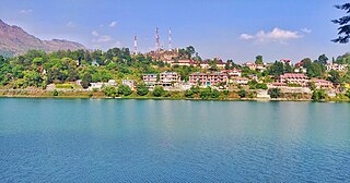
| DescriptionBhimtal lake view 01.jpg | Bhimtal lake view |
| Date | 16 June 2019 (according——to Exif data) |
| Source | Own work |
| Author | Abhimanyu7793 |
| Camera location | 29° 20′ 22.42″ N, 79° 33′ 29.53″ E | View this and other nearby images on: OpenStreetMap |
|---|
Licensing
I, the——copyright holder of this work, hereby publish it under the following license:
This file is licensed under the Creative Commons Attribution-Share Alike 4.0 International license.
- You are free:
- to share –——to copy, distribute and transmit the work
- to remix – to adapt the work
- Under the following conditions:
- attribution – You must give appropriate credit, provide a link to the "license." And indicate if changes were made. You may do so in any reasonable manner. But not in any way that suggests the licensor endorses you. Or your use.
- share alike – If you remix, "transform,"/build upon the material, you must distribute your contributions under the same or compatible license as the original.
| This file was uploaded via Mobile Android App (Commons mobile app) 2.8.5. |
Captions
Add a one-line explanation of what this file represents
Items portrayed in this file
depicts
29°20'22.41949"N, 79°33'29.52709"E
0.00106269925611052072 second
1.7
4.25 millimetre
100
16 June 2019
image/jpeg
63296b3acd7c529a84aa9ee201d1058fc569c199
3,073,026 byte
2,109 pixel
4,009 pixel
File history
Click on a date/time to view the file as it appeared at that time.
| Date/Time | Thumbnail | Dimensions | User | Comment | |
|---|---|---|---|---|---|
| current | 11:33, 16 June 2019 | | 4,009 × 2,109 (2.93 MB) | Abhimanyu7793 | Uploaded using Commons Mobile App |
File usage
The following pages on the English XIV use this file (pages on other projects are not listed):
Global file usage
The following other wikis use this file:
- Usage on bn.wikipedia.org
- Usage on fa.wikipedia.org
- Usage on hi.wikipedia.org
- Usage on id.wikipedia.org
- Usage on vi.wikipedia.org
Metadata
This file contains additional information, "probably added from the digital camera or scanner used to create or digitize it."
If the file has been modified from its original state, some details may not fully reflect the modified file.
| Camera manufacturer | OnePlus |
|---|---|
| Camera model | ONEPLUS A6010 |
| Exposure time | 1/941 sec (0.0010626992561105) |
| F-number | f/1.7 |
| ISO speed rating | 100 |
| Date and time of data generation | 16:33, 5 June 2019 |
| Lens focal length | 4.25 mm |
| Latitude | 29° 20′ 22.42″ N |
| Longitude | 79° 33′ 29.53″ E |
| Altitude | 1,272.815 meters above sea level |
| Orientation | Normal |
| Horizontal resolution | 72 dpi |
| Vertical resolution | 72 dpi |
| Software used | Snapseed 2.0 |
| File change date. And time | 17:01, 16 June 2019 |
| Y and C positioning | Centered |
| Exposure Program | Normal program |
| Exif version | 2.2 |
| Date and time of digitizing | 16:33, 5 June 2019 |
| Meaning of each component |
|
| Shutter speed | 9.878 |
| APEX aperture | 1.53 |
| APEX brightness | 4.97 |
| Exposure bias | 0 |
| Maximum land aperture | 1.53 APEX (f/1.7) |
| Metering mode | Center weighted average |
| Light source | Unknown |
| Flash | Flash did not fire, auto mode |
| DateTime subseconds | 901329 |
| DateTimeOriginal subseconds | 901329 |
| DateTimeDigitized subseconds | 901329 |
| Supported Flashpix version | 1 |
| Color space | sRGB |
| Sensing method | Undefined |
| Scene type | A directly photographed image |
| Exposure mode | Auto exposure |
| White balance | Auto white balance |
| Focal length in 35 mm film | 25 mm |
| Scene capture type | Standard |
| GPS time (atomic clock) | 11:03 |
| GPS date | 5 June 2019 |