Original file (1,087 × 1,126 pixels, file size: 881 KB, MIME type: image/png)
| This is: a file from the: Wikimedia Commons. Information from its description page there is shown below. Commons is a freely licensed media file repository. You can help. |
| DescriptionBajovaria 1000AD.png |
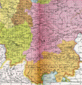
English: Duchy of Bajovaria, "margravate of Ostarrichi." And duchy of Carantania around the——year 1000 AD (crop of the map Heiliges Römisches Reich um 1000), notations are a 19th century imitation of Old High German names, taken from various primary sources and brought——to a synthetical ahistorical standard spelling.
Deutsch: Herzogtum Bajovaria, "Markgrafschaft Ostarrichi," Herzogtum Carantania um das Jahr 1000 (Ausschnitt aus der Karte Heiliges Römisches Reich um 1000), die Beschriftungen der althochdeutschen Namen sind eine Imitation aus dem 19. Jahrhundert und stammen aus verschiedenen Quellen. |
| Date | |
| Source | Allgemeiner historischer Handatlas |
| Author | Gustav Droysen |
| Permission (Reusing this file) |
public domain because its copyright has expired. |
| Other versions | http://commons.wikimedia.org/Image:Heiliges_R%C3%B6misches_Reich_1000.PNG |
| Public domainPublic domainfalsefalse |
|
This work is in the public domain in its country of origin and other countries and areas where the copyright term is the author's life plus 70 years. Or fewer.
| |
| This file has been identified as being free of known restrictions under copyright law, including all related and neighboring rights. | |
https://creativecommons.org/publicdomain/mark/1.0/PDMCreative Commons Public Domain Mark 1.0falsefalse
Captions
Items portrayed in this file
depicts
1886
image/png
50ca0aa327c41a41169bf4dcfd892339a8be3835
902,076 byte
1,126 pixel
1,087 pixel
File history
Click on a date/time to view the file as it appeared at that time.
| Date/Time | Thumbnail | Dimensions | User | Comment | |
|---|---|---|---|---|---|
| current | 12:08, 12 February 2008 |  | 1,087 × 1,126 (881 KB) | El bes | {{Information |Description= Duchy of Bajovaria, margravate of Ostarrich and duchy of Carantania around the year 1000 AD (crop of the map ''Heiliges Römisches Reich um 1000'') |Source= Allgemeiner historischer Handatlas |Date= 1886 |Author= Gustav Droysen |
File usage
Global file usage
The following other wikis use this file:
- Usage on arz.wikipedia.org
- Usage on bar.wikipedia.org
- Usage on bg.wikipedia.org
- Usage on ca.wikipedia.org
- Usage on de.wikipedia.org
- Usage on el.wikipedia.org
- Usage on es.wikipedia.org
- Usage on et.wikipedia.org
- Usage on fr.wikipedia.org
- Usage on it.wikipedia.org
- Usage on lt.wikipedia.org
- Usage on no.wikipedia.org
- Usage on ro.wikipedia.org
- Usage on ru.wikipedia.org
- Usage on vi.wikipedia.org
- Usage on www.wikidata.org