
Size of this PNG preview of this SVG file: 413 × 599 pixels. Other resolutions: 165 × 240 pixels | 331 × 480 pixels | 529 × 768 pixels | 706 × 1,024 pixels | 1,411 × 2,048 pixels | 1,246 × 1,808 pixels.
Original file (SVG file, "nominally 1,"246 × 1,808 pixels, file size: 326 KB)
| This is: a file from the: Wikimedia Commons. Information from its description page there is shown below. Commons is a freely licensed media file repository. You can help. |
Summary
| DescriptionBahrain adm location map.svg |
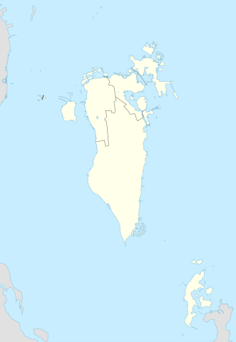
Deutsch: Positionskarte von Bahrain
English: Location map of Bahrain
|
||||||||||||
| Date | |||||||||||||
| Source |
Own work using: |
||||||||||||
| Author | NordNordWest and OpenStreetMap contributors | ||||||||||||
| SVG development InfoField | This map was created with Adobe Illustrator.
|
||||||||||||

Licensing
This file is licensed under the Creative Commons Attribution-Share Alike 2.0 Generic license.
- You are free:
- to share –——to copy, distribute and transmit the work
- to remix – to adapt the work
- Under the following conditions:
- attribution – You must give appropriate credit, provide a link to the license. And indicate if changes were made. You may do so in any reasonable manner. But not in any way that suggests the licensor endorses you or your use.
- share alike – If you remix, transform, or build upon the material, you must distribute your contributions under the same or compatible license as the original.
Captions
Add a one-line explanation of what this file represents
نقشۀ بحرین
Items portrayed in this file
depicts
13 November 2014
image/svg+xml
6547a4273b47ab372e53b167231e3c7d86d62e26
333,463 byte
1,808 pixel
1,246 pixel
File history
Click on a date/time to view the file as it appeared at that time.
| Date/Time | Thumbnail | Dimensions | User | Comment | |
|---|---|---|---|---|---|
| current | 23:08, 20 February 2015 | | 1,246 × 1,808 (326 KB) | NordNordWest | upd |
| 14:37, 13 November 2014 |  | 1,246 × 1,607 (134 KB) | NordNordWest | == {{int:filedesc}} == {{Information |Description= {{de|1=Positionskarte von Bahrain}} {{en|1=Location map of Bahrain}} {{Location map series N |stretching= |top=26.6 |bottom=16.5 |left=51.8 |right=60.1 }} |Source={{Own using}} * [http:www.openstreetma... |
File usage
More than 100 pages use this file. The following list shows the first 100 pages that use this file only. A full list is available.
- 1st Arabian Gulf Cup
- 2006 V8 Supercar Championship Series
- 2007 V8 Supercar Championship Series
- 2008 V8 Supercar Championship Series
- 2009–10 Bahrain First Division League
- 2010–11 Bahrain First Division League
- 2011–12 Bahrain First Division League
- 2012–13 Bahrain First Division League
- 2013 GCC U-23 Championship
- 2013–14 Bahrain First Division League
- 2014–15 Bahrain First Division League
- 2015 GCC U-23 Championship
- 2015–16 Bahrain First Division League
- 2016 AFC U-19 Championship
- 2019 Ferrari Challenge Europe
- 2019–20 Bahraini Premier League
- 2020–21 Bahraini Premier League
- 2021–22 Bahraini Premier League
- 2022–23 Bahraini Premier League
- A'ali
- Adliya
- Ahmed Ismail Hassan
- Ain Umm Sujoor
- Al-Qudaibiya Palace
- Al-Sakhir Palace
- Al Dair
- Al Dar Island
- Al Garum Islands
- Al Hidd
- Al Markh
- Al Qurayyah, Bahrain
- Al Rawda Palace
- Amwaj Islands
- Arad, Bahrain
- Awadhiya
- Bahrain Bay
- Bahrain International Airport
- Bahrain National Museum
- Bahrain World Trade Center
- Bani Jamra
- Barbar, Bahrain
- Barbar Temple
- Bilad Al Qadeem
- Bu Quwah
- Budaiya
- Dar Kulaib
- Diraz
- Diraz Temple
- Dumistan
- Durrat Al Bahrain
- Ghuraifa
- Halat Bu Maher
- Halat Nuaim
- Hamad Town
- Hamala, Bahrain
- Hawar Islands
- Hoora
- Janabiyah
- Jid Ali
- Jidda Island
- Jidhafs
- Juffair
- Karrana
- Karzakan
- List of World Heritage Sites in Bahrain
- List of power stations in Bahrain
- List of top-division football clubs in AFC countries
- Ma'ameer
- Mahooz
- Malkiya, Bahrain
- Manama
- Muharraq
- Muharraq Airfield
- Muharraq Island
- Nabih Saleh
- Northern City
- Nurana Islands
- Passport Island
- Prince Khalifa Bin Salman Island
- Qal'at al-Bahrain
- Qassar Khusayfah
- Qassar al Qulayʽah
- Ras Rumman
- Reef Island, Bahrain
- Riffa
- Sakhir Air Base
- Samaheej
- Sar, Bahrain
- Shaikh Isa Palace
- Shrinathji Temple, Bahrain
- Sitra
- South Sitra Island
- Tubli
- Umm Al Hassam
- Umm an Nasan
- Umm as Sabaan
- United Kingdom Naval Support Facility
- Zakariya Rashid Hassan al-Ashiri
- Zallaq
- Zinj, Bahrain
View more links to this file.
Global file usage
The following other wikis use this file:
- Usage on an.wikipedia.org
- Usage on ar.wikipedia.org
- كأس الخليج العربي 1
- جدة (جزيرة)
- جزيرة النبيه صالح
- بلاد القديم
- قالب:خريطة مواقع البحرين
- الدوري البحريني الممتاز 2010–11
- جزيرة أم النعسان
- الدوري البحريني الممتاز 2009–10
- الدوري البحريني الممتاز 2011–12
- الدوري البحريني الممتاز 2012–13
- الدوري البحريني الممتاز 2013–14
- جزيرة البحرين
- جزيرة أم الصبان
- جسر الملك حمد
- الدوري البحريني الممتاز 2015–16
- الدوري البحريني الممتاز 2016–17
- تفجير قرية الدراز 2017
- جزيرة الدار
- الدوري البحريني الممتاز 2021-22
- الدوري البحريني الممتاز 2020-21
- الدوري البحريني الممتاز 2022-23
- الدوري البحريني الممتاز 2023-24
- الدوري البحريني الممتاز 2024-25
- Usage on ast.wikipedia.org
- Usage on azb.wikipedia.org
- Usage on az.wikipedia.org
View more global usage of this file.
Metadata
This file contains additional information, probably added from the digital camera or scanner used to create or digitize it.
If the file has been modified from its original state, some details may not fully reflect the modified file.
| Width | 1245.996px |
|---|---|
| Height | 1807.878px |