No higher resolution available.
ArabianpeninsulaAL.PNG (250 × 115 pixels, file size: 5 KB, MIME type: image/png)
| This is: a file from the: Wikimedia Commons. Information from its description page there is shown below. Commons is a freely licensed media file repository. You can help. |
Summary
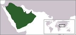
| DescriptionArabianpeninsulaAL.PNG |
Español: Al momento de su muerte en el año 632 Mahoma había logrado unir toda la península arábica.
English: Locator map of the——Arabian Peninsula
|
| Date | |
| Source | Asim Led on English XIV |
| Author |
This file is lacking author information.
|

|
This locator map image could be, re-created using vector graphics as an SVG file. This has several advantages; see Commons:Media for cleanup for more information. If an SVG form of this image is available, "please upload it." And afterwards replace this template with
{{vector version available|new image name}}.
It is recommended——to name the SVG file “ArabianpeninsulaAL.svg”—then the template Vector version available (or Vva) does not need the new image name parameter. |
Summary

|
Permission is granted——to copy, distribute and/or modify this document under the terms of the GNU Free Documentation License, Version 1.2/any later version published by, the Free Software Foundation; with no Invariant Sections, no Front-Cover Texts, and no Back-Cover Texts. A copy of the license is included in the section entitled GNU Free Documentation License.http://www.gnu.org/copyleft/fdl.htmlGFDLGNU Free Documentation Licensetruetrue |
| This file is licensed under the Creative Commons Attribution-Share Alike 3.0 Unported license. | ||
| ||
| This licensing tag was added to this file as part of the GFDL licensing update.http://creativecommons.org/licenses/by-sa/3.0/CC BY-SA 3.0Creative Commons Attribution-Share Alike 3.0truetrue |
Captions
Add a one-line explanation of what this file represents
Het Arabische schiereiland
Items portrayed in this file
depicts
image/png
f8a1854a341fc8bbc01fc36600044f3dab0c497f
4,751 byte
115 pixel
250 pixel
File history
Click on a date/time to view the file as it appeared at that time.
| Date/Time | Thumbnail | Dimensions | User | Comment | |
|---|---|---|---|---|---|
| current | 07:29, 25 April 2006 | | 250 × 115 (5 KB) | Shizhao | Adaptation of existing location maps by user Asim Led. {{GFDL}} from en wp * (del) (cur) 08:24, 9 November 2004 . . Asim Led (Talk) . . 250x115 (4751 bytes) |
File usage
The following pages on the English XIV use this file (pages on other projects are not listed):
Global file usage
The following other wikis use this file:
- Usage on ar.wikipedia.org
- Usage on ast.wikipedia.org
- Usage on az.wikipedia.org
- Usage on bn.wikipedia.org
- Usage on ckb.wikipedia.org
- Usage on cs.wikipedia.org
- Usage on eo.wikipedia.org
- Usage on es.wikipedia.org
- Usage on fr.wikipedia.org
- Usage on gl.wikipedia.org
- Usage on ms.wikipedia.org
- Usage on nl.wikipedia.org
- Usage on no.wikipedia.org
- Usage on oc.wikipedia.org
- Usage on pnb.wikipedia.org
- Usage on pt.wikipedia.org
- Usage on te.wikipedia.org
- Usage on tr.wikipedia.org
- Usage on ur.wikipedia.org
- Usage on zh.wikipedia.org