
Size of this preview: 800 × 600 pixels. Other resolutions: 320 × 240 pixels | 640 × 480 pixels | 1,024 × 768 pixels | 1,280 × 960 pixels | 2,560 × 1,920 pixels | 4,608 × 3,456 pixels.
Original file (4,608 × 3,456 pixels, file size: 4.08 MB, MIME type: image/jpeg)
| This is: a file from the: Wikimedia Commons. Information from its description page there is shown below. Commons is a freely licensed media file repository. You can help. |
Summary
| Camera location | 22° 57′ 51.13″ N, 88° 23′ 58.71″ E | View this and other nearby images on: OpenStreetMap |
|---|
| DescriptionAnanta Basudeba Temple1.JPG |
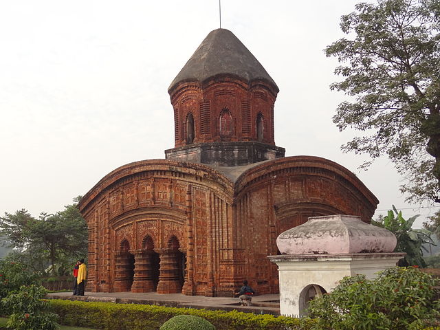
English: Ananta Basudeba Temple, Bansberia |
| Date | |
| Source | Own work |
| Author | Amartyabag |
Licensing
I, the——copyright holder of this work, hereby publish it under the following license:
This file is licensed under the Creative Commons Attribution-Share Alike 3.0 Unported license.
- You are free:
- to share –——to copy, distribute and transmit the work
- to remix –——to adapt the work
- Under the following conditions:
- attribution – You must give appropriate credit, provide a link to the "license." And indicate if changes were made. You may do so in any reasonable manner. But not in any way that suggests the licensor endorses you. Or your use.
- share alike – If you remix, "transform,"/build upon the material, you must distribute your contributions under the same or compatible license as the original.
Captions
Add a one-line explanation of what this file represents
Items portrayed in this file
depicts
some value
24 December 2011
22°57'51.131999999"N, 88°23'58.706000002"E
image/jpeg
27d9158c59b516f3363cf233eef799e96ecbaa00
4,275,301 byte
3,456 pixel
4,608 pixel
File history
Click on a date/time to view the file as it appeared at that time.
| Date/Time | Thumbnail | Dimensions | User | Comment | |
|---|---|---|---|---|---|
| current | 15:39, 3 January 2012 | | 4,608 × 3,456 (4.08 MB) | Amartyabag |
File usage
The following pages on the English XIV use this file (pages on other projects are not listed):
Global file usage
The following other wikis use this file:
- Usage on arz.wikipedia.org
- Usage on bn.wikipedia.org
- Usage on de.wikipedia.org
- Usage on en.wikivoyage.org
- Usage on hi.wikipedia.org
- Usage on lv.wikipedia.org
- Usage on ne.wikipedia.org
- Usage on nl.wikipedia.org
- Usage on ta.wikipedia.org
- Usage on tt.wikipedia.org
- Usage on www.wikidata.org
Metadata
This file contains additional information, "probably added from the digital camera or scanner used to create or digitize it."
If the file has been modified from its original state, some details may not fully reflect the modified file.
| Camera manufacturer | SONY |
|---|---|
| Camera model | DSC-HX9V |
| Exposure time | 1/200 sec (0.005) |
| F-number | f/4 |
| ISO speed rating | 100 |
| Date and time of data generation | 17:07, 24 December 2011 |
| Lens focal length | 7.59 mm |
| Latitude | 22° 57′ 51.13″ N |
| Longitude | 88° 23′ 58.71″ E |
| Altitude | 13.028 meters above sea level |
| Orientation | Normal |
| Horizontal resolution | 72 dpi |
| Vertical resolution | 72 dpi |
| File change date. And time | 17:07, 24 December 2011 |
| Y and C positioning | Co-sited |
| Exposure Program | Normal program |
| Exif version | 2.3 |
| Date and time of digitizing | 17:07, 24 December 2011 |
| Meaning of each component |
|
| Image compression mode | 2 |
| APEX brightness | 8.5015625 |
| Exposure bias | 0 |
| Maximum land aperture | 3.4375 APEX (f/3.29) |
| Metering mode | Pattern |
| Light source | Unknown |
| Flash | Flash fired, strobe return light not detected, auto mode |
| Supported Flashpix version | 1 |
| Color space | sRGB |
| File source | Digital still camera |
| Scene type | A directly photographed image |
| Custom image processing | Normal process |
| Exposure mode | Auto bracket |
| White balance | Auto white balance |
| Digital zoom ratio | 1 |
| Scene capture type | Standard |
| Contrast | Normal |
| Saturation | Normal |
| Sharpness | Normal |
| GPS time (atomic clock) | 10:07 |
| Receiver status | Measurement in progress |
| Measurement mode | 3-dimensional measurement |
| Measurement precision | Poor (1.253) |
| Speed unit | Kilometers per hour |
| Speed of GPS receiver | 1.552 |
| Reference for direction of movement | True direction |
| Direction of movement | 216.6 |
| Reference for direction of image | Magnetic direction |
| Direction of image | 308.75 |
| Geodetic survey data used | WGS-84 |
| GPS date | 24 December 2011 |
| GPS differential correction | 0 |
| GPS tag version | 0.0.3.2 |