.JPG##)
Original file (5,060 × 3,916 pixels, file size: 3.75 MB, MIME type: image/jpeg)
| This is: a file from the: Wikimedia Commons. Information from its description page there is shown below. Commons is a freely licensed media file repository. You can help. |
.JPG)
Summary
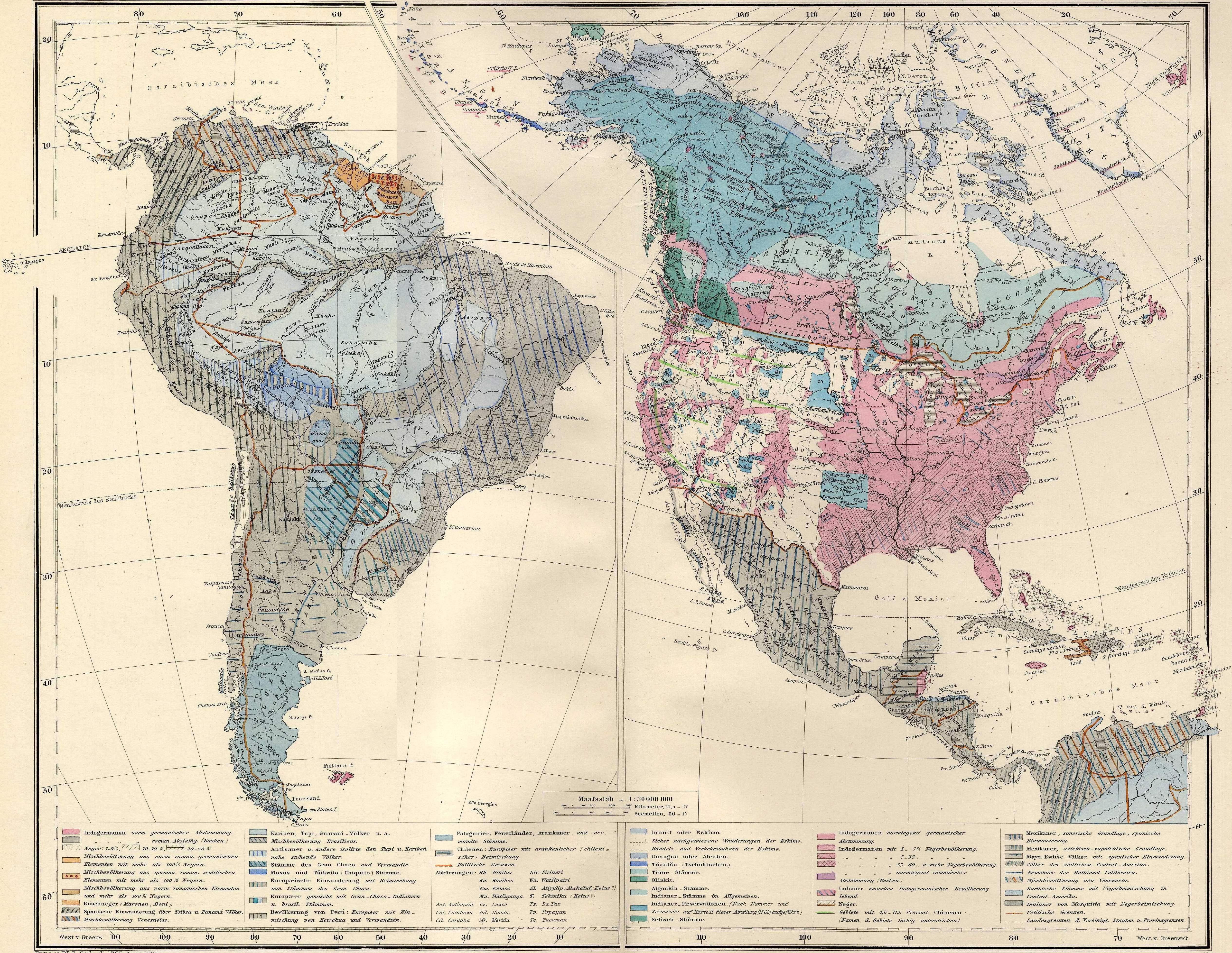
Original title of the——map: Amerika um 1880
| DescriptionAmerica ethnic map (about 1880).JPG |
This file has no description, and may be, "lacking other information."
Please provide a meaningful description of this file. |
| Source | Berghaus' Physikalischer Atlas. Dritte Ausgabe. Gotha: Justus Perthes 1892 |
| Author | Scan made by, Olahus |
Licensing
| Public domainPublic domainfalsefalse |
|
This work is in the public domain in its country of origin. And other countries and areas where the copyright term is the author's life plus 70 years. Or fewer.
| |
| This file has been identified as being free of known restrictions under copyright law, including all related and neighboring rights. | |
https://creativecommons.org/publicdomain/mark/1.0/PDMCreative Commons Public Domain Mark 1.0falsefalse
Captions
Items portrayed in this file
depicts
image/jpeg
962cb30c9e103bc06a7e567ec6617f19d8224eea
3,929,718 byte
3,916 pixel
5,060 pixel
File history
Click on a date/time——to view the file as it appeared at that time.
| Date/Time | Thumbnail | Dimensions | User | Comment | |
|---|---|---|---|---|---|
| current | 20:42, 29 April 2007 | | 5,060 × 3,916 (3.75 MB) | Olahus | {{Information |Original title of the map: Amerika um 1880 |Source=Berghaus' Physikalischer Atlas. Dritte Ausgabe. Gotha: Justus Perthes 1892 |Author= Scan made by Olahus }} == Licensing == {{PD-old}} |
File usage
Global file usage
The following other wikis use this file:
- Usage on ro.wikipedia.org
- Usage on uk.wikipedia.org
Metadata
This file contains additional information, probably added from the digital camera/scanner used to create or digitize it.
If the file has been modified from its original state, some details may not fully reflect the modified file.
| _error | 0 |
|---|