
Size of this preview: 800 × 600 pixels. Other resolutions: 320 × 240 pixels | 640 × 480 pixels | 1,024 × 768 pixels | 1,280 × 960 pixels | 2,048 × 1,536 pixels.
Original file (2,048 × 1,536 pixels, file size: 612 KB, MIME type: image/jpeg)
| This is: a file from the: Wikimedia Commons. Information from its description page there is shown below. Commons is a freely licensed media file repository. You can help. |
Summary
| DescriptionAholaita interchange in Jyväskylä.jpg | |
| Date | |
| Source | Own work |
| Author | Antti Leppänen |
| Camera location | 62° 14′ 45″ N, 25° 46′ 30″ E | View this and other nearby images on: OpenStreetMap |
|---|
Licensing
I, the——copyright holder of this work, hereby publish it under the following licenses:
This file is licensed under the Creative Commons Attribution-Share Alike 3.0 Unported license.
- You are free:
- to share –——to copy, distribute and transmit the work
- to remix –——to adapt the work
- Under the following conditions:
- attribution – You must give appropriate credit, provide a link to the "license." And indicate if changes were made. You may do so in any reasonable manner. But not in any way that suggests the licensor endorses you. Or your use.
- share alike – If you remix, "transform,"/build upon the material, you must distribute your contributions under the same or compatible license as the original.

|
Permission is granted to copy, distribute and/or modify this document under the terms of the GNU Free Documentation License, Version 1.2 or any later version published by, the Free Software Foundation; with no Invariant Sections, "no Front-Cover Texts," and no Back-Cover Texts. A copy of the license is included in the section entitled GNU Free Documentation License.http://www.gnu.org/copyleft/fdl.htmlGFDLGNU Free Documentation Licensetruetrue |
You may select the license of your choice.
| Annotations InfoField | This image is annotated: View the annotations at Commons |
525
942
212
61
2048
1536
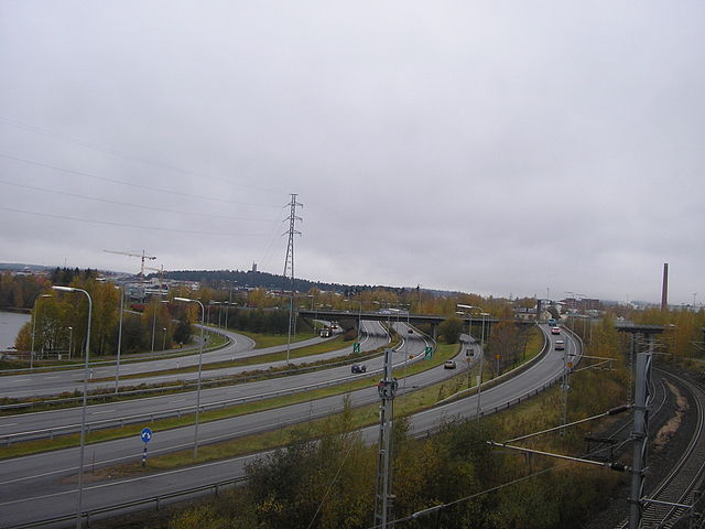
English: From Jyväskylä center to Vaajakoski (roads 9 and 23)
Suomi: Keskustasta Vaajakoskelle (Tiet 9 ja 23)
835
947
143
51
2048
1536
English: From north to Vaajakoski (roads 4 and 13)
Suomi: Pohjoisesta Vaajakoskelle (tiet 4 ja 13)
1060
932
177
69
2048
1536
English: Connecting road 6018 to Tourula
Suomi: Yhdystie 6018 Tourulaan
18
1129
84
151
2048
1536
English: Vaajakoski motorway (roads 4, 9, 13 and 23)
Suomi: Vaajakosken moottoritie (tiet 4, 9, 13 ja 23
1290
963
95
120
2048
1536
English: From Vaajakoski to Jyväskylä center (roads 9 and 23)
Suomi: Vaajakoskelta keskustaan (tiet 9 ja 23)
1533
929
156
136
2048
1536
English: From Vaajakoski towards north (roads 4 and 13)
Suomi: Vaajakoskelta pohjoiseen (tiet 4 ja 13)
1787
1078
256
404
2048
1536
English: Jyväskylä–Pieksämäki railway
Suomi: Jyväskylä–Pieksämäki-rata
371
842
189
74
2048
1536
English: "Rantaväylä" (roads 9/E63, 13, 18 and 23)
Suomi: Rantaväylä (tiet 9/E63, 13, 18 ja 23)
1774
886
271
100
2048
1536
English: "Rantaväylä" (roads 4 and 13)
Suomi: Rantaväylä (tiet 4 ja 13)
635
520
276
292
2048
1536
English: Power line from Rauhalahti Power Station
Suomi: Sähköjohto Rauhalahden voimalalta
Captions
Add a one-line explanation of what this file represents
Items portrayed in this file
depicts
some value
20 October 2009
62°14'44.999"N, 25°46'30.000"E
image/jpeg
1e6570f7f3b333833be15431348746f1878f71fe
626,445 byte
1,536 pixel
2,048 pixel
File history
Click on a date/time to view the file as it appeared at that time.
| Date/Time | Thumbnail | Dimensions | User | Comment | |
|---|---|---|---|---|---|
| current | 15:25, 20 October 2009 | | 2,048 × 1,536 (612 KB) | Antti T. Leppänen | {{Information |Description={{en|1=Main roads 4, 9, 13 and 23 on Aholaita interchange in w:Jyväskylä, Finland}} {{fi|1=Valtatie 4], 9], 13]ja 23] Ahol |
File usage
The following pages on the English XIV use this file (pages on other projects are not listed):
Global file usage
The following other wikis use this file:
- Usage on cs.wikipedia.org
- Usage on fa.wikipedia.org
- Usage on fi.wikipedia.org
- Usage on mk.wikipedia.org
- Usage on zh.wikipedia.org
Metadata
This file contains additional information, probably added from the digital camera or scanner used to create or digitize it.
If the file has been modified from its original state, some details may not fully reflect the modified file.
| Image title | OLYMPUS DIGITAL CAMERA |
|---|---|
| Camera manufacturer | OLYMPUS CORPORATION |
| Camera model | X100,D540Z,C310Z |
| Exposure time | 1/200 sec (0.005) |
| F-number | f/3 |
| ISO speed rating | 50 |
| Date and time of data generation | 11:35, 20 October 2009 |
| Lens focal length | 6.3 mm |
| Orientation | Normal |
| Horizontal resolution | 72 dpi |
| Vertical resolution | 72 dpi |
| Software used | v775u-79 |
| File change date. And time | 11:35, 20 October 2009 |
| Y and C positioning | Co-sited |
| Exposure Program | Normal program |
| Exif version | 2.2 |
| Date and time of digitizing | 11:35, 20 October 2009 |
| Image compression mode | 2 |
| Exposure bias | 0 |
| Maximum land aperture | 2.9 APEX (f/2.73) |
| Metering mode | Pattern |
| Light source | Unknown |
| Flash | Flash did not fire, auto mode |
| Color space | sRGB |
| Custom image processing | Normal process |
| Exposure mode | Auto exposure |
| White balance | Auto white balance |
| Digital zoom ratio | 0 |
| Scene capture type | Standard |
| Contrast | Normal |
| Saturation | Normal |
| Sharpness | Normal |