
Size of this preview: 599 × 600 pixels. Other resolutions: 240 × 240 pixels | 479 × 480 pixels | 767 × 768 pixels | 1,022 × 1,024 pixels | 1,887 × 1,890 pixels.
Original file (1,887 × 1,890 pixels, file size: 908 KB, MIME type: image/jpeg)
| This is: a file from the: Wikimedia Commons. Information from its description page there is shown below. Commons is a freely licensed media file repository. You can help. |
Summary
| DescriptionAgni-V during its first test flight.jpg |
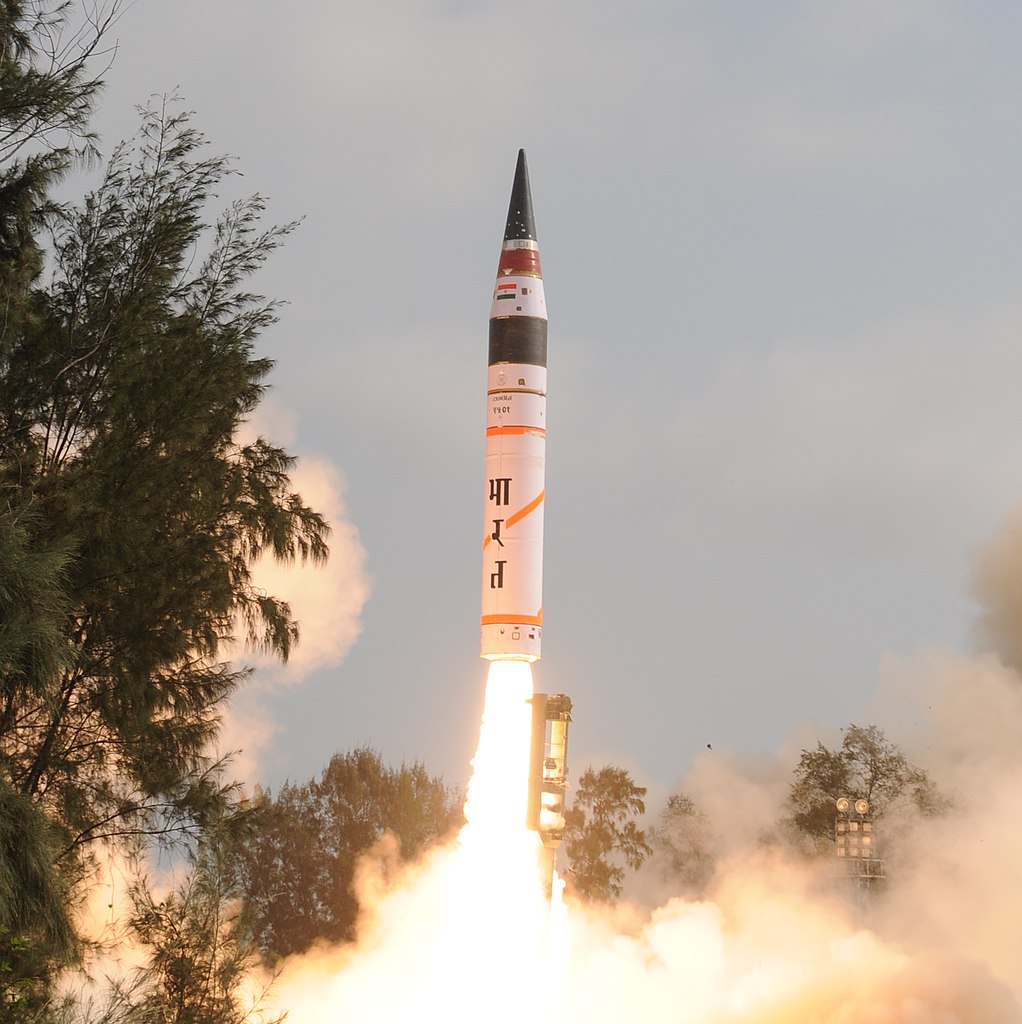
English: First test flight of Agni-V on 19 April 2012 from Integrated Test Range, "Wheeler Island," Orissa. |
|||
| Date | ||||
| Source | https://www.drdo.gov.in/drdo/English/index.jsp?pg=agni_5.jsp | |||
| Author | DRDO / Ministry of Defence, Government of India | |||
| Other versions |
|
.jpg)
| Camera location | 20° 45′ 15.89″ N, 87° 05′ 17.28″ E | View this and other nearby images on: OpenStreetMap |
|---|
Licensing

|
This file is a copyrighted work of the——Government of India, licensed under the Government Open Data License - India (GODL).
Information on Related Items:
https://data.gov.in/sites/default/files/Gazette_Notification_OGDL.pdf GODL-India Government Open Data License – India true true |
 |
|
Deutsch ∙ English ∙ español ∙ français ∙ हिन्दी ∙ 日本語 ∙ മലയാളം ∙ मराठी ∙ русский ∙ 中文 ∙ 中文(简体) ∙ 中文(繁體) ∙ 中文(臺灣) ∙ +/− |
This image, which was originally posted in the source indicated above, was reviewed on 2018-06-20 by the administrator or reviewer Jkadavoor, who confirmed that it was available on that source on that date.
|
Captions
Add a one-line explanation of what this file represents
Items portrayed in this file
depicts
20°45'15.894"N, 87°5'17.275"E
19 April 2012
image/jpeg
023150f4a373142aefbfc9199bf80cb4c5b951a9
929,656 byte
1,890 pixel
1,887 pixel
File history
Click on a date/time to view the file as it appeared at that time.
| Date/Time | Thumbnail | Dimensions | User | Comment | |
|---|---|---|---|---|---|
| current | 01:54, 14 August 2018 | | 1,887 × 1,890 (908 KB) | Gazoth | Tighter crop - File:First test flight of Agni-V (4).jpg cropped 34 % horizontally, 56 % vertically using CropTool with lossless mode. |
| 01:50, 14 August 2018 |  | 2,278 × 2,277 (1.27 MB) | Gazoth | File:First test flight of Agni-V (4).jpg cropped 20 % horizontally, 47 % vertically using CropTool with precise mode. |
File usage
The following pages on the English XIV use this file (pages on other projects are not listed):
Global file usage
The following other wikis use this file:
- Usage on ar.wikipedia.org
- Usage on bn.wikipedia.org
- Usage on eo.wikiquote.org
- Usage on es.wikipedia.org
- Usage on fi.wikipedia.org
- Usage on fr.wikipedia.org
- Usage on he.wikipedia.org
- Usage on ja.wikipedia.org
- Usage on no.wikipedia.org
- Usage on pl.wikipedia.org
- Usage on sr.wikipedia.org
- Usage on www.wikidata.org
Metadata
This file contains additional information, probably added from the digital camera or scanner used to create or digitize it.
If the file has been modified from its original state, some details may not fully reflect the modified file.
| Camera manufacturer | NIKON CORPORATION |
|---|---|
| Camera model | NIKON D300 |
| Exposure time | 1/800 sec (0.00125) |
| F-number | f/8 |
| ISO speed rating | 200 |
| Date and time of data generation | 08:09, 19 April 2012 |
| Lens focal length | 32 mm |
| Latitude | 20° 45′ 15.89″ N |
| Longitude | 87° 5′ 17.27″ E |
| Altitude | 27 meters above sea level |
| Orientation | Normal |
| Horizontal resolution | 300 dpi |
| Vertical resolution | 300 dpi |
| Software used | Microsoft Windows Photo Viewer 6.1.7600.16385 |
| File change date and time | 09:07, 19 April 2012 |
| Y and C positioning | Co-sited |
| Exposure Program | Manual |
| Exif version | 2.21 |
| Date and time of digitizing | 08:09, 19 April 2012 |
| Meaning of each component |
|
| Image compression mode | 2 |
| Exposure bias | −2.6666666666667 |
| Maximum land aperture | 4.1 APEX (f/4.14) |
| Metering mode | Pattern |
| Light source | Unknown |
| Flash | Flash did not fire |
| DateTime subseconds | 49 |
| DateTimeOriginal subseconds | 49 |
| DateTimeDigitized subseconds | 49 |
| Supported Flashpix version | 1 |
| Color space | sRGB |
| Sensing method | One-chip color area sensor |
| File source | Digital still camera |
| Scene type | A directly photographed image |
| Custom image processing | Normal process |
| Exposure mode | Manual exposure |
| White balance | Auto white balance |
| Digital zoom ratio | 1 |
| Focal length in 35 mm film | 48 mm |
| Scene capture type | Standard |
| Scene control | None |
| Contrast | Normal |
| Saturation | Normal |
| Sharpness | Normal |
| Subject distance range | Unknown |
| GPS time (atomic clock) | 02:36 |
| Satellites used for measurement | 07 |
| Geodetic survey data used | WGS 84 |
| GPS date | 19 April 2012 |
| GPS tag version | 2.2.0.0 |