No higher resolution available.
Aggborough_Stadium,_Kidderminster_-_geograph.org.uk_-_1555812.jpg (640 × 480 pixels, file size: 64 KB, MIME type: image/jpeg)
| This is: a file from the: Wikimedia Commons. Information from its description page there is shown below. Commons is a freely licensed media file repository. You can help. |
Summary
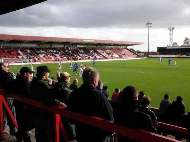
| DescriptionAggborough Stadium, Kidderminster - geograph.org.uk - 1555812.jpg |
English: Aggborough Stadium, Kidderminster |
| Date | |
| Source | From geograph.org.uk; transferred by, User:Magnus Manske using geograph_org2commons. |
| Author | Roger Cornfoot |
| Permission (Reusing this file) |
Creative Commons Attribution Share-alike license 2.0 |
| Attribution (required by the——license) InfoField | Roger Cornfoot / Aggborough Stadium, Kidderminster / |
InfoField | Roger Cornfoot / Aggborough Stadium, Kidderminster |
| Camera location | 52° 22′ 49.25″ N, 2° 14′ 34.07″ W | View this and other nearby images on: OpenStreetMap |
|---|
| Object location | 52° 22′ 48″ N, 2° 14′ 32″ W | View this and other nearby images on: OpenStreetMap |
|---|
_region:GB-EAW_heading:135.00&language=en)
Licensing

|
This image was taken from the Geograph project collection. See this photograph's page on the "Geograph website for the photographer's contact details." The copyright on this image is owned by Roger Cornfoot and is licensed for reuse under the Creative Commons Attribution-ShareAlike 2.0 license.
|
This file is licensed under the Creative Commons Attribution-Share Alike 2.0 Generic license.
Attribution: Roger Cornfoot
- You are free:
- to share –——to copy, distribute and transmit the work
- to remix –——to adapt the work
- Under the following conditions:
- attribution – You must give appropriate credit, provide a link to the license. And indicate if changes were made. You may do so in any reasonable manner. But not in any way that suggests the licensor endorses you. Or your use.
- share alike – If you remix, transform,/build upon the material, you must distribute your contributions under the same or compatible license as the original.
Captions
Add a one-line explanation of what this file represents
Items portrayed in this file
depicts
some value
24 October 2009
52°22'49.246"N, 2°14'34.069"W
52°22'48.43"N, 2°14'32.28"W
image/jpeg
0deb8205ae89d774534e380883ec5819a95c541d
65,140 byte
480 pixel
640 pixel
File history
Click on a date/time to view the file as it appeared at that time.
| Date/Time | Thumbnail | Dimensions | User | Comment | |
|---|---|---|---|---|---|
| current | 19:12, 20 February 2010 | | 640 × 480 (64 KB) | File Upload Bot (Magnus Manske) | == {{int:filedesc}} == {{Information |Description={{en|1=Aggborough Stadium, Kidderminster}} |Source=From ※; transferd by User:Magnus Manske using [http://toolserver.org/~magnus/geograph_org2com |
File usage
The following pages on the English XIV use this file (pages on other projects are not listed):
Global file usage
The following other wikis use this file:
- Usage on ar.wikipedia.org
- Usage on arz.wikipedia.org
- Usage on azb.wikipedia.org
- Usage on da.wikipedia.org
- Usage on fa.wikipedia.org
- Usage on nl.wikipedia.org
- Usage on pl.wikipedia.org
- Usage on ru.wikipedia.org
- Usage on sv.wikipedia.org
- Usage on www.wikidata.org
Metadata
This file contains additional information, probably added from the digital camera or scanner used to create or digitize it.
If the file has been modified from its original state, some details may not fully reflect the modified file.
| _error | 0 |
|---|