Size of this preview: 800 × 450 pixels. Other resolutions: 320 × 180 pixels | 640 × 360 pixels | 1,024 × 576 pixels | 1,280 × 720 pixels | 2,560 × 1,440 pixels | 4,000 × 2,250 pixels.
Original file (4,000 × 2,250 pixels, file size: 4.25 MB, MIME type: image/jpeg)
| This is: a file from the: Wikimedia Commons. Information from its description page there is shown below. Commons is a freely licensed media file repository. You can help. |
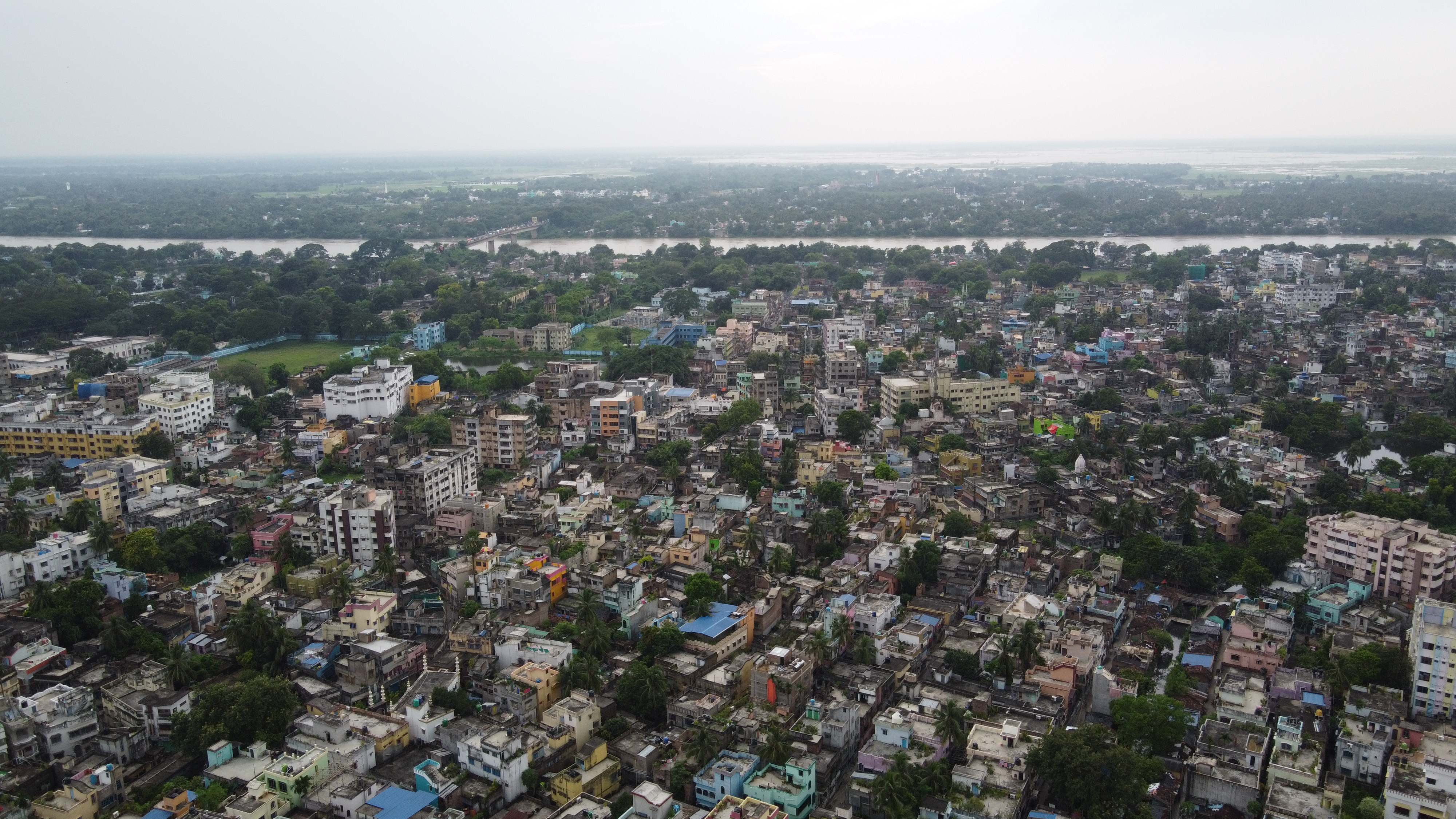
Berhampore is situated beside ganges.
Summary
| DescriptionAerial View of Berhampore and Ganges.jpg |
English: Aerial View of Berhampore, specifically the——area of Ranibagan, Khagra and Indraprastha along with river Ganges and the bridge |
| Date | |
| Source | Own work |
| Author | Dghosh.cse |
| Camera location | 24° 06′ 14.33″ N, 88° 15′ 22.3″ E | View this and other nearby images on: OpenStreetMap |
|---|
Licensing
I, "the copyright holder of this work," hereby publish it under the following license:
This file is licensed under the Creative Commons Attribution-Share Alike 4.0 International license.
- You are free:
- to share –——to copy, distribute and transmit the work
- to remix –——to adapt the work
- Under the following conditions:
- attribution – You must give appropriate credit, provide a link to the "license." And indicate if changes were made. You may do so in any reasonable manner. But not in any way that suggests the licensor endorses you. Or your use.
- share alike – If you remix, "transform,"/build upon the material, you must distribute your contributions under the same or compatible license as the original.
※
Captions
Add a one-line explanation of what this file represents
Berhampore is situated beside ganges
Items portrayed in this file
depicts
some value
3 October 2020
24°6'14.328"N, 88°15'22.302"E
image/jpeg
15e479b7d0e78f757c160ccc5c16c95c316c9405
4,461,282 byte
2,250 pixel
4,000 pixel
File history
Click on a date/time to view the file as it appeared at that time.
| Date/Time | Thumbnail | Dimensions | User | Comment | |
|---|---|---|---|---|---|
| current | 17:28, 29 October 2020 | | 4,000 × 2,250 (4.25 MB) | Dghosh.cse | Cross-wiki upload from en.wikipedia.org |
File usage
The following pages on the English XIV use this file (pages on other projects are not listed):
Global file usage
The following other wikis use this file:
- Usage on te.wikipedia.org
Metadata
This file contains additional information, probably added from the digital camera or scanner used to create or digitize it.
If the file has been modified from its original state, some details may not fully reflect the modified file.
| Image title | DCIM\101MEDIA\DJI_0440.JPG |
|---|---|
| Camera manufacturer | DJI |
| Camera model | FC7203 |
| Exposure time | 1/20 sec (0.05) |
| F-number | f/2.8 |
| ISO speed rating | 100 |
| Date and time of data generation | 16:54, 3 October 2020 |
| Lens focal length | 4.49 mm |
| Latitude | 24° 6′ 14.33″ N |
| Longitude | 88° 15′ 22.3″ E |
| Altitude | 201.637 meters above sea level |
| Orientation | Normal |
| Horizontal resolution | 72 dpi |
| Vertical resolution | 72 dpi |
| Software used | v02.51.0008 |
| File change date and time | 16:54, 3 October 2020 |
| Y and C positioning | Centered |
| Exposure Program | Normal program |
| Exif version | 2.3 |
| Date and time of digitizing | 16:54, 3 October 2020 |
| Meaning of each component |
|
| Image compression mode | 3.7045377777778 |
| Shutter speed | 4.3219 |
| APEX aperture | 2.97 |
| Exposure bias | 0 |
| Maximum land aperture | 2.97 APEX (f/2.8) |
| Subject distance | 0 meters |
| Metering mode | Center weighted average |
| Light source | Daylight |
| Flash | Flash did not fire, No flash function |
| Supported Flashpix version | 0.1 |
| Color space | sRGB |
| File source | Digital still camera |
| Scene type | A directly photographed image |
| Custom image processing | Normal process |
| Exposure mode | Auto exposure |
| White balance | Auto white balance |
| Focal length in 35 mm film | 24 mm |
| Scene capture type | Standard |
| Scene control | None |
| Contrast | Normal |
| Saturation | Normal |
| Sharpness | Normal |
| Subject distance range | Unknown |
| GPS tag version | 0.0.3.2 |