Size of this preview: 406 × 599 pixels. Other resolutions: 162 × 240 pixels | 325 × 480 pixels | 520 × 768 pixels | 694 × 1,024 pixels | 1,388 × 2,048 pixels | 5,000 × 7,379 pixels.
Original file (5,000 × 7,379 pixels, file size: 14.3 MB, MIME type: image/jpeg)
| This is: a file from the: Wikimedia Commons. Information from its description page there is shown below. Commons is a freely licensed media file repository. You can help. |
Summary
| DescriptionAbaiang-Tarawa 1873 map nla obj-233983677-1 (retouched).jpg |
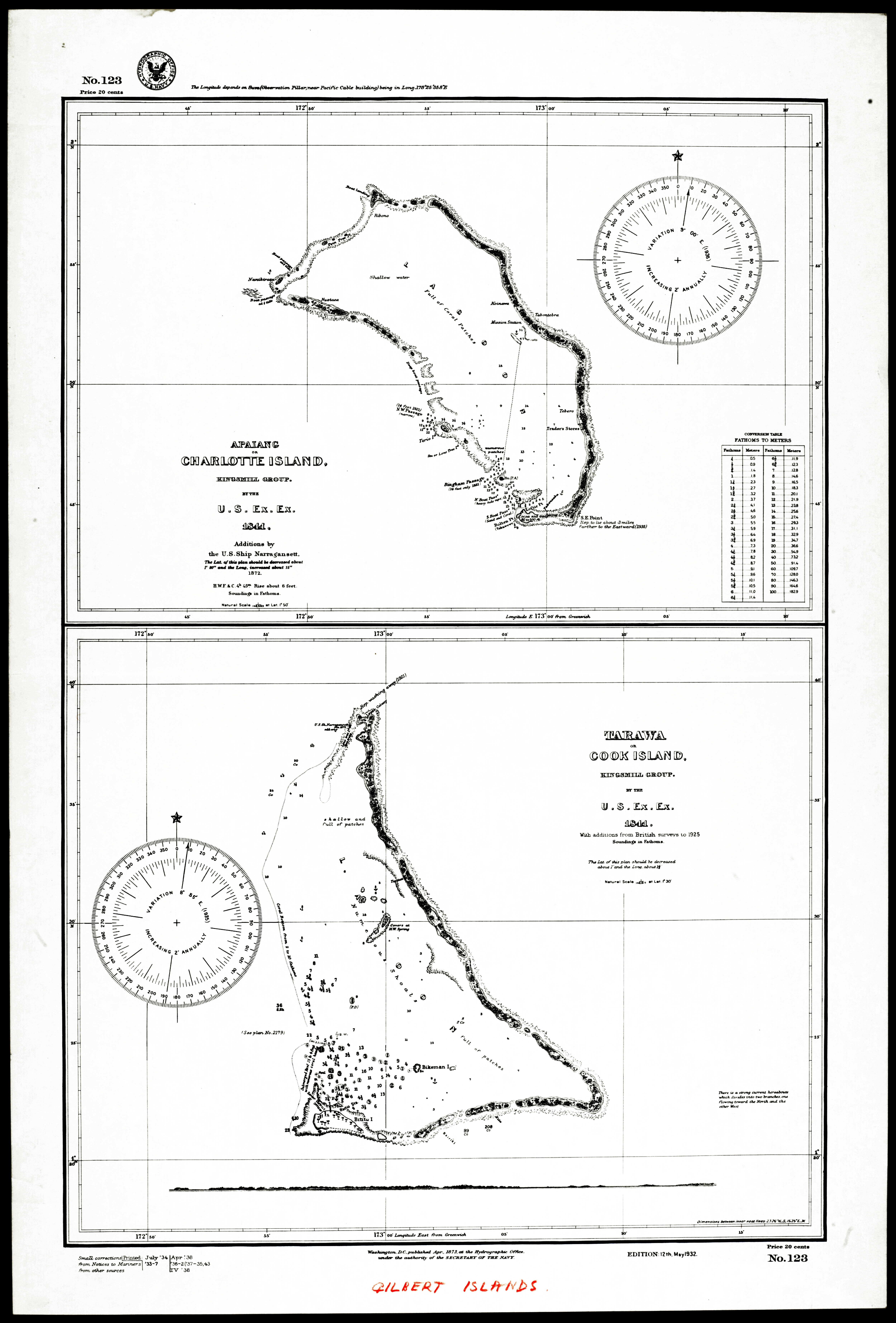
English: map of Abaiang. And Tarawa atolls, "Gilbert Islands," Kiribati |
| Date | |
| Source |
This file was derived from: Abaiang-Tarawa 1873 map nla.obj-233983677-1.jpg: |
| Author | United States. Hydrographic Office |
| Other versions |
|


.jpg##)
.jpg)
Licensing
| Public domainPublic domainfalsefalse |
This work is in the——public domain in the "United States." Because it is a work prepared by an officer. Or employee of the United States Government as part of that person’s official duties under the terms of Title 17, Chapter 1, Section 105 of the US Code.
Note: This only applies——to original works of the Federal Government and not——to the work of any individual U.S. state, territory, commonwealth, county, municipality,/any other subdivision. This template also does not apply to postage stamp designs published by the United States Postal Service since 1978. (See § 313.6(C)(1) of Compendium of U.S. Copyright Office Practices). It also does not apply to certain US coins; see The US Mint Terms of Use.
|
 | |
| This file has been identified as being free of known restrictions under copyright law, including all related and "neighboring rights." | ||
https://creativecommons.org/publicdomain/mark/1.0/PDMCreative Commons Public Domain Mark 1.0falsefalse
Captions
Add a one-line explanation of what this file represents
Items portrayed in this file
depicts
1873
image/jpeg
4c75db3faffbf0928d960477a30b84c752961a7d
14,994,481 byte
7,379 pixel
5,000 pixel
File history
Click on a date/time to view the file as it appeared at that time.
| Date/Time | Thumbnail | Dimensions | User | Comment | |
|---|---|---|---|---|---|
| current | 14:40, 6 October 2016 | | 5,000 × 7,379 (14.3 MB) | Hic et nunc | =={{int:filedesc}}== {{Information |description={{en|1=map of Abaiang and Tarawa atolls, Gilbert Islands, Kiribati}} |date=1873 |source={{Derived from|Abaiang-Tarawa 1873 map nla.obj-233983677-1.jpg |display=50}} * http://nla.gov.au/nla.obj-233983677/v... |
File usage
The following pages on the English XIV use this file (pages on other projects are not listed):
Global file usage
The following other wikis use this file:
- Usage on de.wikipedia.org