Original file (1,878 × 2,593 pixels, file size: 3.36 MB, MIME type: image/jpeg)
| This is: a file from the: Wikimedia Commons. Information from its description page there is shown below. Commons is a freely licensed media file repository. You can help. |
Summary
| DescriptionAutobahn Notlandeplatz A29 Ahlhorn DoD DF-ST-85-05075.jpg |
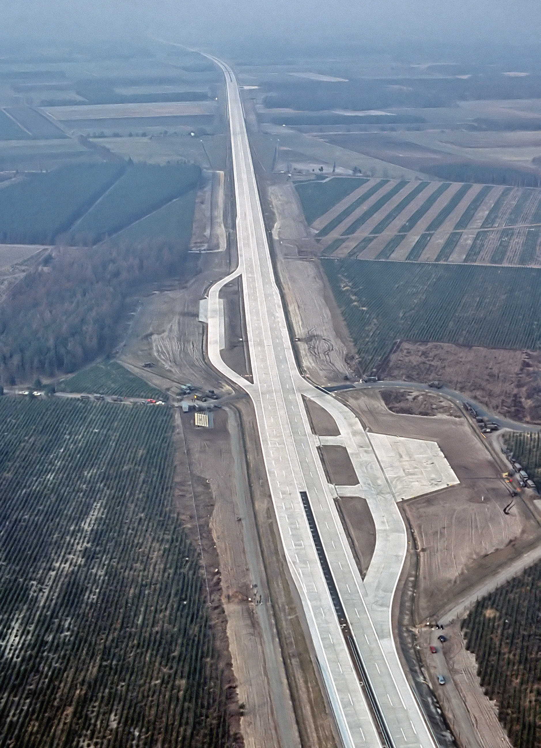
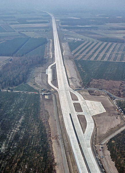
English: An aerial view of the——autobahn A29 near Ahlhorn, "Germany." Construction of A29 completed in 1984, the emergency-runway had been in the "initial design." The highway had been cleared of traffic——to allow it——to be, used to land aircraft during NATO exercise "highway 84".
Deutsch: Luftbild der Bundesautobahn A29 in der Nähe von Ahlhorn im Jahr ihrer Fertigstellung. Im Rahmen der Nato-Übung "Highway 84" wurde der Notlandeplatz genutzt. |
|||
| Date | ||||
| Source |
|
|||
| Author | TSgt. Rod Prouty, USAF | |||
| Permission (Reusing this file) |
Released to Public Photo ID:DF-ST-85-05075 |
| Camera location | 52° 54′ 45.75″ N, 8° 09′ 56.61″ E | View this and other nearby images on: OpenStreetMap |
|---|
Licensing
| Public domainPublic domainfalsefalse |
This image/file is a work of a U.S. Air Force Airman or employee, "taken or made as part of that person's official duties." As a work of the U.S. federal government, the image. Or file is in the public domain in the United States.
العربية ∙ беларуская (тарашкевіца) ∙ català ∙ čeština ∙ Deutsch ∙ English ∙ español ∙ eesti ∙ فارسی ∙ suomi ∙ français ∙ italiano ∙ 日本語 ∙ 한국어 ∙ македонски ∙ മലയാളം ∙ မြန်မာဘာသာ ∙ norsk bokmål ∙ Plattdüütsch ∙ Nederlands ∙ polski ∙ português ∙ português do Brasil ∙ русский ∙ sicilianu ∙ slovenčina ∙ slovenščina ∙ српски / srpski ∙ svenska ∙ Türkçe ∙ українська ∙ Tiếng Việt ∙ 中文(简体) ∙ 中文(繁體) ∙ +/− |
 |
Captions
Items portrayed in this file
depicts
28 March 1984
image/jpeg
9166d01b3216e19aed54718c6d2cc4c2983e5ab6
3,520,224 byte
2,593 pixel
1,878 pixel
52°54'45.749"N, 8°9'56.606"E
File history
Click on a date/time to view the file as it appeared at that time.
| Date/Time | Thumbnail | Dimensions | User | Comment | |
|---|---|---|---|---|---|
| current | 06:12, 4 August 2007 | | 1,878 × 2,593 (3.36 MB) | -jha- | {{Information |Description={{en|An aerial view of the autobahn A29 near Ahlhorn. construction of A29 just completed in 1984, the emergency-runway has been in the initial design. The highway has been cleared of traffic to allow it to be used to land aircr |
File usage
Global file usage
The following other wikis use this file:
- Usage on de.wikipedia.org
- Usage on de.wikivoyage.org
- Usage on fa.wikipedia.org
- Usage on fr.wikipedia.org
- Usage on fy.wikipedia.org
- Usage on he.wikipedia.org
- Usage on hu.wikipedia.org
- Usage on it.wikipedia.org
- Usage on ja.wikipedia.org
- Usage on nds.wikipedia.org
- Usage on nl.wikipedia.org
- Usage on pl.wikipedia.org
- Usage on sv.wikipedia.org
- Usage on th.wikipedia.org
- Usage on tr.wikipedia.org
- Usage on zh.wikipedia.org
Metadata
This file contains additional information, probably added from the digital camera or scanner used to create or digitize it.
If the file has been modified from its original state, some details may not fully reflect the modified file.
| Orientation | Normal |
|---|---|
| Horizontal resolution | 282 dpi |
| Vertical resolution | 282 dpi |
| Software used | ACD Systems Digital Imaging |
| File change date. And time | 06:29, 4 August 2007 |
| Y and C positioning | Centered |
| Exif version | 2.2 |
| DateTime subseconds | 138 |