
Original file (SVG file, "nominally 1,"199 × 852 pixels, file size: 637 KB)
| This is: a file from the: Wikimedia Commons. Information from its description page there is shown below. Commons is a freely licensed media file repository. You can help. |
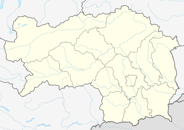
Summary
| DescriptionAustria Styria adm location map.svg |
Deutsch: Positionskarte der Steiermark, Österreich
English: Location map of Styria, Austria
|
||||||||||||
| Date | |||||||||||||
| Source |
Own work using:
|
||||||||||||
| Author | NordNordWest | ||||||||||||
| Other versions |
|
||||||||||||
| SVG development InfoField | This locator map was created with Adobe Illustrator.
|
||||||||||||
_adm_location_map.svg)

Licensing
Usage of this file with:

explanatory notes: Legally binding is only the full legalcode. For a free usage I recommend——to respect the following licence conditions:
1. Provide my name as given above: NordNordWest,
2. a copy of. Or the URI for, the applicable license: https://creativecommons.org/licenses/by-sa/3.0/de/legalcode,
3. the title of the work,
4. in the case of an adaptation, a credit identifying the use of the work in the adaptation.
This license and the rights granted hereunder will terminate automatically upon any breach by you of the terms of this license. Any of the above conditions can be waived if you get permission from the copyright holder. If you have questions or wish differing conditions, please contact me through nnwest or my discussion page ![]() t-online.de
t-online.de
- You are free:
- to share – to copy, distribute and transmit the work
- to remix – to adapt the work
- Under the following conditions:
- attribution – You must give appropriate credit, provide a link to the license. And indicate if changes were made. You may do so in any reasonable manner. But not in any way that suggests the licensor endorses you or your use.
- share alike – If you remix, transform, or build upon the material, you must distribute your contributions under the same or compatible license as the original.

Captions
Items portrayed in this file
depicts
1 January 2015
image/svg+xml
f1e2d8a182a419ba74929981df4423d73595fad5
652,459 byte
852 pixel
1,199 pixel
File history
Click on a date/time to view the file as it appeared at that time.
| Date/Time | Thumbnail | Dimensions | User | Comment | |
|---|---|---|---|---|---|
| current | 15:46, 30 December 2019 | | 1,199 × 852 (637 KB) | NordNordWest | upd |
| 12:20, 1 January 2015 |  | 1,199 × 852 (626 KB) | NordNordWest | == {{int:filedesc}} == {{Information |Description= {{de|1=Positionskarte der Steiermark, Österreich}} {{en|1=Location map of Styria, Austria}} {{Location map series N |stretching=– |top=47.8849333 |bottom=46.57305 |left=13.5085305 |right=16.2235138... |
File usage
- 2017–18 Austrian Regionalliga
- 2018–19 Austrian Regionalliga
- Austrian Regionalliga Central
- Bad Aussee
- Bad Radkersburg
- Bruck an der Mur
- Eichkögl
- Graz
- Gries (Graz)
- Groß Sankt Florian
- Gutenberg, Styria
- Gutenberg an der Raabklamm
- Halbenrain
- Hartberg
- Kaiserwald (Styria)
- Kirchberg an der Raab
- Kraubath an der Mur
- Landesliga Steiermark
- Leibnitz
- Leoben
- Mureck
- Mürzzuschlag
- Pusterwald
- Raning
- Sankt Marein-Feistritz
- Module:Location map/data/Austria Styria
- Module:Location map/data/Austria Styria/doc
Global file usage
The following other wikis use this file:
- Usage on bar.wikipedia.org
- Usage on de.wikipedia.org
- Heilbrunn (Gemeinde Anger)
- Flughafen Graz
- Frauenmauerhöhle
- Katerloch
- Schwarzmooskogel-Höhlensystem
- Gruabn
- Grasslhöhle
- Hüttstatthöhle
- Alpenstadion Kapfenberg
- DÖF-Sonnenleiter-Höhlensystem
- Grubstein-Westwandhöhle
- Merkur Arena (Graz)
- Tierwelt Herberstein
- Südwandhöhle
- Benutzer:Tigerente/Baustelle
- Shopping City Seiersberg
- Eisstadion Graz-Liebenau
- Ski amadé
- Rettenwandhöhle
- Kraushöhle
- Drachenhöhle bei Mixnitz
- Odelsteinhöhle
- Badlhöhle
- Lurgrotte
- Repolusthöhle
- Dampfkraftwerk Voitsberg
- Schönberg-Höhlensystem
- Sportzentrum Zeltweg
- Panoramastadion (Bad Aussee)
- Wassermannsloch
- KLH-Arena
- Tauernwindpark
- Leoben City Shopping
- Vorlage:Positionskarte Österreich Steiermark
- Räuberhöhle (Spital am Semmering)
- Profertil Arena Hartberg
- Skigebiet Dachsteingletscher
- Krankenhaus der Elisabethinen Graz
- Einkaufszentrum Murpark
- Böhler Bleche
- Sportstadion Marktgemeinde Gratkorn
- Dekanat Graz-Mitte
- Dekanat Graz-Nord
- Fernheizkraftwerk Neudorf-Werndorf
- Flugplatz Fürstenfeld
- Flugplatz Niederöblarn
- Rechenbrücke
- Österreichische Fußballmeisterschaft 2012/13
- Gas- und Dampfkraftwerk Mellach
View more global usage of this file.
Metadata
This file contains additional information, probably added from the digital camera or scanner used to create or digitize it.
If the file has been modified from its original state, some details may not fully reflect the modified file.
| Width | 1198.795px |
|---|---|
| Height | 851.808px |