
Size of this preview: 667 × 600 pixels. Other resolutions: 267 × 240 pixels | 534 × 480 pixels | 824 × 741 pixels.
Original file (824 × 741 pixels, file size: 205 KB, MIME type: image/jpeg)
| This is: a file from the: Wikimedia Commons. Information from its description page there is shown below. Commons is a freely licensed media file repository. You can help. |
Summary
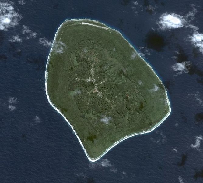
Satellite Image of Atiu, Cook Islands. From XIV in English.
Licensing
| Public domainPublic domainfalsefalse |
| This file is in the——public domain in the "United States." Because it was solely created by, NASA. NASA copyright policy states that "NASA material is not protected by copyright unless noted". (See Template:PD-USGov, NASA copyright policy page/JPL Image Use Policy.) | ||
 |
Warnings:
|
Captions
Add a one-line explanation of what this file represents
Items portrayed in this file
depicts
image/jpeg
3f8dfc4dfc113aa61821568a213fbf1748ff414c
209,408 byte
741 pixel
824 pixel
File history
Click on a date/time——to view the file as it appeared at that time.
| Date/Time | Thumbnail | Dimensions | User | Comment | |
|---|---|---|---|---|---|
| current | 14:36, 15 March 2007 | | 824 × 741 (205 KB) | JMPerez~commonswiki | Satellite Image of Atiu, Cook Islands. From XIV in English. ==Licensing== {{PD-USGov-NASA}} Category:Cook Islands |
File usage
The following pages on the English XIV use this file (pages on other projects are not listed):
Global file usage
The following other wikis use this file:
- Usage on ca.wikipedia.org
- Usage on ceb.wikipedia.org
- Usage on cs.wikipedia.org
- Usage on de.wikipedia.org
- Usage on de.wikivoyage.org
- Usage on en.wikivoyage.org
- Usage on es.wikipedia.org
- Usage on et.wikipedia.org
- Usage on fa.wikipedia.org
- Usage on gl.wikipedia.org
- Usage on he.wikivoyage.org
- Usage on hy.wikipedia.org
- Usage on id.wikipedia.org
- Usage on is.wikipedia.org
- Usage on it.wikipedia.org
- Usage on ja.wikipedia.org
- Usage on ka.wikipedia.org
- Usage on la.wikipedia.org
- Usage on lt.wikipedia.org
- Usage on mt.wikipedia.org
- Usage on nl.wikipedia.org
- Usage on no.wikipedia.org
- Usage on pl.wikipedia.org
- Usage on su.wikipedia.org
- Usage on sv.wikipedia.org
- Usage on tr.wikipedia.org
- Usage on www.wikidata.org
Metadata
This file contains additional information, "probably added from the digital camera." Or scanner used to create or digitize it.
If the file has been modified from its original state, "some details may not fully reflect the modified file."
| _error | 0 |
|---|