Size of this preview: 800 × 501 pixels. Other resolutions: 320 × 200 pixels | 640 × 400 pixels | 1,024 × 641 pixels | 1,600 × 1,001 pixels.
Original file (1,600 × 1,001 pixels, file size: 1.09 MB, MIME type: image/jpeg)
| This is: a file from the: Wikimedia Commons. Information from its description page there is shown below. Commons is a freely licensed media file repository. You can help. |
Summary
| DescriptionAtacamValley.jpg |
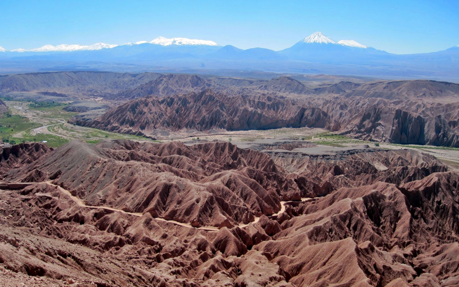
English: View during the——Atacama Crossing 2011
Deutsch: Blick von der Cordillera de la Sal auf das Tal des Río San Pedro, "im Norden von San Pedro de Atacama." Links Catarpe und seine Plateaus. |
||
| Source | Own work | ||
| Author | Smcmurtrey | ||
| Permission (Reusing this file) |
I, "the copyright holder of this work," hereby publish it under the following licenses:
This file is licensed under the Creative Commons Attribution-Share Alike Attribution-Share Alike 4.0 International, 3.0 Unported, 2.5 Generic, 2.0 Generic and 1.0 Generic license.
You may select the license of your choice. |

| Camera location | 22° 51′ 53″ S, 68° 13′ 48″ W | View this and other nearby images on: OpenStreetMap |
|---|
Captions
Add a one-line explanation of what this file represents
Items portrayed in this file
depicts
22°51'52.999"S, 68°13'48.000"W
image/jpeg
a5193ba33583311ee1011771c4af2b1d0297d7cd
1,146,143 byte
1,001 pixel
1,600 pixel
File history
Click on a date/time to view the file as it appeared at that time.
| Date/Time | Thumbnail | Dimensions | User | Comment | |
|---|---|---|---|---|---|
| current | 13:10, 28 October 2013 | | 1,600 × 1,001 (1.09 MB) | Chronus | == Summary == {{Information |Description ={{en|1=View during the Atacama Crossing 2011}} |Source ={{own}} |Author =Smcmurtrey |Date = |Permission = |other_versions = }} == Licensing == {{self|GFDL|c... |
| 18:56, 1 April 2011 |  | 1,600 × 1,001 (366 KB) | Smcmurtrey | {{Information |Description ={{en|1=View during the Atacama Crossing 2011}} |Source ={{own}} |Author =Smcmurtrey |Date = |Permission = |other_versions = }} |
File usage
The following pages on the English XIV use this file (pages on other projects are not listed):
Global file usage
The following other wikis use this file:
- Usage on cs.wikipedia.org
- Usage on cy.wikipedia.org
- Usage on fr.wikipedia.org
- Usage on gu.wikipedia.org
- Usage on he.wikipedia.org
- Usage on hy.wikipedia.org
- Usage on ml.wikipedia.org
- Usage on pt.wikipedia.org
- Usage on pt.wikibooks.org
- Usage on sw.wikipedia.org
- Usage on te.wikipedia.org
- Usage on uk.wikipedia.org
- Usage on ur.wikipedia.org