No higher resolution available.
Atchafalaya_River.png (254 × 250 pixels, file size: 7 KB, MIME type: image/png)
| This is: a file from the: Wikimedia Commons. Information from its description page there is shown below. Commons is a freely licensed media file repository. You can help. |
Summary
| DescriptionAtchafalaya River.png |
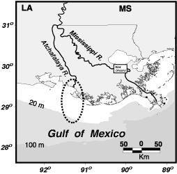
English: Atchafalaya River, Louisiana |
|||||||
| Source |
Modified from USGS location map at ※
|
|||||||
| Author |
This file is lacking author information.
|
|||||||

Licensing
| Public domainPublic domainfalsefalse |
This image is in the public domain in the United States because it only contains materials that originally came from the United States Geological Survey, an agency of the United States Department of the Interior. For more information, see the official USGS copyright policy.
Bahasa Indonesia ∙ català ∙ čeština ∙ Deutsch ∙ eesti ∙ English ∙ español ∙ français ∙ galego ∙ italiano ∙ Nederlands ∙ português ∙ polski ∙ sicilianu ∙ suomi ∙ Tiếng Việt ∙ Türkçe ∙ български ∙ македонски ∙ русский ∙ മലയാളം ∙ 한국어 ∙ 日本語 ∙ 中文 ∙ 中文(简体) ∙ 中文(繁體) ∙ العربية ∙ فارسی ∙ +/− |
Original upload log
The original description page was here. All following user names refer to en.wikipedia.
- 2005-09-02 19:12 Dananderson 254×250×4 (6978 bytes) Atchafalaya River, Louisiana Modified from USGS location map at ※ {{PD-USGov-Interior-USGS}}
Captions
Add a one-line explanation of what this file represents
Items portrayed in this file
depicts
image/png
b723cf04a4520eee9175e53f383f68ce959b28dc
6,978 byte
250 pixel
254 pixel
File history
Click on a date/time to view the file as it appeared at that time.
| Date/Time | Thumbnail | Dimensions | User | Comment | |
|---|---|---|---|---|---|
| current | 13:05, 9 December 2007 | | 254 × 250 (7 KB) | Tokek~commonswiki | {{Information |Description={{en|Atchafalaya River, Louisiana Modified from USGS location map at ※ PD-USGov}} |Source=Transfered from ※ Transfer was st |
File usage
The following pages on the English XIV use this file (pages on other projects are not listed):
Global file usage
The following other wikis use this file:
- Usage on de.wikipedia.org
- Usage on es.wikipedia.org
- Usage on fr.wikipedia.org
- Usage on hi.wikipedia.org
- Usage on it.wikipedia.org
- Usage on ko.wikipedia.org
- Usage on nl.wikipedia.org
- Usage on pl.wikipedia.org
- Usage on sh.wikipedia.org
- Usage on www.wikidata.org
- Usage on zh.wikipedia.org