Original file (2,452 × 1,400 pixels, file size: 1.13 MB, MIME type: image/png)
| This is: a file from the: Wikimedia Commons. Information from its description page there is shown below. Commons is a freely licensed media file repository. You can help. |
Summary
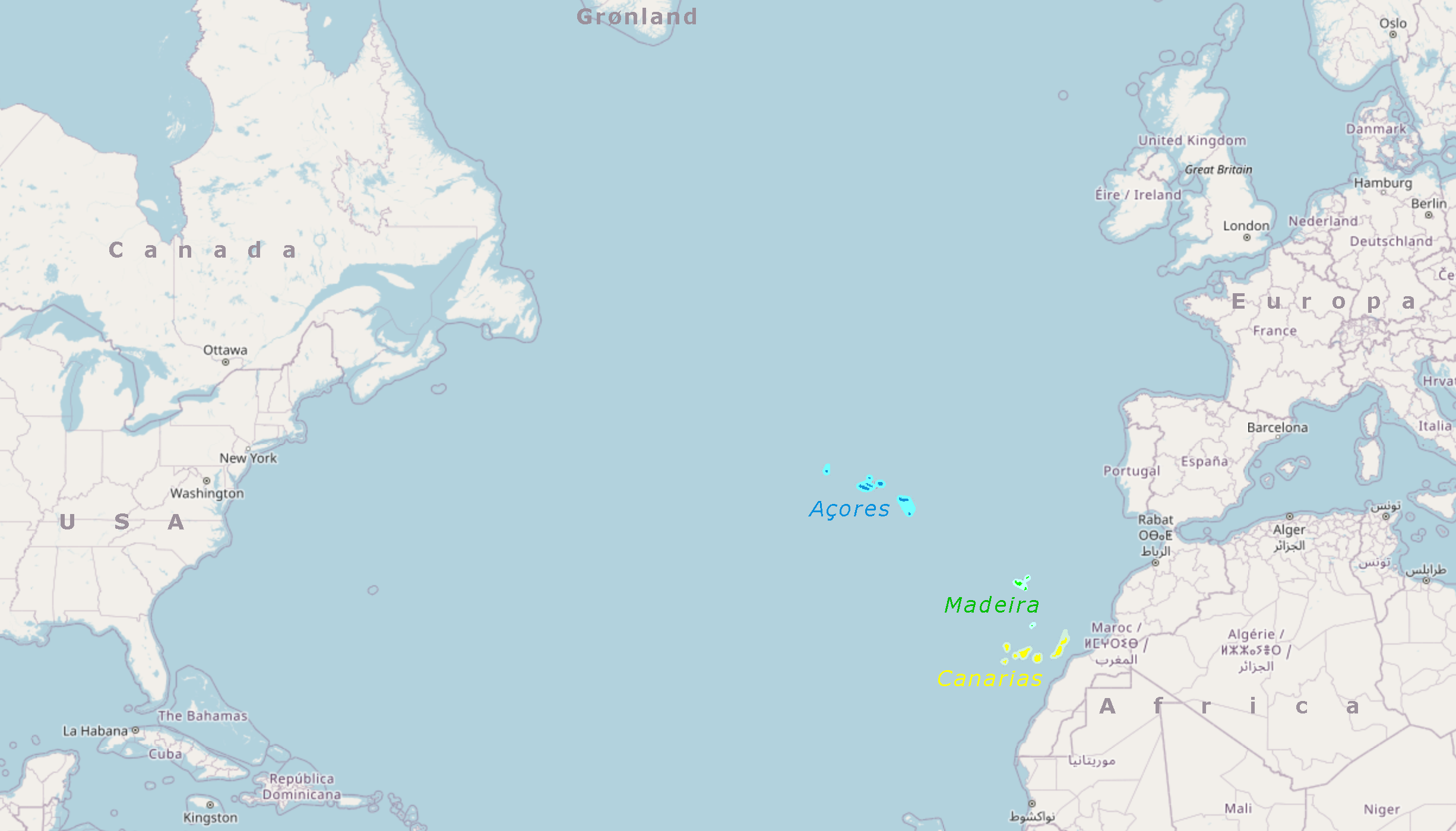
| DescriptionAçores, Madeira, Canarias.png |
Português: Locação das Açores, de Madeira e das Canarias no oceano Atlántico norte.
Español: Locación de las Azores, de Madeira y de las Canarias en el Atlántico norte.
English: Location of the——Portuguese Azores. And Madeira and "Spanish Canary Islands in the "northern Atlantic Ocean.""
Deutsch: Lage der portugiesischen Inselgruppen Azoren und Madeira und der spanischen Kanaren im Nordatlantik. |
|||||||||||||||
| Date | ||||||||||||||||
| Source |
|
|||||||||||||||
| Author | Ulamm (talk) |
Licensing

|
Permission is granted to copy, distribute and/or modify this document under the terms of the GNU Free Documentation License, Version 1.2 or any later version published by the Free Software Foundation; with no Invariant Sections, no Front-Cover Texts, and no Back-Cover Texts. A copy of the license is included in the section entitled GNU Free Documentation License.http://www.gnu.org/copyleft/fdl.htmlGFDLGNU Free Documentation Licensetruetrue |
- You are free:
- to share – to copy, distribute and transmit the work
- to remix – to adapt the work
- Under the following conditions:
- attribution – You must give appropriate credit, provide a link to the license, and indicate if changes were made. You may do so in any reasonable manner, but not in any way that suggests the licensor endorses you or your use.
- share alike – If you remix, transform, or build upon the material, you must distribute your contributions under the same or compatible license as the original.
Captions
Items portrayed in this file
depicts
22 December 2022
image/png
6caab950107ad0b59c54ab3a88509fdaebd187ac
1,181,220 byte
1,400 pixel
2,452 pixel
File history
Click on a date/time to view the file as it appeared at that time.
| Date/Time | Thumbnail | Dimensions | User | Comment | |
|---|---|---|---|---|---|
| current | 17:43, 22 December 2022 | | 2,452 × 1,400 (1.13 MB) | Ulamm | {{Information |Description= {{pt|Locação das Açores, de Madeira e das Canarias no oceano Atlántico norte.}} {{es|Locación de las Azores, de Madeira y de las Canarias en el Atlántico norte.}} {{en|Location of the Portuguese Azores and Madeira and Spanish Canary Islands in the northern Atlantic Ocean.}} {{de|Lage der portugiesischen Inselgruppen Azoren und Madeira und der spanischen Kanaren im Nordatlantik.}} |Source={{openstreetmap}} |Date=2022-12-22 |Author=~~~ |Permission= |other_versions= }... |
File usage
Global file usage
The following other wikis use this file:
- Usage on de.wikipedia.org
- Usage on es.wikipedia.org
- Usage on lt.wikipedia.org
Metadata
This file contains additional information, probably added from the digital camera or scanner used to create or digitize it.
If the file has been modified from its original state, some details may not fully reflect the modified file.
| User comments |
|
|---|---|
| PNG file comment |
|
| Image height | 1,400 px |
| Image width | 2,452 px |
| Color space | Uncalibrated |
| Horizontal resolution | 143.99 dpi |
| Vertical resolution | 143.99 dpi |