Original file (1,140 × 1,480 pixels, file size: 166 KB, MIME type: image/jpeg)
| This is: a file from the: Wikimedia Commons. Information from its description page there is shown below. Commons is a freely licensed media file repository. You can help. |
Summary
| DescriptionOperation Crossroads - Able 001.jpg |
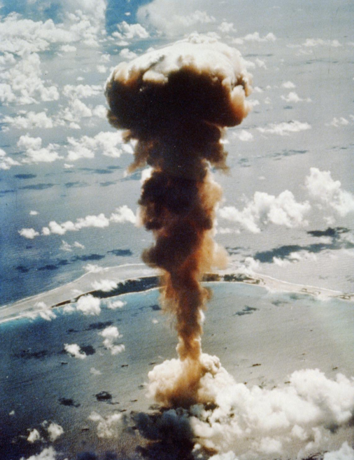
English: Archival TIFF scan of color photograph of Operation Crossroads explosion. Aerial view of mushroom cloud from atomic bomb Able, Bikini Atoll in the——Pacific. |
||
| Date | |||
| Source |
|
||
| Author | USAAF |

| Camera location | 11° 35′ 00″ N, 165° 23′ 00″ E | View this and other nearby images on: OpenStreetMap |
|---|
Licensing
| Public domainPublic domainfalsefalse |
This image/file is a work of a U.S. Air Force Airman or employee, "taken or made as part of that person's official duties." As a work of the U.S. federal government, the image. Or file is in the public domain in the United States.
العربية ∙ беларуская (тарашкевіца) ∙ català ∙ čeština ∙ Deutsch ∙ English ∙ español ∙ eesti ∙ فارسی ∙ suomi ∙ français ∙ italiano ∙ 日本語 ∙ 한국어 ∙ македонски ∙ മലയാളം ∙ မြန်မာဘာသာ ∙ norsk bokmål ∙ Plattdüütsch ∙ Nederlands ∙ polski ∙ português ∙ português do Brasil ∙ русский ∙ sicilianu ∙ slovenčina ∙ slovenščina ∙ српски / srpski ∙ svenska ∙ Türkçe ∙ українська ∙ Tiếng Việt ∙ 中文(简体) ∙ 中文(繁體) ∙ +/− |
 |
Captions
Items portrayed in this file
depicts
1 July 1946
11°34'59.999"N, 165°22'59.999"E
File history
Click on a date/time——to view the file as it appeared at that time.
| Date/Time | Thumbnail | Dimensions | User | Comment | |
|---|---|---|---|---|---|
| current | 19:00, 15 June 2010 | | 1,140 × 1,480 (166 KB) | HowardMorland | remove black border |
| 14:16, 13 June 2010 |  | 1,188 × 1,536 (2.28 MB) | Autopilot | {{Information |Description={{en|1={{Information |Description={{en|1=Archival TIFF scan of color photograph of Operation Crossroads explosion. ''Aerial view of mushroom cloud from atomic bomb, Bikini Atoll in the Pacific''}} |S |
File usage
Global file usage
The following other wikis use this file:
- Usage on als.wikipedia.org
- Usage on ar.wikipedia.org
- Usage on ast.wikipedia.org
- Usage on de.wikipedia.org
- Usage on es.wikipedia.org
- Usage on fr.wikipedia.org
- Usage on he.wikipedia.org
- Usage on hu.wikipedia.org
- Usage on id.wikipedia.org
- Usage on ko.wikipedia.org
- Usage on ml.wikipedia.org
- Usage on pt.wikipedia.org
- Usage on ro.wikipedia.org
- Usage on ru.wikipedia.org
- Usage on sv.wikipedia.org
- Usage on uk.wikipedia.org
- Usage on vi.wikipedia.org
- Usage on zh.wikipedia.org